AIMS
AIMS AIMS-H Long Focus
 Farsightā¢ System
 Riegl VQ-1560i
 Riegl VQ-780II
 UltraCam Eagle M3
 Y-1 VTOL UAV
 Aerial Acquisition
 UAV Acquisition
 Satellite Acquisition
 Field Acquisition
 Integrated
 LiDAR
LiDAR Orthophoto
 DEM
DEM DTM/DSM
 3D Mapping
 Topographic
 Infrared
 Feature Extraction
 BIM
BIM Transportation
 Water
Water power
power  Forestry
 Agriculture
 Mines & Quarries
 Heritage Buildings
 About feiyan
 Recognition
 Cases
Cases

search


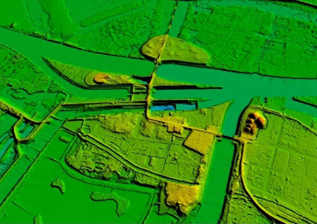
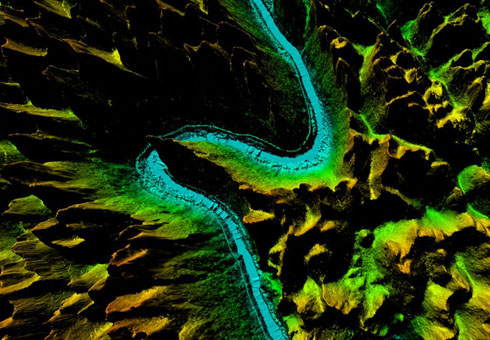
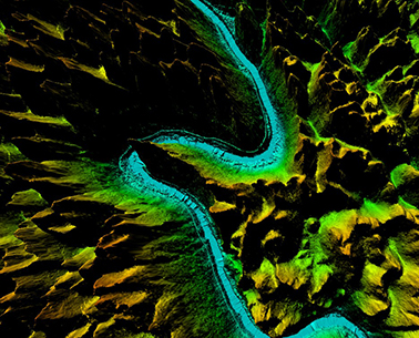
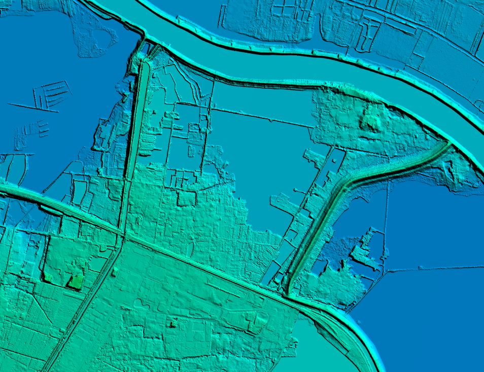
DEM
DEM Digital Elevation Model is a three-dimensional representation of the earth's surface, represented as an array of points with a defined height. The terrain model contains information about the height without considering vegetation, buildings, and other objects.
DEM Digital Elevation Model
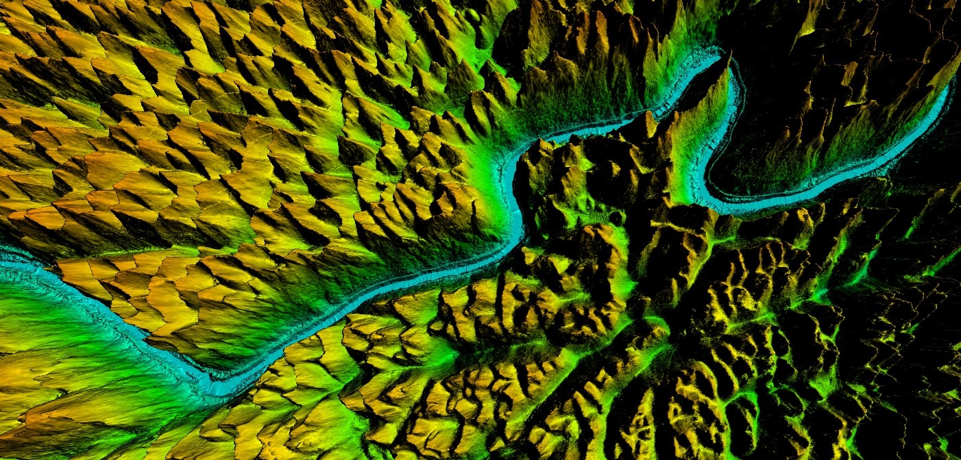
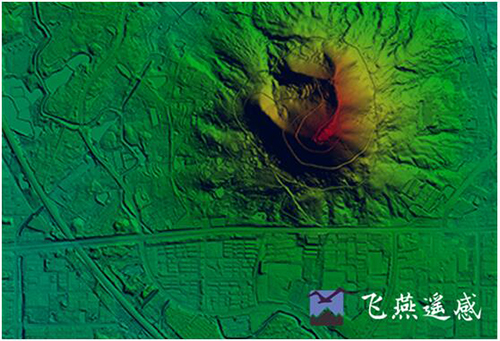
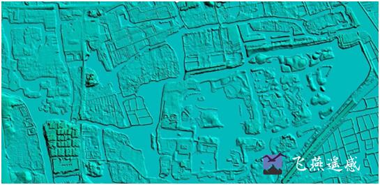
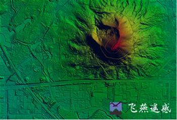
Digital Elevation Model (DEM) is a digital representation of the topography of a terrain or surface, created through a combination of ground surveying techniques and remote sensing technologies such as LiDAR (Light Detection and Ranging) and radar. DEMs are generated from variably-spaced Lidar ground points, or they can be created using a raster grid. The DEM is essentially a 3D digital model of the surface, which includes the elevation data for each point on the surface.
DEM data is stored in a raster format, with each cell or pixel of the raster representing a specific location on the surface and its corresponding elevation. DEM data can be used for a variety of applications, including terrain analysis, hydrological modeling, urban planning, and visualization of landscapes.
The accuracy of the DEM depends on the resolution of the data used to create it, as well as the processing techniques used to interpolate the elevation data. Higher resolution data and more advanced interpolation techniques generally result in more accurate DEMs.
DEM data is commonly used in GIS (Geographic Information Systems) and other mapping applications, where it can be combined with other types of spatial data to create detailed visualizations and analysis of the terrain.
Specifications of DEM Digital Elevation Model Processing
Resolution: ā„3 points/mĀ²
Project area: 39,090 kmĀ²
Duration: 1 month
Output: DEM, DSM,classified point clouds
Application: Forestry planning
Accuracy: ā„98%
Grid spacing: 2m
From: Guangxi Forestry Bureau
Feiyan Technology focus on creation of high quality DEM Digital Elevation Model to support specialized applications such as 3D modeling, volumetric calculations, and powerline as-built surveys. For more information of DEM digital elevation model or get DEM data processing service from Feiyan Technology, please contact us or directly mail to frank.zhao@feiyantech.com.


-
 Jul 30, 2021
The DEM (1:1000) 12000kmĀ² of the entire watershed area was obtained and processed within 40 days.
Torrential rains have battered Zhengzhou and its surrounding area during the last ten days, displacing hundreds of thousands of people and causing 1.22 billion yuan of economic damage, Henan authorities said Thursday. More > -
Mar 22, 2022
Guangxi Forestry Bureau's DEM
After collecting the data, the processing of the point cloud data will be done to obtain the desired outputs. In this process, filtering and classification algorithms will be used to remove noise from the data to obtain a clean point cloud. More > -
Sep 26, 2022
DEM Editing In DOM Aerial Triangulation
DEM editing is an indispensable part of producing orthophotos(DOM). More > -
Apr 07, 2023
What is Digital Elevation Modelļ¼DEMļ¼ļ¼
A digital elevation model (DEM) is a digital representation of the topography of a geographic area. More > -
Apr 10, 2023
Application of Digital Elevation Model (DEM) in Natural Resources Field
There are many applications of Digital Elevation Model (DEM) in natural resources field, such as environmental analysis, forest management, etc. More > -
Apr 11, 2023
Application of Digital Elevation Model (DEM) in Multiple Fields
āDigital elevation model is an important type of geographic data used to represent the topography of a geographic area in a numerical format. More > -
Apr 20, 2023
What is Digital Elevation Model(DEM)
The Digital Elevation Model is a bare earth raster grid referenced to a vertical datum, and when non-ground points such as bridges and roads are filtered out, a smooth digital elevation model is obtained. More > -
Apr 26, 2023
What is 4D?
4D technology: Digital Elevation Model (DEM), Digital Orthophoto (DOM), Digital Line Drawing (DLG) and Digital Raster Map (DRG). More > -
Jul 04, 2023
What are the uses of Digital Elevation Model
Digital Elevation Model is a data set of plane coordinates (X, Y) and elevation (Z) of regular grid points within a certain range. It mainly describes the spatial distribution of regional geomorphology, and uses contour lines or similar three-dimensional models for data collection. Acquisition (including sampling and measurement), followed by data interpolation. More >