 AIMS
AIMS AIMS-H Long Focus
 Farsightā¢ System
 Riegl VQ-1560i
 Riegl VQ-780II
 UltraCam Eagle M3
 Y-1 VTOL UAV
 Aerial Acquisition
 UAV Acquisition
 Satellite Acquisition
 Field Acquisition
 Integrated
 LiDAR
LiDAR Orthophoto
 DEM
DEM DTM/DSM
 3D Mapping
 Topographic
 Infrared
 Feature Extraction
 BIM
BIM Transportation
 Water
Water power
power  Forestry
 Agriculture
 Mines & Quarries
 Heritage Buildings
 About feiyan
 Recognition
 Cases
Cases

search

Enter search content


-
Forest Health Monitoring
We enable early detection of forest degradation by deploying theĀ Farsightā¢ UAV SystemĀ for regular, high-resolution multispectral surveys. Data is analyzed on ourĀ Swift4D platformĀ to identify subtle changes in vegetation indices, providing timely alerts forĀ pest outbreaks,Ā drought stress, and nutrient deficiencies. This supports proactive intervention, loss mitigation, and long-term ecosystem resilience management. MORE + -
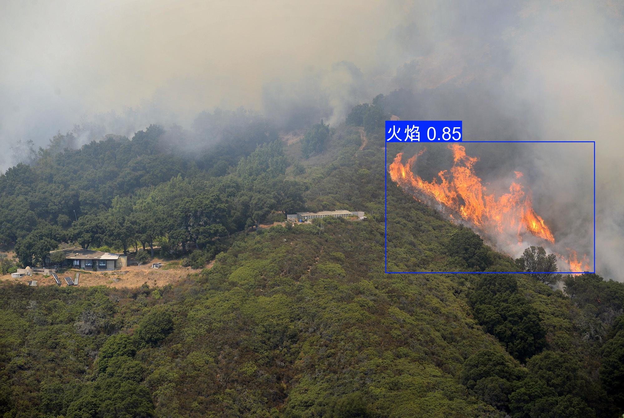
Proactive Forest Fire Detection & Operational Monitoring
We deliver rapid wildfire intelligence by integrating near-real-time satellite data with our Farsightā¢ UAV System for targeted hotspot verification and perimeter mapping. Data is processed on our Swift4D analytics platform for active fire detection, spread modeling, and burn scar assessment. This enables optimized emergency response, including evacuation route planning and resource deployment, supporting firefighting coordination and post-fire recovery. MORE + -
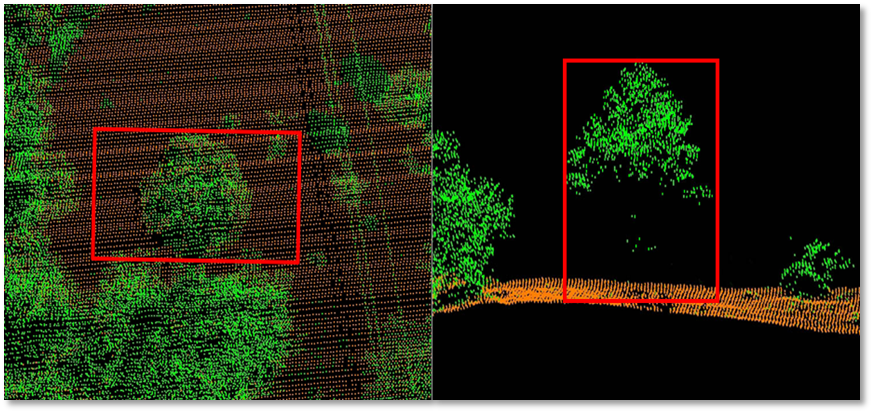
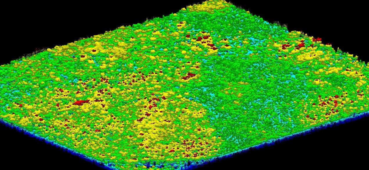
Canopy Structure Analysis & Biomass Estimation
We provide detailed 3D forest structure analysis usingĀ LiDAR data from our AIMS Multi-Modal Aerial Survey SystemĀ andĀ Farsightā¢ UAV System, calculating key metrics likeĀ Canopy Bulk Density (CBD)Ā andĀ Canopy Base Height (CBH)Ā for fire behavior modeling. This enables preciseĀ above-ground biomassĀ andĀ carbon stock estimation, delivering essential data for sustainable forest inventory, health assessment, and growth trend monitoring. MORE + -
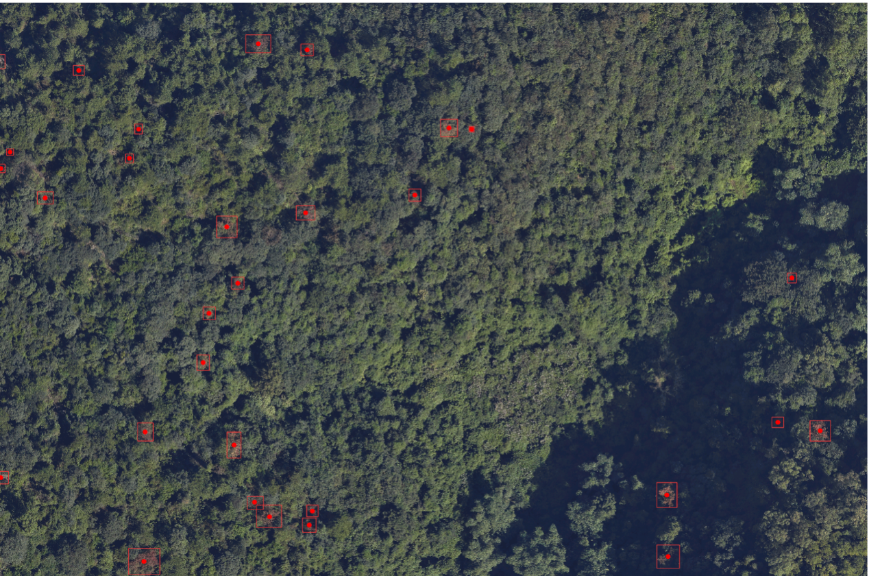
AI-Driven Tree Species Classification & Biodiversity Mapping
We achieve high-accuracy species identification by combiningĀ very high-resolution imageryĀ from satellites and ourĀ Farsightā¢ UAV System. OurĀ Swift4D platformĀ employs advancedĀ machine learning algorithmsĀ to analyze spectral and textural signatures, creating detailed species distribution maps forĀ biodiversity conservation, invasive species management, and precision silviculture. MORE +


