 AIMS
AIMS AIMS-H Long Focus
 Farsightā¢ System
 Riegl VQ-1560i
 Riegl VQ-780II
 UltraCam Eagle M3
 Y-1 VTOL UAV
 Aerial Acquisition
 UAV Acquisition
 Satellite Acquisition
 Field Acquisition
 Integrated
 LiDAR
LiDAR Orthophoto
 DEM
DEM DTM/DSM
 3D Mapping
 Topographic
 Infrared
 Feature Extraction
 BIM
BIM Transportation
 Water
Water power
power  Forestry
 Agriculture
 Mines & Quarries
 Heritage Buildings
 About feiyan
 Recognition
 Cases
Cases

search

Enter search content


-
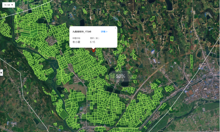
Data-Driven Crop Yield Estimation & Forecasting
We deliver accurateĀ pre-harvest yield forecastsĀ by integratingĀ multi-temporal satellite imageryĀ with data from ourĀ AIMS Multi-Modal Aerial Survey System. Our models, powered by theĀ Swift4D platform, analyze crop phenology and biomass to predict production. This provides actionable intelligence forĀ commodity trading,Ā supply chain logistics, andĀ agricultural insuranceĀ underwriting, enabling proactive market decisions and risk management. MORE + -
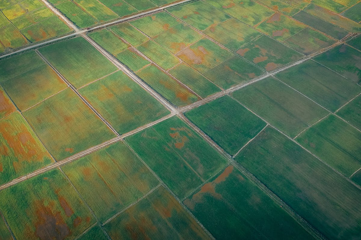
Crop Growth & Health Monitoring for Precision Management
We enableĀ precision farmingĀ through continuous crop surveillance using time-seriesĀ satellite dataĀ analyzed onĀ Swift4D. For targeted issues, ourĀ Farsightā¢ UAV SystemĀ provides centimeter-scale imagery. This integrated approach allows early detection ofĀ water stress, nutrient deficiencies, and disease, supporting variable-rate application and optimized input use. MORE + -
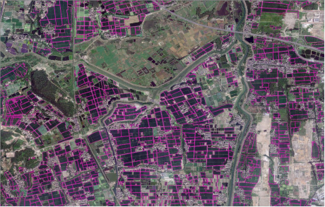
Crop Type Classification & Mapping
We provide reliableĀ crop classification mapsĀ usingĀ AI algorithmsĀ on theĀ Swift4D platformĀ to analyze spectral signatures from satellite andĀ AIMS Multi-Modal Aerial Survey SystemĀ data. This service is essential forĀ crop acreage statistics, supporting government subsidy programs (e.g.,Ā CAP compliance),Ā supply chain traceability, and land-use auditing. MORE + -
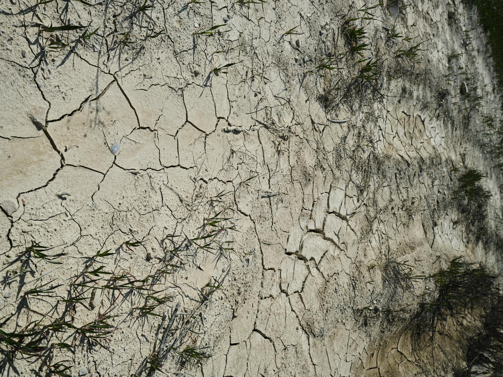
Precision Soil & Field Analysis
We conduct high-resolutionĀ precision soil mappingĀ and micro-terrain analysis using ourĀ Farsightā¢ UAV SystemĀ and AIMS Multi-Modal Aerial Survey System This capability supportsĀ soil property analysis,Ā drainage design, and rapidĀ post-disaster assessment, providing field-level insights to maximize productivity and sustainability. MORE +


