 AIMS
AIMS AIMS-H Long Focus
 Farsightā¢ System
 Riegl VQ-1560i
 Riegl VQ-780II
 UltraCam Eagle M3
 Y-1 VTOL UAV
 Aerial Acquisition
 UAV Acquisition
 Satellite Acquisition
 Field Acquisition
 Integrated
 LiDAR
LiDAR Orthophoto
 DEM
DEM DTM/DSM
 3D Mapping
 Topographic
 Infrared
 Feature Extraction
 BIM
BIM Transportation
 Water
Water power
power  Forestry
 Agriculture
 Mines & Quarries
 Heritage Buildings
 About feiyan
 Recognition
 Cases
Cases

search

Enter search content


-

Strategic Water Infrastructure & Watershed Health Monitoring
We employ the Farsightā¢ UAV System for automated, periodic close-range inspections of hydraulic infrastructure, while the AIMS Multi-sensor Aerial Survey System performs watershed-scale periodic surveys of land cover and topography. All data is consolidated and analyzed through multi-temporal comparative analysis on the Swift4D platform. This supports structural integrity diagnosis, reservoir sedimentation calculation, and ecological change assessment, enabling preventive maintenance of infrastructure and integrated watershed management. MORE + -
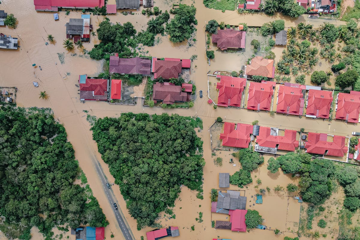
Comprehensive Flood Inundation Mapping & Damage Analytics
We provide rapid flood impact assessment by deploying our AIMS Multi-sensor Aerial Survey System for wide-area synchronous data acquisition, complemented by our Farsightā¢ UAV System for swift, targeted emergency surveys of critical zones. All data is integrated into the Swift4D platform, where AI algorithms automatically delineate inundation extents and quantify asset damage to generate precise reports for insurance claims processing and disaster recovery planning. This offers a complete solution from rapid initial assessment to in-depth analysis for decision-makers. MORE + -
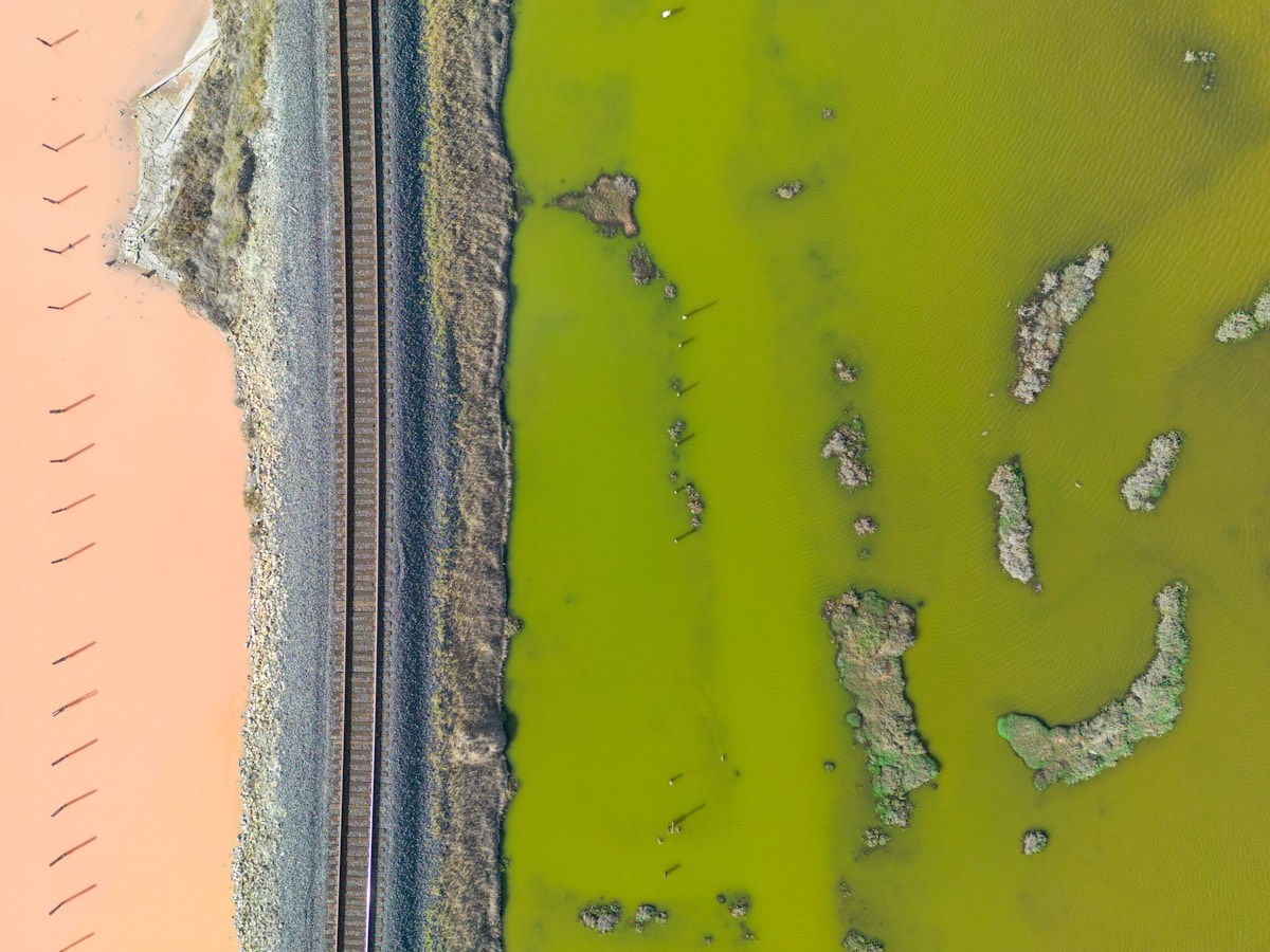
Proactive Harmful Algal Bloom (HAB) Monitoring & Early Warning
Our service utilizes the AIMS Multi-sensor Aerial Survey System to establish regional hyperspectral baseline data, while the Farsightā¢ UAV System conducts high-frequency, high-resolution monitoring of key water bodies. Data fusion and spatiotemporal trend analysis on the Swift4D platform enable precise tracking of bloom biomass dynamics. This supports early warning systems, guides targeted sampling, and informs management decisions, delivering an end-to-end solution for water quality management from macroscopic oversight to microscopic validation. MORE + -

Rapid Oil Spill Detection & Impact Screening
In response to oil spill incidents, we first deploy theĀ Farsightā¢ UAV SystemĀ for rapid preliminary investigation and source identification. TheĀ AIMS Multi-sensor Aerial Survey SystemĀ then executes large-scale, accurate mapping and data collection. TheĀ Swift4D platformĀ automates the processing of this multi-source data to facilitateĀ oil slick identification, trajectory modeling, and preliminary impact assessment. MORE +


