 AIMS
AIMS AIMS-H Long Focus
 Farsightā¢ System
 Riegl VQ-1560i
 Riegl VQ-780II
 UltraCam Eagle M3
 Y-1 VTOL UAV
 Aerial Acquisition
 UAV Acquisition
 Satellite Acquisition
 Field Acquisition
 Integrated
 LiDAR
LiDAR Orthophoto
 DEM
DEM DTM/DSM
 3D Mapping
 Topographic
 Infrared
 Feature Extraction
 BIM
BIM Transportation
 Water
Water power
power  Forestry
 Agriculture
 Mines & Quarries
 Heritage Buildings
 About feiyan
 Recognition
 Cases
Cases

search

Enter search content


-
Disaster Response & Grid Resilience
Following severe weather or natural disasters, we offer rapidĀ aerial damage assessmentĀ services. Using UAVs and aircraft equipped with optical and LiDAR sensors, we quickly identify damaged assets,Ā vegetation-caused outages, and terrain changes affecting infrastructure. This supportsĀ emergency restorationĀ prioritization and strengthens long-termĀ grid resilience planningĀ against future events. MORE + -
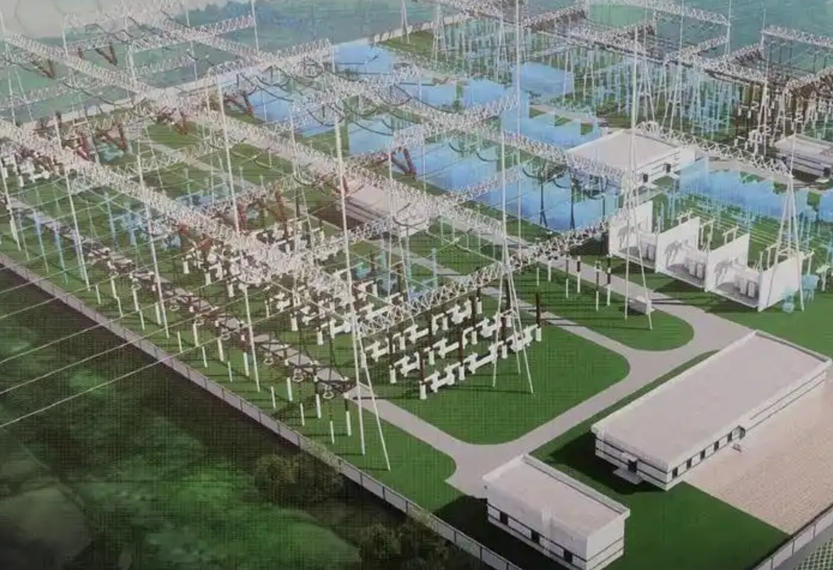
Substation & Facility Mapping
We deliver high-accuracyĀ 3D digital twinsĀ of substations and critical power infrastructure using close-range LiDAR and photogrammetry. TheseĀ as-built modelsĀ supportĀ asset inventory,Ā spatial analysis for expansion planning, andĀ safety compliance audits. The virtual replicas serve as a foundational tool forĀ facility managementĀ andĀ simulation-based training, improving operational awareness and decision-making. MORE + -
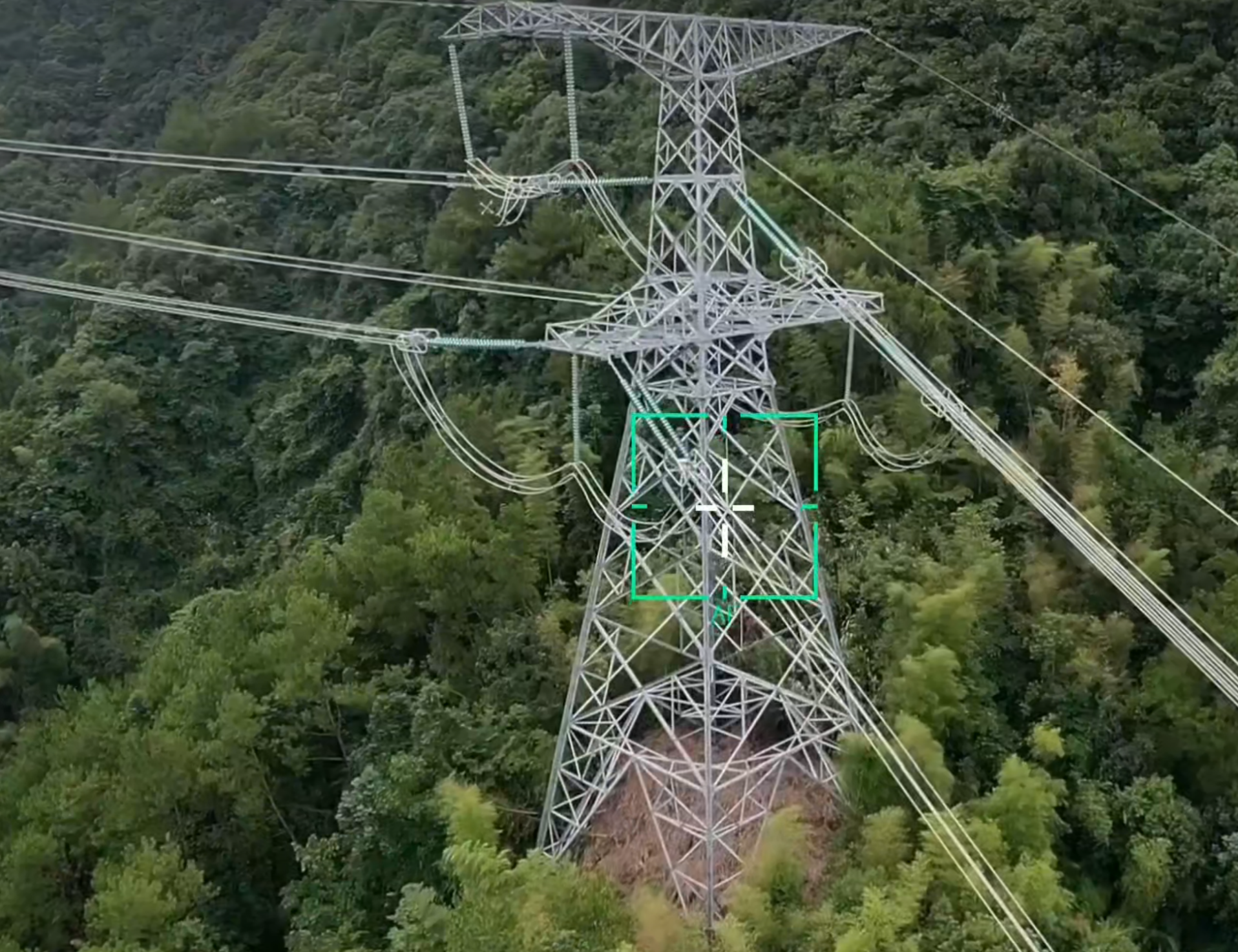
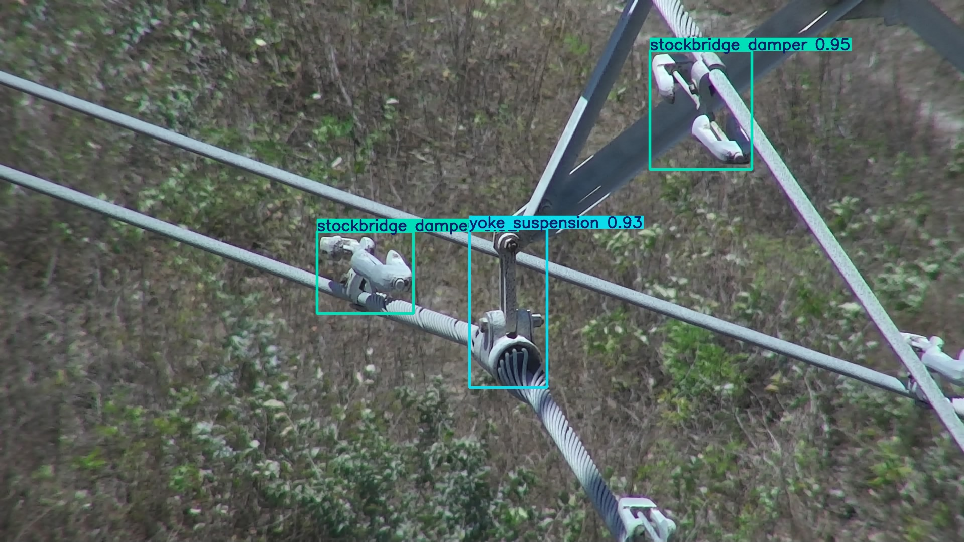
Automated Power Line Inspection
We provideĀ automated power line inspection servicesĀ utilizing UAV or helicopter platforms equipped withĀ LiDAR and high-resolution cameras. This enables efficient, large-scale data collection even in challenging terrain. Our proprietary AI analytics automatically process point clouds to detectĀ vegetation encroachment, classify risks, and identify hardware defects, generating actionable reports for proactiveĀ right-of-way maintenanceĀ to enhanceĀ grid reliabilityĀ and safety. MORE + -
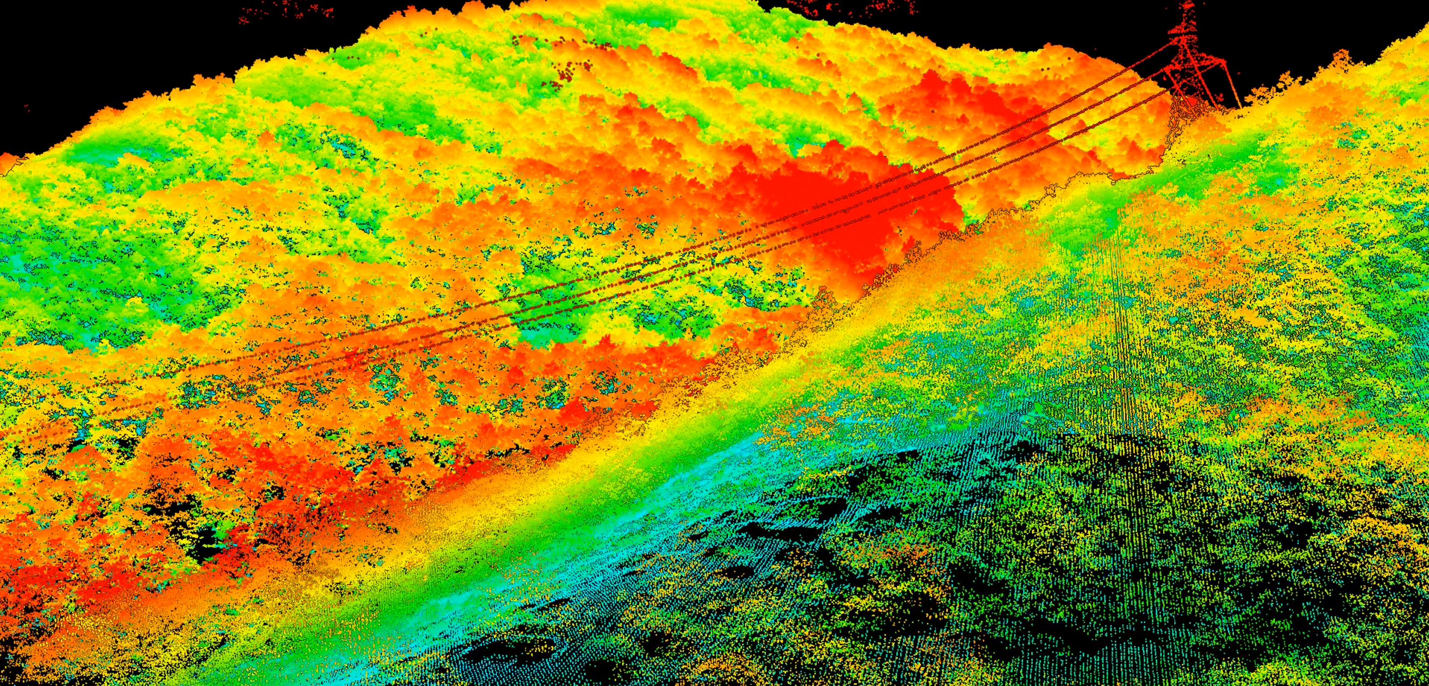
Power Line Route Planning
OurĀ airborne LiDAR survey for transmission linesĀ captures precise ground data through vegetation, creating accurateĀ Digital Terrain Models (DTMs). This data is fundamental forĀ power line route planning, allowing engineers to conduct detailedĀ clearance profiling, optimizeĀ corridor sitingĀ to reduce environmental impact, and performĀ construction feasibility studies, thereby de-risking the early design phase. MORE +


