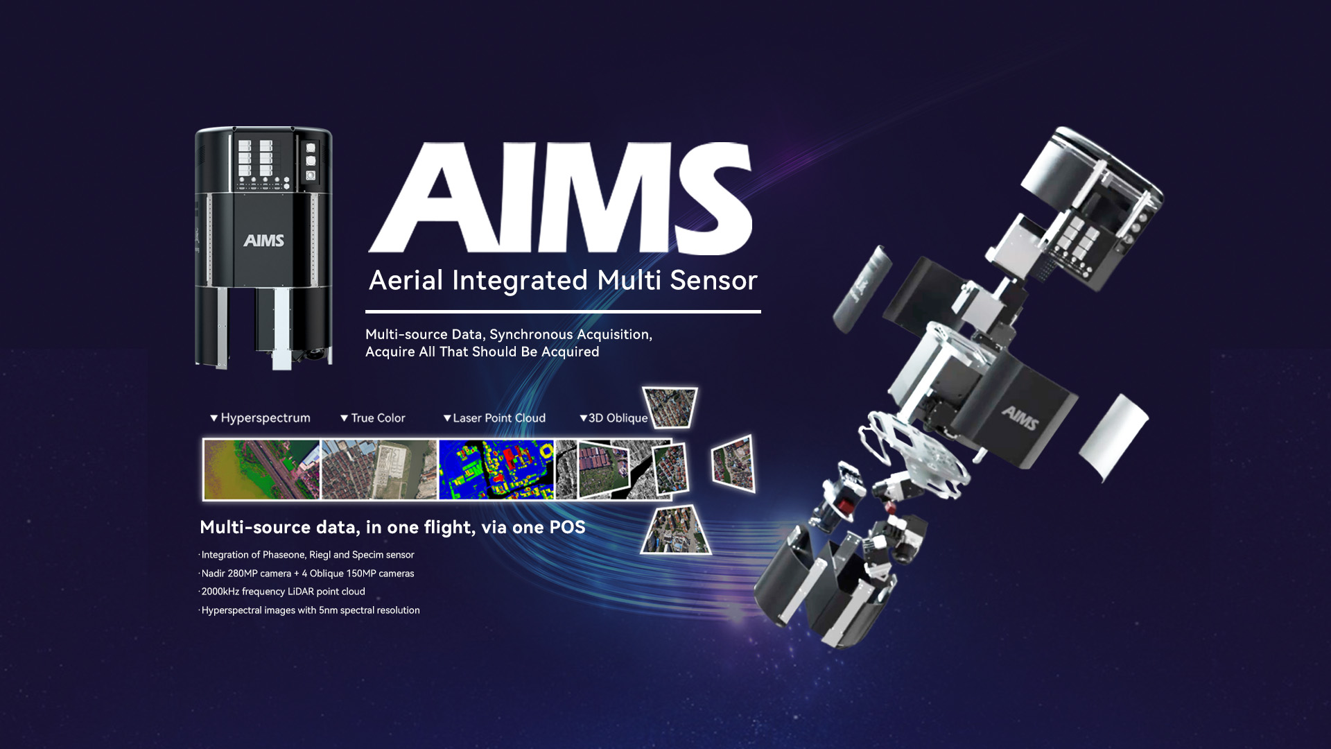
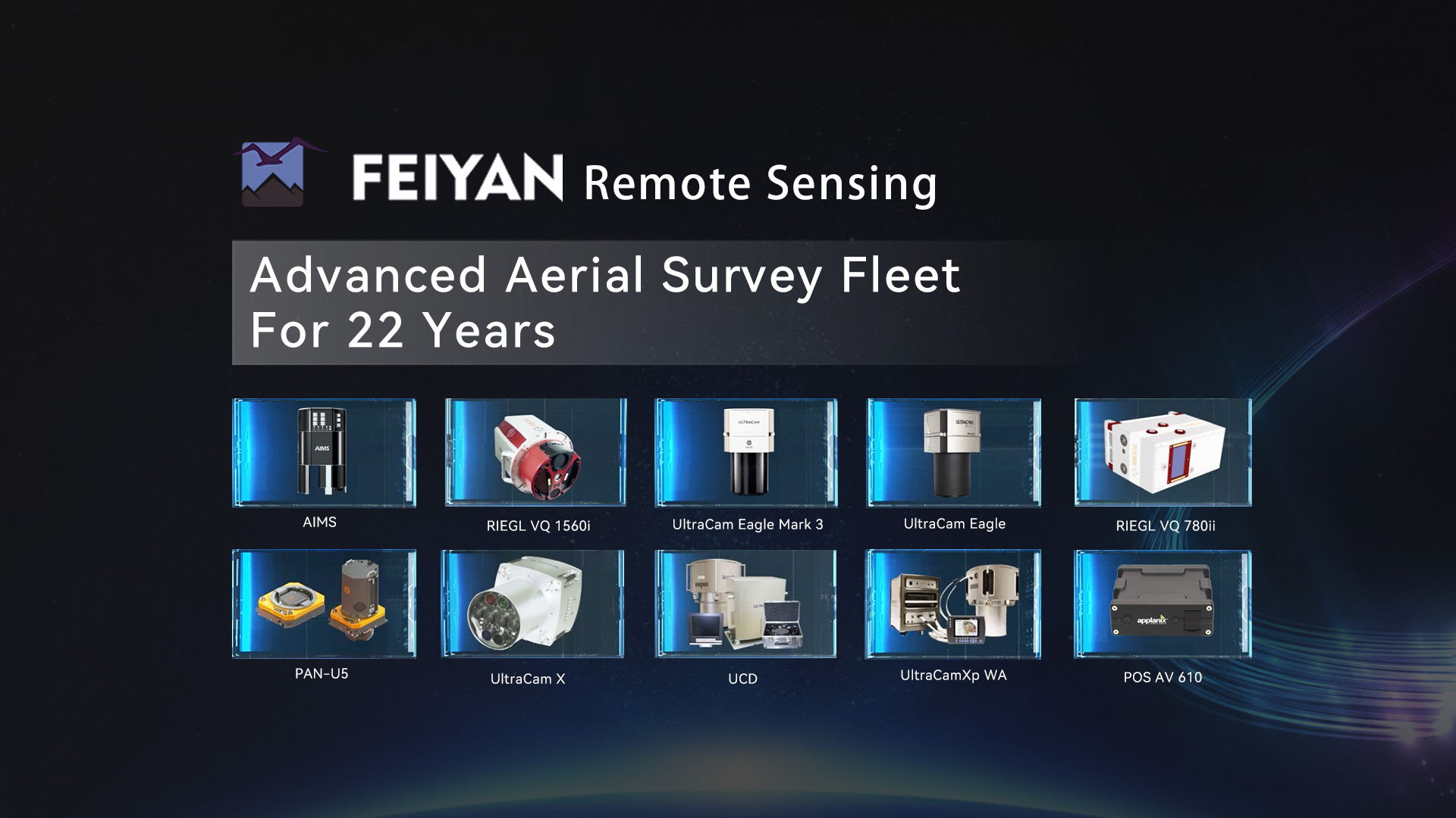
 AIMS
AIMS AIMS-H Long Focus
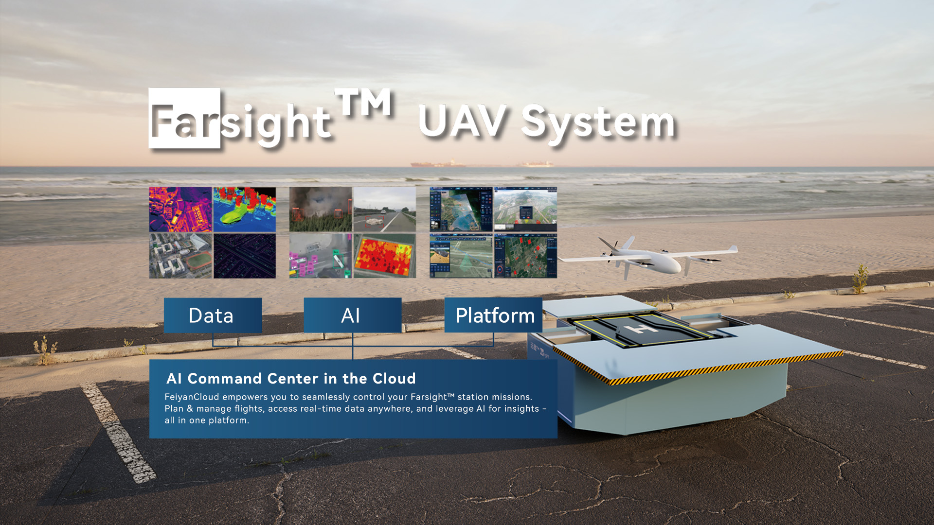
 Farsight™ System
 Riegl VQ-1560i
 Riegl VQ-780II
 UltraCam Eagle M3
 Y-1 VTOL UAV
 Aerial Acquisition
 UAV Acquisition
 Satellite Acquisition
 Field Acquisition
 Integrated
 LiDAR
LiDAR Orthophoto
 DEM
DEM DTM/DSM
 3D Mapping
 Topographic
 Infrared
 Feature Extraction
 BIM
BIM Transportation
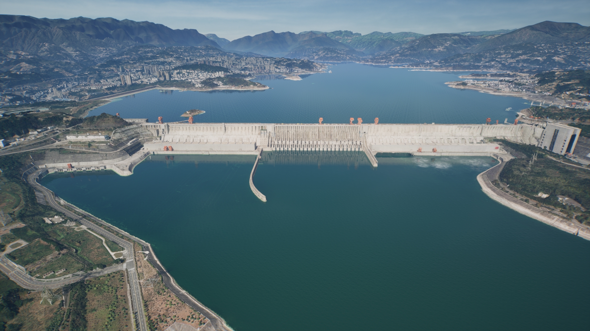
 Water
Water power
power  Forestry
 Agriculture
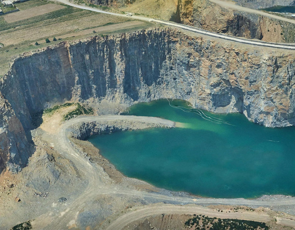
 Mines & Quarries
 Heritage Buildings
 About feiyan
 Recognition
 Cases
Cases

search


about feiyan
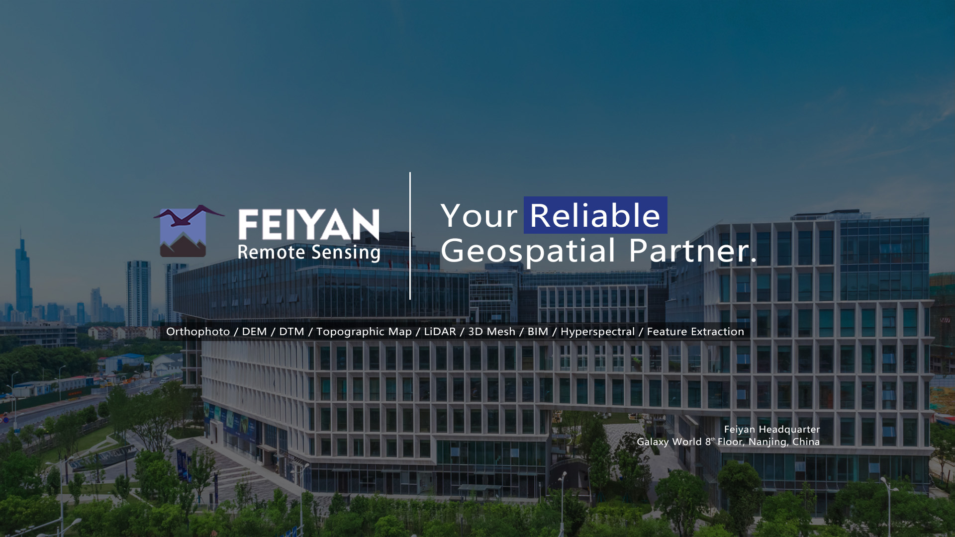
Founded in 2003, Feiyan Aerial Remote Sensing Tech Co., Ltd. has been the nation's largest independent geospatial data firm and top aerial imagery company in Asia that provides geographic insights to many of the most influential projects in China. As an industry leader in advanced mapping technology, Feiyan delivers the leading data quality and data analysis service with efficiency, while leveraging the most cutting-edge technologies for aerial data acquisitions, geospatial data processing, and GIS platform solutions.
Founded in 2003, Feiyan Aerial Remote Sensing Tech Co., Ltd. has been the nation's largest independent geospatial data firm that provides geographic insights to many of the most influential projects in China. An industry leader in advanced mapping technology, Feiyan delivers the leading data quality with efficiency, while leveraging the most cutting-edge technologies for aerial data acquisitions, geospatial processing, and GIS platform solutions.
2003
YearEstablished
100+
DataEngineers
800+
ProjectCompleted
106km2
DataProcessed
product


 return
Transportation
Transportation has always played a vital role in human activities, so it is right to improve, GIS for transportaion can monitor and analyze transportation and transportation flows to improve the efficiency of any continent, region or town's transportation system.Digital Twin for Planning & Simulation Traffic Flow Analysis & Situational Awareness High-Definition (HD) Map Production & Dynamic Updates Transportation Asset Management & Resilience
View More
Water Resource
Satellite imagery is the main source of thematic information for mapping of inland waterways. Satellite imagery allows exploration of water resources and how ecosystems are changing under the influence of natural and human factors.Strategic Water Infrastructure & Watershed Health Monitoring Comprehensive Flood Inundation Mapping & Damage Analytics Proactive Harmful Algal Bloom (HAB) Monitoring & Early Warning Rapid Oil Spill Detection & Impact Screening
View More
Power
GIS for Power Supply will help us with aerial acquisition, 3D modeling and LiDAR capture data, as well as digital orthophotos, and we've supported some of the most prominent power engineering and construction projects in the country. Contact us for details on Power GIS.Disaster Response & Grid Resilience Substation & Facility Mapping Automated Power Line Inspection Power Line Route Planning
View More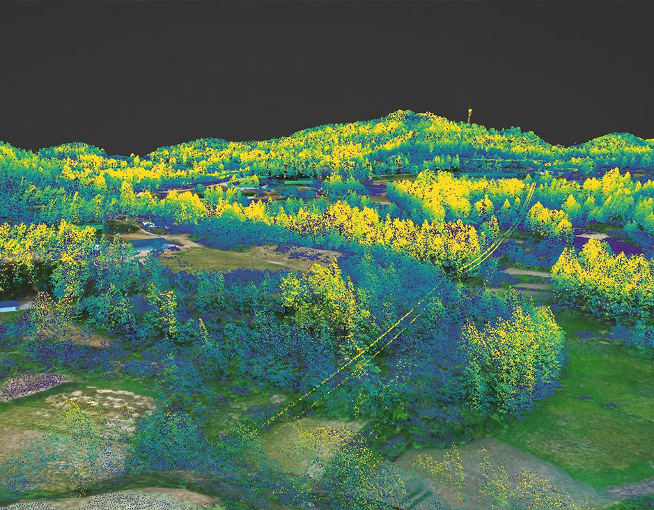
Forestry
Feiyan GIS for forest and vegetation mapping and wildfire management products and services generates critical data for effective management decisions affecting forest resources. If you are looking for resources, please feel free to ask us for more information.Forest Health Monitoring Proactive Forest Fire Detection & Operational Monitoring Canopy Structure Analysis & Biomass Estimation AI-Driven Tree Species Classification & Biodiversity Mapping
View More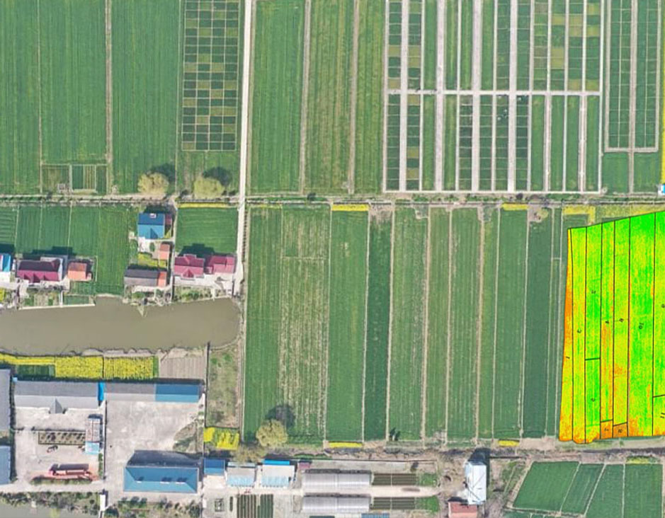
Agriculture
Analytics for better crop management. Feiyan has a legacy of building cutting-edge analytics to solve a variety of industry problems. We've used that experience to analyze spectral and spatial data within imagery to provide extensive crop health information. The best part is, this product is designed to be used by anyone – regardless of prior experience with remote sensing. Let analytics from Feiyan power your Agriculture.Data-Driven Crop Yield Estimation & Forecasting Crop Growth & Health Monitoring for Precision Management Crop Type Classification & Mapping Precision Soil & Field Analysis
View More
Mines and Quarries
Feiyan Technology has extensive experience in GIS for mine and quarry. We advise on a variety of prospective mine planning applications, provide on-site support during mining activities, and advise and assist in the implementation of post-mining recovery.Mining Environmental Assessment & Compliance Monitoring Mineral Extraction Planning & Operational Optimization Volumetric Change Detection & Mine Production Auditing Geotechnical Monitoring & Resource Management
View More
Heritage Build
Feiyan can help clients make informed decisions about the future of their historically significant buildings and cultural heritage landscapes. Through rigorous questioning, research, development and innovation, we use appropriate technology and design to find solutions that anticipate future changes while maintaining architectural integrity.Archeological Prospection & Digital Documentation Heritage Planning & Conservation Policy Support Built Heritage & Cultural Landscape 3D Recording Geomatics & Heritage Information Management Systems
View Morenews
-
 Dec 29, 2025
Zhangzhou Unveils Fujian's First Real 3D City Model, Setting New Standard for Digital Urban Development
More > -
Dec 22, 2025
Forbes China Under 30 Summit Celebrates a Decade, Honoring Young Innovators like Frank Zhao of Feiyan Remote Sensing
Frank Zhao received the award at the Forbes China 30 Under 30 award ceremony More >


Dec 13,2025
AIMS Multi-Modal Aerial Survey System Supports 3D Reality Modeling in Wuhan
Jun 25,2023
What are the characteristics of aerial photogrammetry technology?
Jul 18,2022
AIMS - Aerial Remote Sensing Solution
Mar 23,2022
AIMS Preliminary Flight
Jul 05,2022
We won the 2021 National Excellent Surveying and Mapping Project Bronze Award
