AIMS
AIMS AIMS-H Long Focus
 Farsightâą System
 Riegl VQ-1560i
 Riegl VQ-780II
 UltraCam Eagle M3
 Y-1 VTOL UAV
 Aerial Acquisition
 UAV Acquisition
 Satellite Acquisition
 Field Acquisition
 Integrated
 LiDAR
LiDAR Orthophoto
 DEM
DEM DTM/DSM
 3D Mapping
 Topographic
 Infrared
 Feature Extraction
 BIM
BIM Transportation
 Water
Water power
power  Forestry
 Agriculture
 Mines & Quarries
 Heritage Buildings
 About feiyan
 Recognition
 Cases
Cases

search


AIMS Multi-Modal Aerial Survey System Supports 3D Reality Modeling in Wuhan
Dec 13, 2025
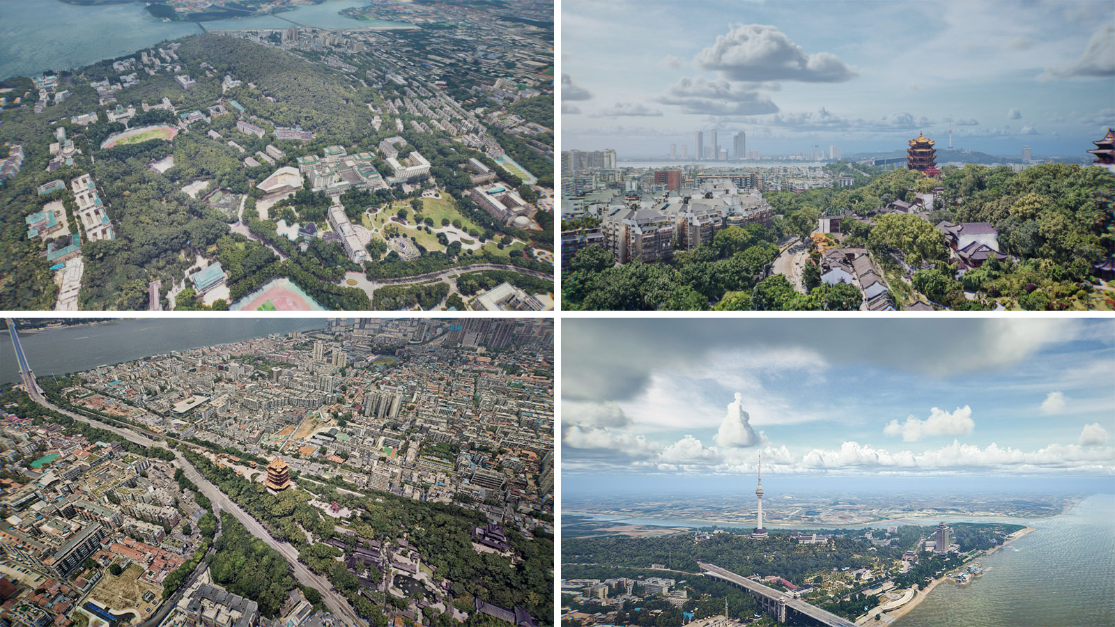
Wuhan, acclaimed as China's âCapital of Remote Sensing,â is situated at the confluence of the Yangtze and Han Rivers. The city is home to the historic poetry of the Yellow Crane Tower and the serene beauty of East Lake, while also pulsating with the momentum of modern technology.
Wuhan's central urban area, characterized by dense building clusters and complex airspace conditions near major aviation facilities, presented significant challenges for high-resolution oblique aerial photography. To successfully complete the 3D reality modeling of the 616 kmÂČ central urban area, the project utilized the AIMS Multi-Modal Aerial Survey System, independently developed by Feiyan Remote Sensing, achieving efficient, safe data acquisition and high-quality 3D modeling. The project collected 492,000 oblique images and produced outcomes including 3D Mesh models, Digital Elevation Models (DEMs), and Digital Surface Models (DSMs). All data were integrated into a spatiotemporal data platform, forming a unified citywide 3D spatial digital base.
Technical Highlights
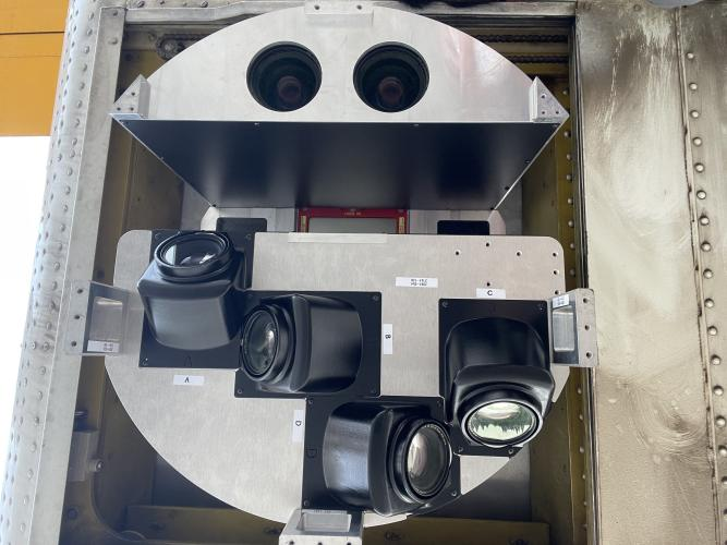
Multi-Modal Synchronized Acquisition: The AIMS system simultaneously acquires oblique 3D imagery, large-format digital aerial images, LiDAR point clouds, and hyperspectral data in a single flight, effectively supporting the production of various products while enhancing model accuracy and image quality.
Ultra-High-Resolution Imaging: Utilizing a 90mm/110mm focal length combination and a flight altitude of 600 meters, the system achieved a ground resolution better than 0.03 meters, exceeding project requirements by 25%.
Intelligent Data Processing: By leveraging POS data for solar radiation correction of multi-angle images and applying a self-developed color harmonization algorithm, the system significantly improved color consistency and visual quality.
Applications and Outcomes
Territorial Planning and Urban Renewal: In multiple urban renewal and key architectural projects, 3D reality models were used for site evaluation, building design comparison, and planning indicator verification, enabling precise analysis and decision-making in a 3D environment.
Integrated Urban Management: The system supported the renovation of old residential districts and area redevelopment projects, allowing for rapid building area extraction and demolition scale assessment,which significantly reducing field survey and manual verification costs.
Ecological Protection and Disaster Prevention: Applied to mining area ecological monitoring and geological hazard identification and risk assessment, multi-temporal 3D data comparisons enabled dynamic monitoring and science-based prevention and control.


-
 May 10, 2021
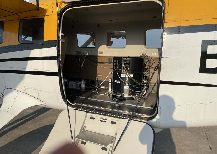
First flight of AIMS
Recently, AIMS,which is the aviation integrated multi-sensor aerial camera,independently developed by Feiyan Aerial Remote Sensing Technology Co. , Ltd. has been successfully carried out the preliminary flight . Nowadays,AIMS is the only one equipment that has integrated Orthophoto true-color camera, laser radar camera, Tilt Camera, multi-spectral camera, hyperspectral camera, synthetic aperture radar camera and other common aerial sensors in China. It can acquire multiple data one-time. More > -
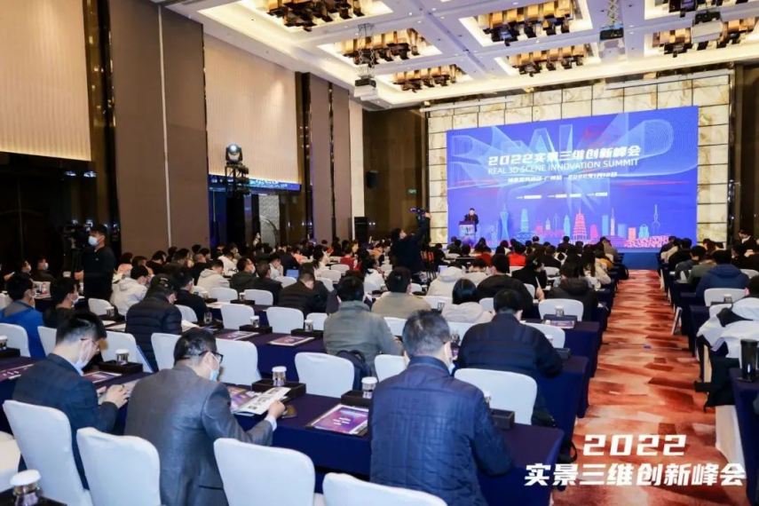
Jul 18, 2022
AIMS - Aerial Remote Sensing Solution
The 2022 Real 3D Innovation Summit was successfully held in Guangzhou on January 12. It is guided by the Guangdong Society of Geodesy, hosted by Taibo.com, and co-organized by Feiyan Remote Sensing. It attracted more than 300 experts and industry representatives to attend. More > -
Mar 23, 2022
AIMS Preliminary Flight
Recently, AIMS, which is the aviation integrated multi-sensor aerial camera, independently developed by Feiyan Aerial Remote sensing Technology Co. , Ltd. has been successfully carried out the preliminary flight. More >