 AIMS
AIMS AIMS-H Long Focus
 Farsightâą System
 Riegl VQ-1560i
 Riegl VQ-780II
 UltraCam Eagle M3
 Y-1 VTOL UAV
 Aerial Acquisition
 UAV Acquisition
 Satellite Acquisition
 Field Acquisition
 Integrated
 LiDAR
LiDAR Orthophoto
 DEM
DEM DTM/DSM
 3D Mapping
 Topographic
 Infrared
 Feature Extraction
 BIM
BIM Transportation
 Water
Water power
power  Forestry
 Agriculture
 Mines & Quarries
 Heritage Buildings
 About feiyan
 Recognition
 Cases
Cases

search


Forbes China Under 30 Summit Celebrates a Decade, Honoring Young Innovators like Frank Zhao of Feiyan Remote Sensing
Dec 22, 2025
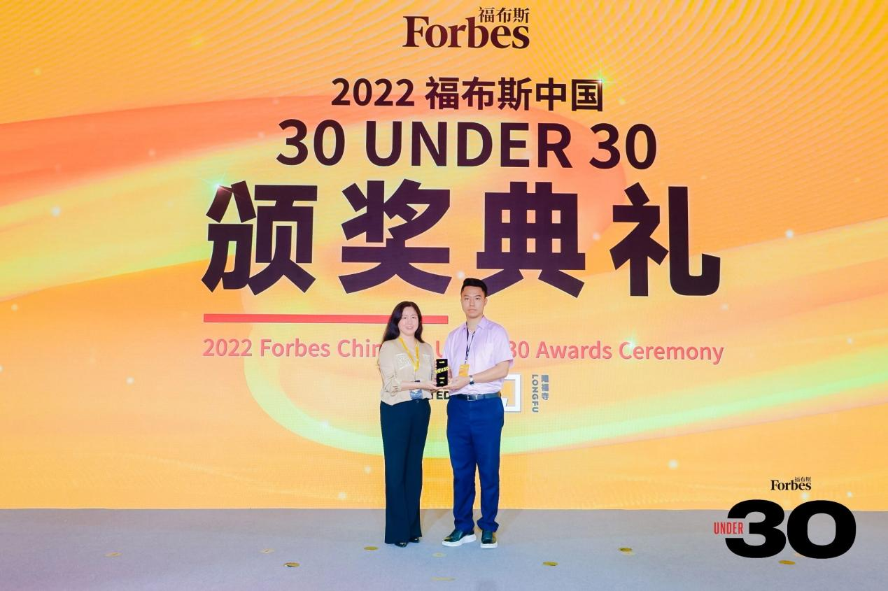
Beijing, July 4-5 â The Forbes China Under 30 Summit commemorated its tenth anniversary with a prestigious gathering at Longfusi in Beijing. The event convened an exceptional group of past Forbes China 30 Under 30 honorees, renowned industry pioneers, leading investors, list judges, government officials, and senior leadership from Forbes China Group to celebrate China's most dynamic young trailblazers.
A notable participant was Frank Zhao, General Manager of Feiyan Aerial Remote Sensing Technology Co., Ltd. (Feiyan Remote Sensing), recognized as a Forbes China 30 Under 30 honoree. Frank holds dual bachelor's degrees in Economics and Geographic Information Science & Cartography from the University of Illinois Urbana-Champaign. Following an internship at the Chicago Planning and Design Institute, he earned a master's degree in Environmental Remote Sensing and Geographic Information Systems from Boston University in 2017. Upon returning to China, Zhao took on comprehensive leadership at Feiyan Remote Sensing, overseeing management, R&D, marketing, and sales for its headquarters and branches. He has directed over 100 aerial remote sensing projects and received 10 provincial and national awards for engineering excellence.
Drawing on his extensive frontline experience and deep insight into both the low-altitude remote sensing sector and end-user needs, Zhao conceived and has continually refinedâin collaboration with the Feiyan team and industry partnersâthe AIMS system. This domestically innovated multi-sensor aerial survey platform is designed for both manned and unmanned aerial vehicles. The AIMS system holds 4 invention patents and 3 utility model patents, and was awarded the 2023 First Prize for Geographic Information Science and Technology Progress by the China Association of Geographic Information. Zhao also serves as Deputy Secretary-General of the Jiangsu High-Resolution Remote Sensing Industry Alliance and is a committee expert for the Location-Based Service Working Committee of the Chinese Society of Surveying and Mapping.
"It is a genuine honor to be part of the Forbes China U30 community," said Zhao. "My goal is to drive meaningful progress in China's low-altitude remote sensing and monitoring industry alongside Feiyan Remote Sensing."
About Feiyan Remote Sensing
Founded in 2003, Feiyan Remote Sensing is a national-level "Specialized, Refined, Distinctive, and Innovative" Little Giant Enterprise and a high-tech company specializing in photogrammetry, remote sensing, 3D digital city modeling, and GIS industry applications. With R&D, technology, and marketing centers in Nanjing, plus integrated development and data processing centers in cities like Wuhan and Hangzhou, the company holds all relevant top-tier (Grade A) and secondary surveying and mapping qualifications in its field.
Building on its foundation of over ten internationally advanced aerial survey systems, Feiyan independently developed the AIMS multi-modal aerial survey system. This system enables the simultaneous acquisition of temporally consistent, multi-modal remote sensing data under near-identical imaging conditions. It allows for detailed perception of all ground features, reduces data acquisition costs, and uses synergistic multi-modal data processing to enhance the automation and intelligence of data interpretation. The resulting products feature rich attributes and strong correlations, providing comprehensive support for geographic entity construction and China's national "Real 3D China" initiative. The company's solutions have been successfully deployed in projects across Wuhan, Zhongshan, Huaian, Hefei, Xiamen, and Hong Kong, among others, serving sectors from natural resources to national defense security.
To advance the development of new smart cities, Feiyan created its proprietary Swift 4D Platform. Operating on Feiyan's core computing infrastructure, Swift4D is an integrated, intelligent Air-Space-Ground geospatial data application platform. It aggregates multi-source dataâincluding geospatial, IoT sensor, and operational management informationâto build essential platforms for spatiotemporal information, UAV operations, remote sensing interpretation, and an AI-powered intelligence base. This integrated approach enables comprehensive urban perception, intelligent analysis, precise assessment, coordinated command, and effective emergency response, supporting sustainable urban development.
Frank Zhao emphasized that low-altitude remote sensing and monitoring is a vital component of the low-altitude economy, playing an increasingly critical role in integrated urban governance. Applications range from ecological protection and solid waste management to urban construction and real-time crop pest monitoring.
"As low-altitude airspace becomes more regulated and the demand for high-quality data grows, a key challenge is how to efficiently capture multi-modal data using limited resources," Zhao noted.
Feiyan Remote Sensing is well-positioned to meet this challenge. The company has a proven track record executing aerial photogrammetry missions for numerous national, provincial, and ministerial key projects. Its expertise spans land resources, urban planning, fundamental surveying, 3D digital city construction, national geographic censuses, transportation, power, water conservancy, and marine surveying. Currently, the company's annual data acquisition coverage exceeds 1.6 million square kilometers. It has successfully completed thousands of projects, earning over 50 national and provincial excellence awards, and has contributed to drafting 8 national, industry, and association standards.
"I envision that a decade from now, China's urban skies will be actively navigated by drones, serving both transport and monitoring functions," Zhao expressed. "The low-altitude domain holds vast potential, and I am committed to ensuring Feiyan Remote Sensing provides robust, innovative support for the diverse urban service scenarios of the future."


-
 Mar 22, 2022
Utility of oblique aerial photography
With the rapid development of China's social economy, the value of real estate is increasing accordingly, which makes the country pay more and more attention to real estate surveying and mapping, and the requirements are higher and higher. More > -
Mar 22, 2022
What is tilt photography?
Tilt photography is a new and high technology developed in recent years in the field of international Remote sensing surveying and mapping. By carrying multiple sensors on the same flight platform and collecting images from different angles such as vertical and tilt, more complete and accurate information of ground objects can be obtained. More > -
Mar 22, 2022
Feiyan Remote Sensing LiDAR aerial photography project accumulates over 100,000 square kilometers
At present, airborne LiDAR technology has made great progress and has been widely used in many fields. Following the trend of technology development, feiyan Remote sensing has long been in the forefront of the industry. More > -
Mar 22, 2022
Mount Everest Elevation Measurement in 2020
On the afternoon of April 30, the first press conference of the 2020 Mount Everest elevation measurement was held at the Everest Base Camp, and the 2020 Mount Everest elevation measurement was officially launched. More > -
Mar 22, 2022
What are the restrictions on drone aerial photography?
Compared with traditional Aerial photography, the low efficiency of UAV Aerial photography has become one of the main bottlenecks restricting its development. More > -
Mar 22, 2022
The 6th Jiangsu University Surveying and Mapping Geo-Information business plan competition achieved
The 6th Jiangsu University Surveying and Mapping Geo-Information business plan competition achieved full success last week. Feiyan Remote sensing participated in this event as one of the chief co-sponsors. The competition provides an excellent platform for our students, played a major role in cultivating talent of Surveying and Mapping Geo-Information application as well. More > -
Mar 22, 2022
7 Ways to Process LiDAR Data
LiDAR technology has given the spatial data industry some of the largest data volumes weâve ever seen. Most point clouds Iâve worked with have been tens of gigabytes in size. More > -
Mar 23, 2022
Flexibility of aerial photogrammetry technology
Aerial photogrammetry is generally low altitude flight, which is easy to operate in airspace and will not be affected by extreme weather. At the same time, it is not limited to the needs of take-off and landing sites. It only needs to select a relatively flat site for take-off and landing. More > -
Jun 17, 2022
Satellite Technologies For Plant Nutrient Deficiency Identification And Treatment
Satellite Technologies For Plant Nutrient Deficiency Identification And Treatment More >


