AIMS
AIMS AIMS-H Long Focus
 Farsightâą System
 Riegl VQ-1560i
 Riegl VQ-780II
 UltraCam Eagle M3
 Y-1 VTOL UAV
 Aerial Acquisition
 UAV Acquisition
 Satellite Acquisition
 Field Acquisition
 Integrated
 LiDAR
LiDAR Orthophoto
 DEM
DEM DTM/DSM
 3D Mapping
 Topographic
 Infrared
 Feature Extraction
 BIM
BIM Transportation
 Water
Water power
power  Forestry
 Agriculture
 Mines & Quarries
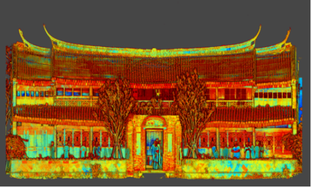
 Heritage Buildings
 About feiyan
 Recognition
 Cases
Cases

search


7 Ways to Process LiDAR Data
Mar 22, 2022

LiDAR technology has given the spatial data industry some of the largest data volumes we've ever seen.
Most point clouds I've worked with have been tens of gigabytes in size.
In 2007, FME users saw point clouds representing one point per square meter for airborne data. In 2013, Feiyan Remote Sensing saw eight points per square meter for the same data. Today, it's more like eighty points per square meter, and LiDAR is used to scan everything from landscapes to movie props.
So how do you use this massive amount of data to your advantage? Below are 7 ways we've seen people make the most out of this versatile data type.
1. Translate between other data formats
Much like CAD, GIS, rasters, and other data types, LiDAR data is not limited to a single format. Point clouds might be delivered as LAS (compressed or not), XYZ, ASTM E57, Oracle Spatial, Pointools POD, RIEGL, TerraScan, ZFS, or any number of other formats. Even Minecraft is technically just a big, blocky point cloud.
2. Combine point clouds with other formats
A magical chasm opens in spacetime when you combine LiDAR data with other data types. Whether thatâs CAD, GIS, rasters, vector data, 3D geometries, another point cloud, a reconstructed pirate map, or all of the above, your point cloud data just got interesting.
3. Inspect point components and values
That multi-gigabyte beast on your hard drive has no hope of transforming into a handsome prince if you can't decipher it. A key step in any transformation is inspection, so open your point clouds for viewing to find out what components are involved.
With the right inspection tool, even the most enormous point cloud datasets will start to make sense.
4. Change the coordinate system
LiDAR data has come to us in a variety of coordinate systems (UTM, StatePlane, etc). If you need to project the point cloud onto a map or combine it with other data, you can reproject it to another system just like any other type of spatial data.
5. Tile the data to speed up processing time
Tiling is when you chop the input features (points) into a series of tiles. If you have a big point cloud and a lot of transformations to do, try tiling it and using parallel processing. Itâll make your old transformation time look like a sloth on sedatives. Of course, tiling is also useful if you need to generate smaller pieces of the point cloud for delivery.
6. Clip to a specific region
1.2 billion points isnât a crazy number when dealing with LiDAR data. In fact, the word âbillionâ is pretty common. Chances are, you might not need all of those points in your output or analysis. Maybe you only want a specific region, like the area around a street.
Clipping is when you toss away the points outside of a defined boundary. This can be mega-helpful in creating a manageable size to work with.
If you provide a 3D solid as your clipper shape, you can perform a cubic clip.
7. Reduce the number of points
Maybe you want a manageable size to work with, but you donât want to clip out important features and make the earth look like it got crushed by a giant steamroller. Thinning a point cloud reduces its overall volume; for example, by removing every Nth point.
Point clouds are a highly useful, advanced way to store data. As the popularity of LiDAR continues to grow, we will certainly see more and more ways to transform this data type. Contact us for more.


-
Jun 17, 2022
Satellite Technologies For Plant Nutrient Deficiency Identification And Treatment
Satellite Technologies For Plant Nutrient Deficiency Identification And Treatment More > -
Jun 22, 2022
Historical Building Surveying and Mapping
China will further step up efforts to safeguard and transmit historical and cultural heritage as part of ongoing urban and rural development strategies. More > -
Mar 22, 2022
Utility of oblique aerial photography
With the rapid development of China's social economy, the value of real estate is increasing accordingly, which makes the country pay more and more attention to real estate surveying and mapping, and the requirements are higher and higher. More > -
Mar 22, 2022
What is tilt photography?
Tilt photography is a new and high technology developed in recent years in the field of international Remote sensing surveying and mapping. By carrying multiple sensors on the same flight platform and collecting images from different angles such as vertical and tilt, more complete and accurate information of ground objects can be obtained. More > -
Mar 22, 2022
Feiyan Remote Sensing LiDAR aerial photography project accumulates over 100,000 square kilometers
At present, airborne LiDAR technology has made great progress and has been widely used in many fields. Following the trend of technology development, feiyan Remote sensing has long been in the forefront of the industry. More > -
Mar 22, 2022
Mount Everest Elevation Measurement in 2020
On the afternoon of April 30, the first press conference of the 2020 Mount Everest elevation measurement was held at the Everest Base Camp, and the 2020 Mount Everest elevation measurement was officially launched. More > -
Mar 22, 2022
What are the restrictions on drone aerial photography?
Compared with traditional Aerial photography, the low efficiency of UAV Aerial photography has become one of the main bottlenecks restricting its development. More > -
Mar 22, 2022
The 6th Jiangsu University Surveying and Mapping Geo-Information business plan competition achieved
The 6th Jiangsu University Surveying and Mapping Geo-Information business plan competition achieved full success last week. Feiyan Remote sensing participated in this event as one of the chief co-sponsors. The competition provides an excellent platform for our students, played a major role in cultivating talent of Surveying and Mapping Geo-Information application as well. More > -
Mar 23, 2022
Flexibility of aerial photogrammetry technology
Aerial photogrammetry is generally low altitude flight, which is easy to operate in airspace and will not be affected by extreme weather. At the same time, it is not limited to the needs of take-off and landing sites. It only needs to select a relatively flat site for take-off and landing. More >