AIMS
AIMS AIMS-H Long Focus
 FarsightБ└╒ System
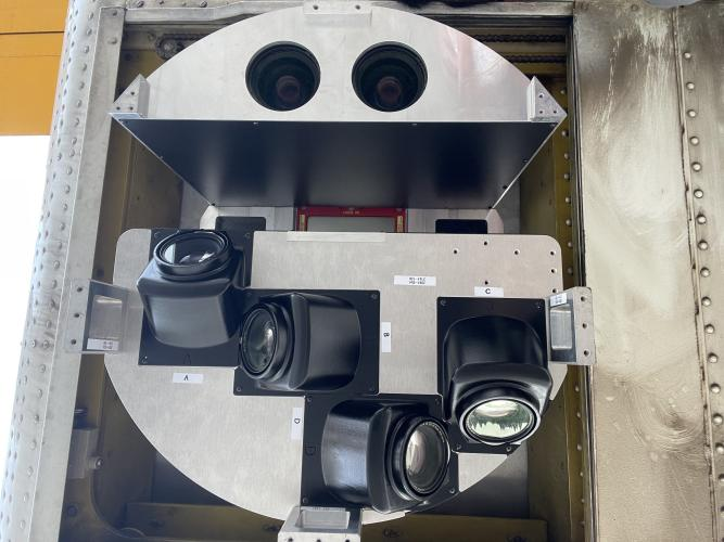
 Riegl VQ-1560i
 Riegl VQ-780II
 UltraCam Eagle M3
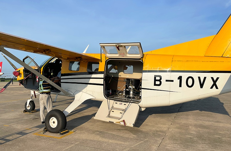
 Y-1 VTOL UAV
 Aerial Acquisition
 UAV Acquisition
 Satellite Acquisition
 Field Acquisition
 Integrated
 LiDAR
LiDAR Orthophoto
 DEM
DEM DTM/DSM
 3D Mapping
 Topographic
 Infrared
 Feature Extraction
 BIM
BIM Transportation
 Water
Water power
power  Forestry
 Agriculture
 Mines & Quarries
 Heritage Buildings
 About feiyan
 Recognition
 Cases
Cases

search

Enter search content


News
 HomeЦ──>Ц──NewsЦ──


all news
-
 Jun 15, 2026
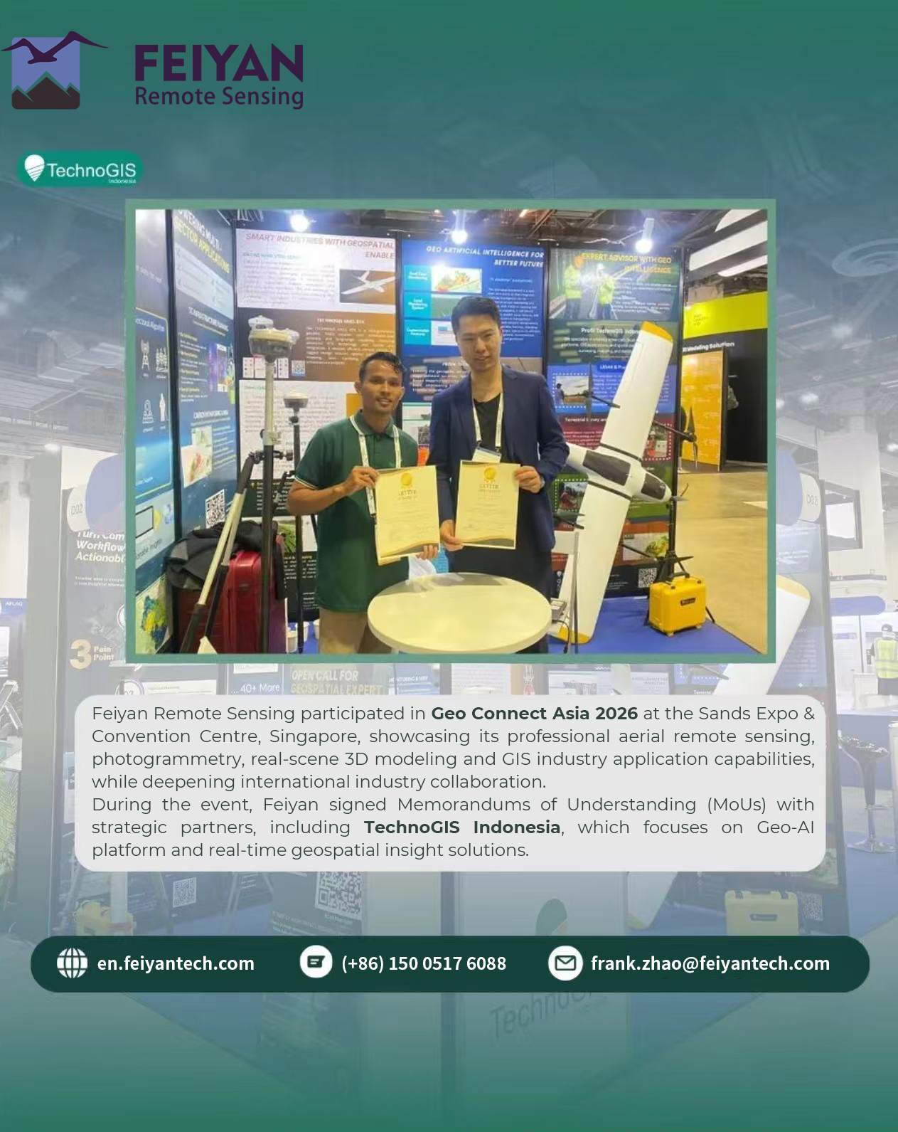
Feiyan Remote Sensing Strengthens Global Partnership at Geo Connect Asia 2026
More > -
Dec 29, 2025
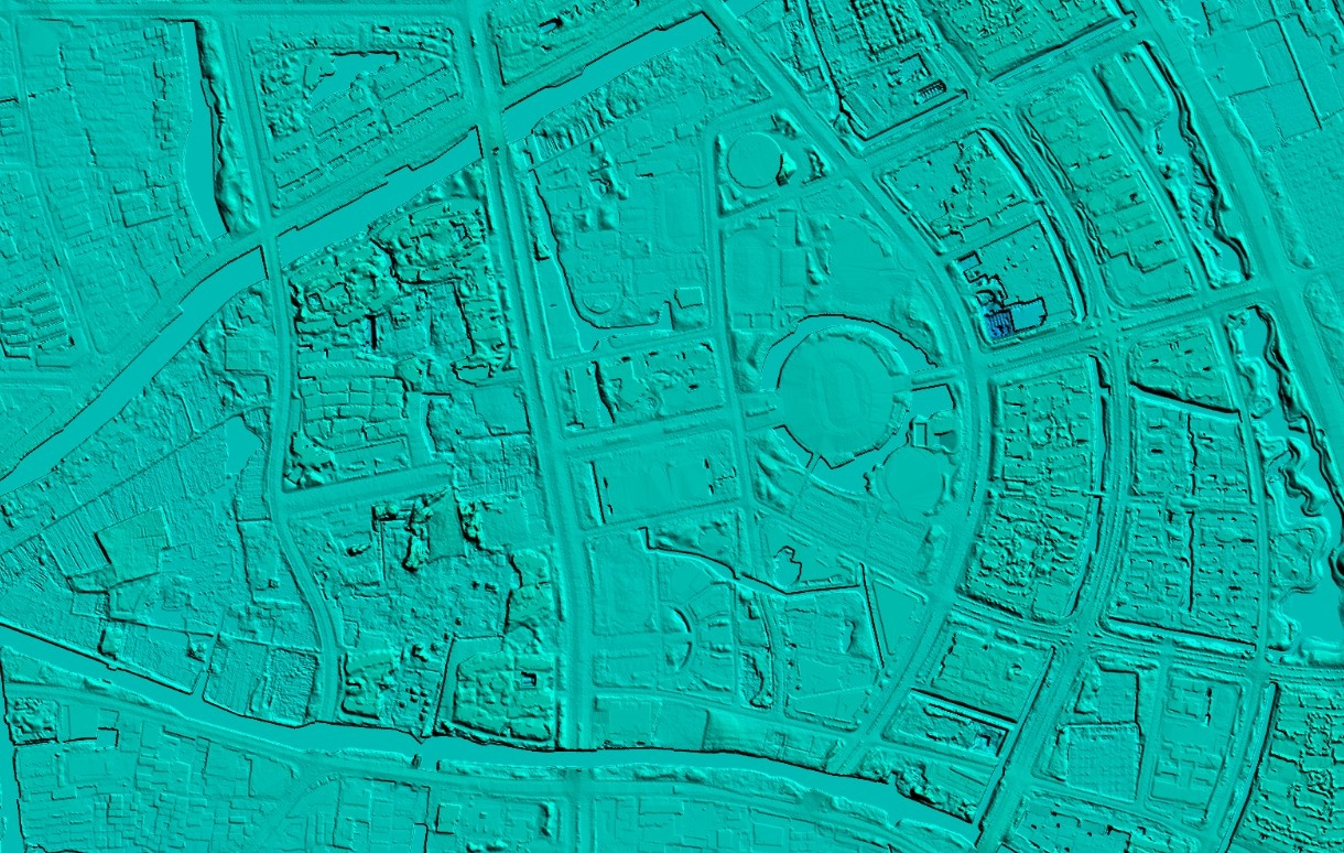
Zhangzhou Unveils Fujian's First Real 3D City Model, Setting New Standard for Digital Urban Development
More > -
Dec 22, 2025
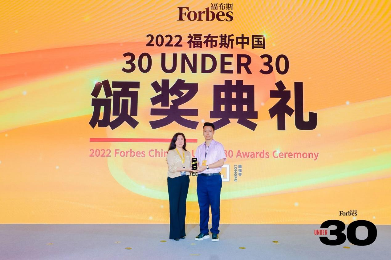
Forbes China Under 30 Summit Celebrates a Decade, Honoring Young Innovators like Frank Zhao of Feiyan Remote Sensing
Frank Zhao received the award at the Forbes China 30 Under 30 award ceremony More > -
Dec 13, 2025
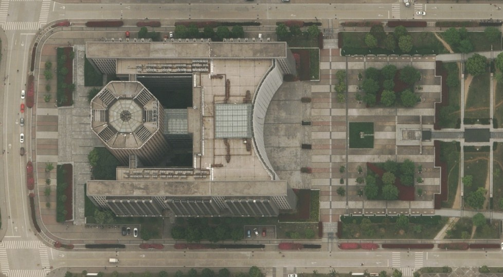
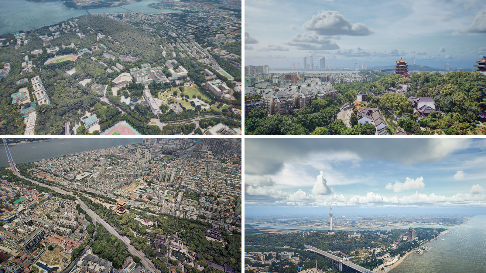
AIMS Multi-Modal Aerial Survey System Supports 3D Reality Modeling in Wuhan
Wuhan, acclaimed as China's Б─°Capital of Remote Sensing,Б─² is situated at the confluence of the Yangtze and Han Rivers. The city is home to the historic poetry of the Yellow Crane Tower and the serene beauty of East Lake, while also pulsating with the momentum of modern technology. More > -
Aug 31, 2023
Technical route of data processing related to digital orthographic image
More > -
Aug 29, 2023
DEM data processing
More >