AIMS
AIMS AIMS-H Long Focus
 Farsightâą System
 Riegl VQ-1560i
 Riegl VQ-780II
 UltraCam Eagle M3
 Y-1 VTOL UAV
 Aerial Acquisition
 UAV Acquisition
 Satellite Acquisition
 Field Acquisition
 Integrated
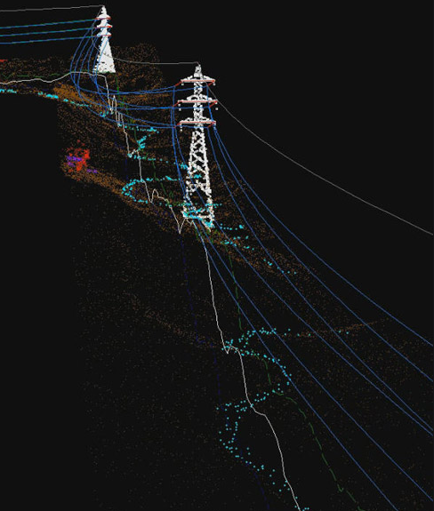
 LiDAR
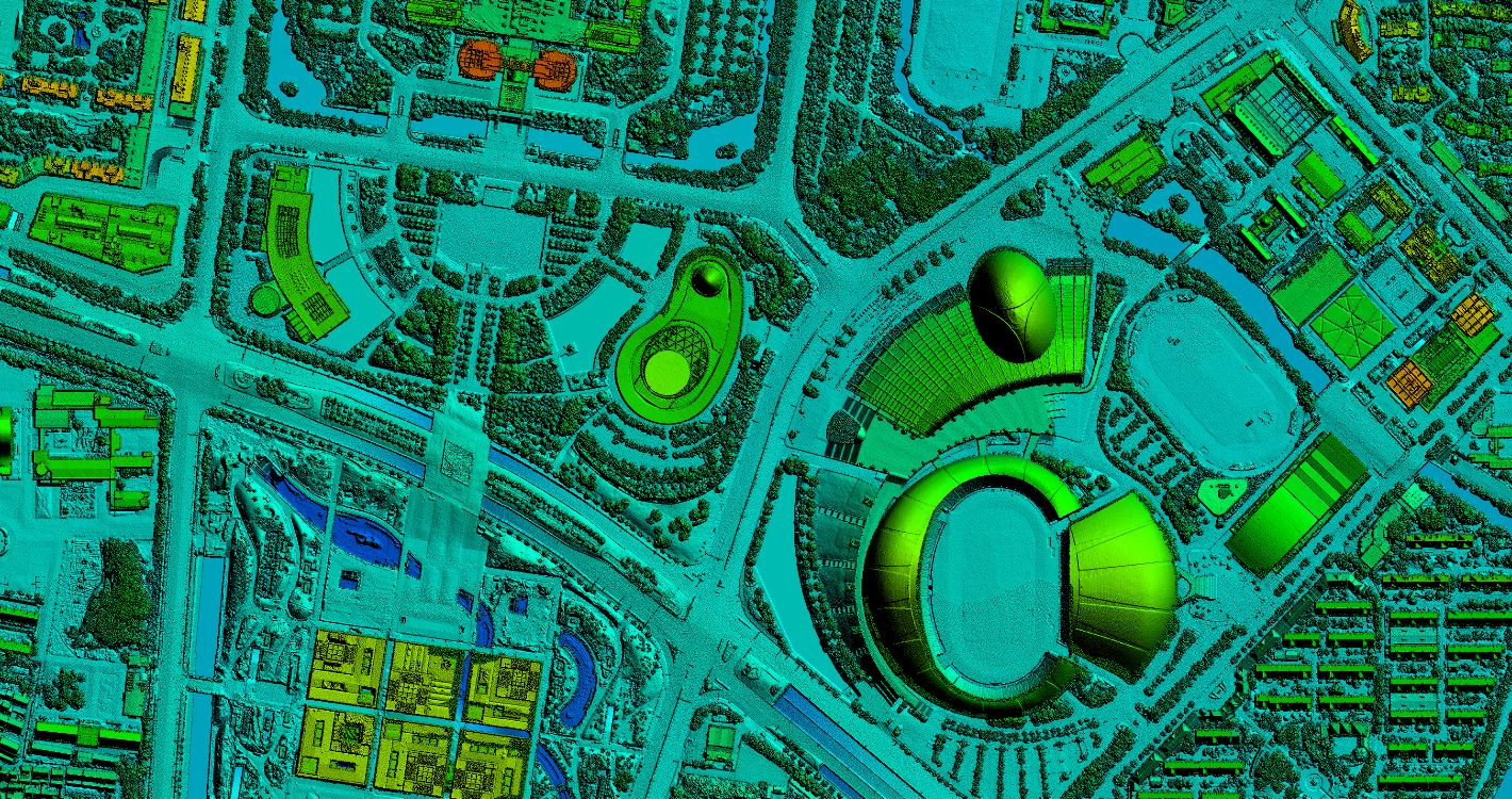
LiDAR Orthophoto
 DEM
DEM DTM/DSM
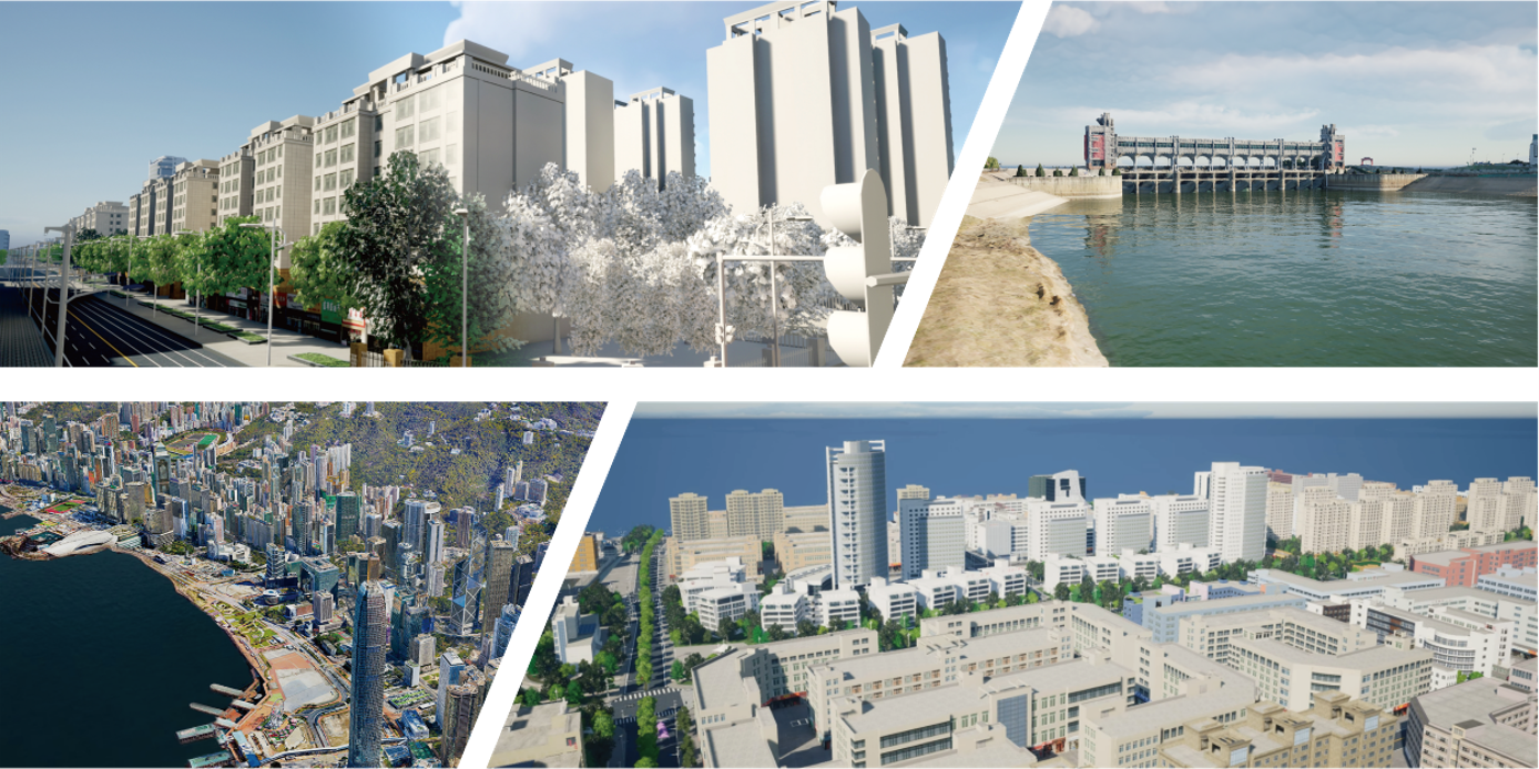
 3D Mapping
 Topographic
 Infrared
 Feature Extraction
 BIM
BIM Transportation
 Water
Water power
power  Forestry
 Agriculture
 Mines & Quarries
 Heritage Buildings
 About feiyan
 Recognition
 Cases
Cases

search


What are the characteristics of aerial photogrammetry technology?
Jun 25, 2023
Aerial photogrammetry technology includes a variety of leading science and technology, and has shown many advantages in practice, focusing on small size, rapid response, good accuracy, and low flight conditions. Compared with the traditional topographic surveying technology, the application of aerial photogrammetry technology to achieve topographic surveying and mapping accurately, effectively and quickly is also an important technical method for the design of topographic surveying and mapping technology for water conservancy projects.
1. Stability of aerial photogrammetry technology
In the practice of aerial photogrammetry, the range of sub-meter level accuracy ranges from 0.1 to 0.5m, which fully meets the mapping requirements related to digital topographic surveying. The design of the aerial photogrammetry system is to independently complete the flight plan production according to the work requirements in the early stage of the aerial photography work, including the flight route and aerial photography point setting, etc.; Point orientation, phase amplitude radiation range, flight direction and its latitude and longitude coordinate axis, altitude, etc.; Find areas for re-shooting, and when conditions permit, re-shooting can also be carried out in a timely manner, assisting technicians to efficiently carry out flight and shooting work.
2. Safety of aerial photogrammetry technology
my country's land area ranks third in the world. It has a vast territory, and its topography and climate are very complex and changeable. A few areas are affected by extreme weather, such as being covered with snow all year round. The use of satellite remote sensing to collect information will be subject to corresponding interference. Traditional topographic measurement methods are subject to the influence of clouds and terrain, which is prone to errors and deviations. At the same time, it brings potential risks to scientific and technical personnel and operators, and access to border areas is also limited. on border issues. The use of aerial photogrammetry technology can avoid the above problems very well, and will not be restricted by the altitude and topography. The image quality and accuracy completely surpass the measurement effect of human-controlled aircraft aerial photography and geological scientific research personnel.

3. Flexibility of aerial photogrammetry technology
Aerial photogrammetry is generally low-altitude flight, the airspace operation is convenient, and it will not be affected by extreme weather. At the same time, it is not limited to the needs of take-off and landing sites, and only needs to choose a relatively flat site for take-off and landing. In the process of collecting aerial photographs, the risk of pilots themselves can be ignored. In the process of data collection, the demand for geographical airspace and meteorological conditions is not high, and manual detection can be realized in areas that cannot be monitored. In addition, the aerial photogrammetry equipment only needs 15 minutes of preparatory work to be ready for flight, the control is not complicated, the tool transportation is convenient, and the daily reference personnel requirements can collect 200kmÂČ topographic measurement information. Compared with the traditional high-resolution satellite remote sensing, the traditional method has two major problems. First, the data storage time interval is very long. Secondly, assuming new impacts are collected, the shooting cycle is long, and impact information cannot be stored at any time. Therefore, the advantages of aerial photogrammetry are that the time is very flexible, the required time is very short, and the work continuity is strong at the same time, and it can be photographed and stored in time, and processed in time. Compared with satellite and artificial machine surveying and mapping, it can achieve less time-consuming and faster Provide customers with finished images.


-
 Jun 20, 2023
Analysis of the Advantages of UAV Aerial Photogrammetry
In recent years, the use of UAVs for aerial photography has gradually increased. UAVs play an irreplaceable role in aerial photography due to their convenience and flexibility. There are four main advantages: More > -
Jun 27, 2023
What are the applications of UAV aerial photogrammetry in terrain mapping?
In order to adapt to the current form of national basic surveying and mapping work, UAV aerial photogrammetry technology has been widely valued by people. UAV aerial photogrammetry makes up for the shortcomings of traditional surveying and mapping technology, and plays a huge role in the current stage of topographic mapping. More > -
Jul 07, 2023
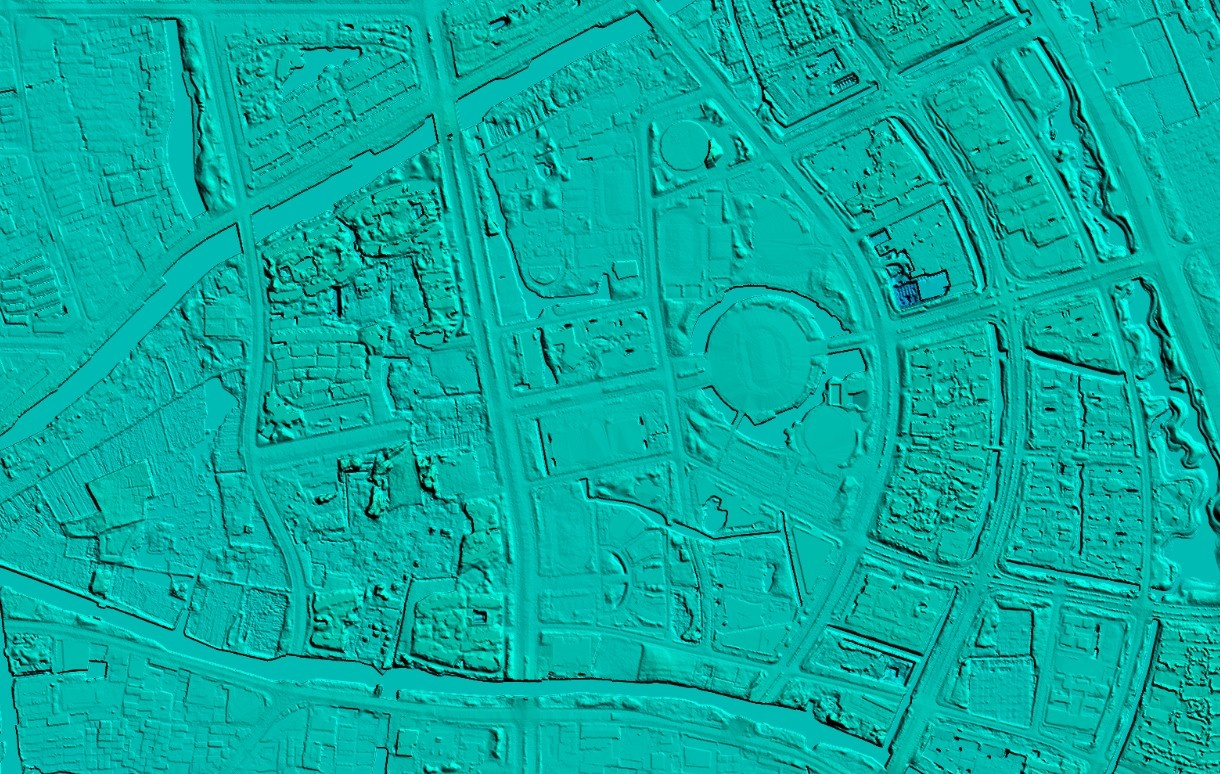
The difference between DEM(Digital Elevation Model), DSM(Digital Surface Model) and DTM(Digital Terrain Modelâ)
DEM DEM, Digital Elevation Model, is a 3D computer graphic representation of elevation data. DSM DSM, Digital Surface Model, represents the earth's surface and includes all objects on it, generally used in landscape modeling, urban modeling and visualization applications. DTM DTM, Digital Terrain Modelâ, represents bare ground without any objects such as plants and buildings, and is often used for flood or drainage modeling, land use studies, geological applications, and other applications. More > -
Jul 10, 2023
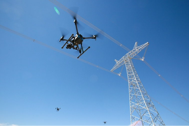
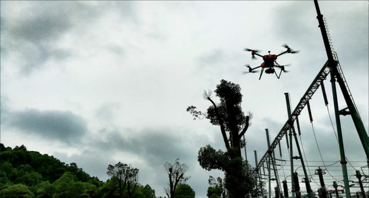
Application of Airborne LiDAR Technology in Power Optimal Line Selection
First of all, it is necessary to analyze the map and image data, and select the appropriate transmission line path according to the actual situation to facilitate the subsequent construction of overhead transmission lines. Secondly, after the initial path selection is completed, it is necessary to use airborne lidar technology for measurement according to the selection results. The measurement process must ensure comprehensiveness, scientific processing through advanced technology, and field research using technical functions. Finally, the laser radar is used to integrate the data, and the results are fused with each other. The staff optimizes the circuit through the circuit design software and outputs the final result. More > -
Aug 04, 2023
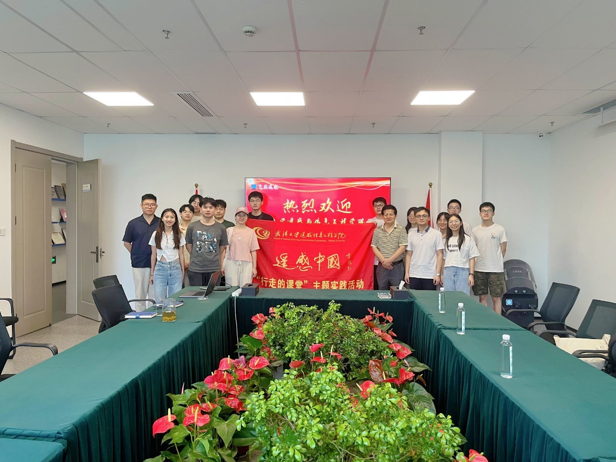
The practice team of the School of Remote Sensing Information Engineering of Wuhan University visited our company
More > -
Aug 18, 2023
Advantages of Feiyan remote sensing data processing
More > -
Aug 21, 2023
The process of satellite image data processing
More > -
Aug 22, 2023
Edge data processing of orthophoto
More > -
Aug 29, 2023
DEM data processing
More >