AIMS
AIMS AIMS-H Long Focus
 Farsightâą System
 Riegl VQ-1560i
 Riegl VQ-780II
 UltraCam Eagle M3
 Y-1 VTOL UAV
 Aerial Acquisition
 UAV Acquisition
 Satellite Acquisition
 Field Acquisition
 Integrated
 LiDAR
LiDAR Orthophoto
 DEM
DEM DTM/DSM
 3D Mapping
 Topographic
 Infrared
 Feature Extraction
 BIM
BIM Transportation
 Water
Water power
power  Forestry
 Agriculture
 Mines & Quarries
 Heritage Buildings
 About feiyan
 Recognition
 Cases
Cases

search


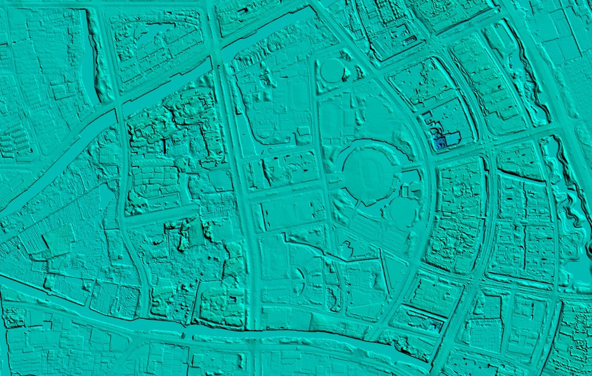
What are the applications of UAV aerial photogrammetry in terrain mapping?
Jun 27, 2023
In order to adapt to the current form of national basic surveying and mapping work, UAV aerial photogrammetry technology has been widely valued by people. UAV aerial photogrammetry makes up for the shortcomings of traditional surveying and mapping technology, and plays a huge role in the current stage of topographic mapping.
1. Control measurement of photos
The control and measurement of photos is one of the most important technologies in UAV aerial photography technology. The so-called photo control measurement is to integrate the data taken by the drone with the navigation and positioning information in the GPS system, convert the data obtained by the aerial photography of the drone and the measurement data on the ground, and obtain the real topography of the area. feature. Especially for some terrains or areas that need special attention, the data can be directly transmitted, recorded and saved through aerial photography of drones. Among them, it is necessary to pay attention to the setting of the control points other than the photo control points, which should be set in more obvious places, so as to obtain more ideal data.
2. Aerial triangulation in aerial photogrammetry
Aerial triangulation is also a relatively common technique in UAV aerial photogrammetry. UAVs use aerial digital camera equipment to perform aerial triangulation technology, which can measure the specific position of terrain. One of the advantages of aerial triangulation is that it can automatically calculate with the help of pre-edited system programs, so as to obtain the corresponding terrain position information. The cumbersome steps of manually setting aerial digital camera equipment are eliminated. With such aerial triangulation techniques, relative orientation can be achieved smoothly. After this step is completed, use the system to connect the survey flight belt with the survey model, and then use aerial triangulation for data calculation, and use the obtained connection point data and image control points as debugging information to draw a more accurate terrain picture.

3.Stereoscopic collection and editing of measurement data
Obtaining data through UAV aerial photogrammetry can use the three-dimensional information in the industry to collect, edit and manage the terrain data information of the measured area. In order to ensure the accuracy and reliability of the three-dimensional acquisition and editing of measurement data, important information such as contour lines and waterlines can be edited manually, and other general information can be edited three-dimensionally by computer. This link needs to pay attention to the precise control of object line nodes and terrain structure data, etc., to ensure the accuracy of the data obtained by drone aerial photography, otherwise it will affect the accuracy of stereoscopic acquisition and editing. If the information surveying and mapping of the house structure is carried out, the outline of the outer edge of the house should be processed first, and the edge or outline of the eaves should be corrected to ensure the accuracy of the data measurement; if there are areas that cannot be measured, they should be carefully marked to ensure the accuracy of the topographic measurement and wholeness.
4.Field supplementary measurement of blind spots in aerial measurement
No matter how advanced the surveying and mapping tools are, they cannot measure all terrain areas, and the blind spots in the survey need to be measured by manual supplementary surveys to measure terrain structures and even hidden areas. In the process of field supplementary measurement, it is necessary to pay attention to comparative analysis, and compare the actual measurement data with the results of drone aerial photography, so as to mutually verify the accuracy of the surveying and mapping data. If there is a large deviation, analyze the cause of the error and correct it in time to ensure the accuracy of the surveying and mapping results. The interference of human factors and the common measurement accidents in traditional surveys should be avoided as much as possible when conducting aerial surveys by UAVs, so as to ensure the accuracy and breadth of surveying and mapping data.


-
 Jun 20, 2023
Analysis of the Advantages of UAV Aerial Photogrammetry
In recent years, the use of UAVs for aerial photography has gradually increased. UAVs play an irreplaceable role in aerial photography due to their convenience and flexibility. There are four main advantages: More > -
Jun 25, 2023
What are the characteristics of aerial photogrammetry technology?
Aerial photogrammetry technology includes a variety of leading science and technology, and has shown many advantages in practice, focusing on small size, rapid response, good accuracy, and low flight conditions. Compared with the traditional topographic surveying technology, the application of aerial photogrammetry technology to achieve topographic surveying and mapping accurately, effectively and quickly is also an important technical method for the design of topographic surveying and mapping technology for water conservancy projects. More > -
Jul 07, 2023
The difference between DEM(Digital Elevation Model), DSM(Digital Surface Model) and DTM(Digital Terrain Modelâ)
DEM DEM, Digital Elevation Model, is a 3D computer graphic representation of elevation data. DSM DSM, Digital Surface Model, represents the earth's surface and includes all objects on it, generally used in landscape modeling, urban modeling and visualization applications. DTM DTM, Digital Terrain Modelâ, represents bare ground without any objects such as plants and buildings, and is often used for flood or drainage modeling, land use studies, geological applications, and other applications. More > -
Jul 10, 2023
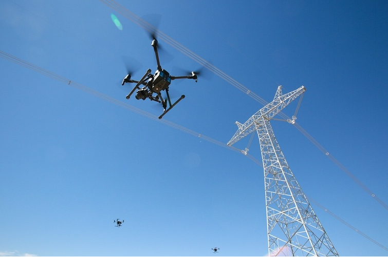
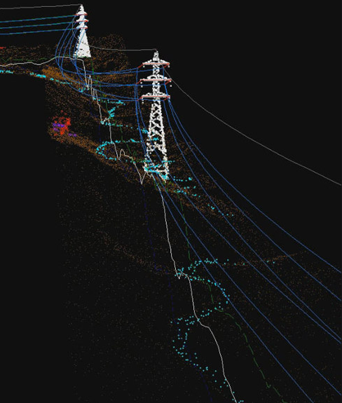
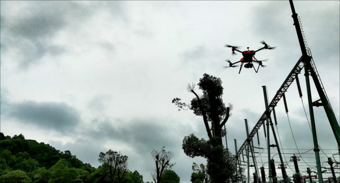
Application of Airborne LiDAR Technology in Power Optimal Line Selection
First of all, it is necessary to analyze the map and image data, and select the appropriate transmission line path according to the actual situation to facilitate the subsequent construction of overhead transmission lines. Secondly, after the initial path selection is completed, it is necessary to use airborne lidar technology for measurement according to the selection results. The measurement process must ensure comprehensiveness, scientific processing through advanced technology, and field research using technical functions. Finally, the laser radar is used to integrate the data, and the results are fused with each other. The staff optimizes the circuit through the circuit design software and outputs the final result. More > -
Aug 04, 2023
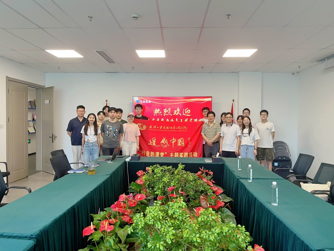
The practice team of the School of Remote Sensing Information Engineering of Wuhan University visited our company
More > -
Aug 18, 2023
Advantages of Feiyan remote sensing data processing
More > -
Aug 21, 2023
The process of satellite image data processing
More > -
Aug 22, 2023
Edge data processing of orthophoto
More > -
Aug 29, 2023
DEM data processing
More >