 AIMS
AIMS AIMS-H Long Focus
 Farsightв„ў System
 Riegl VQ-1560i
 Riegl VQ-780II
 UltraCam Eagle M3
 Y-1 VTOL UAV
 Aerial Acquisition
 UAV Acquisition
 Satellite Acquisition
 Field Acquisition
 Integrated
 LiDAR
LiDAR Orthophoto
 DEM
DEM DTM/DSM
 3D Mapping
 Topographic
 Infrared
 Feature Extraction
 BIM
BIM Transportation
 Water
Water power
power  Forestry
 Agriculture
 Mines & Quarries
 Heritage Buildings
 About feiyan
 Recognition
 Cases
Cases

search


Solution

Automated Power Line Inspection
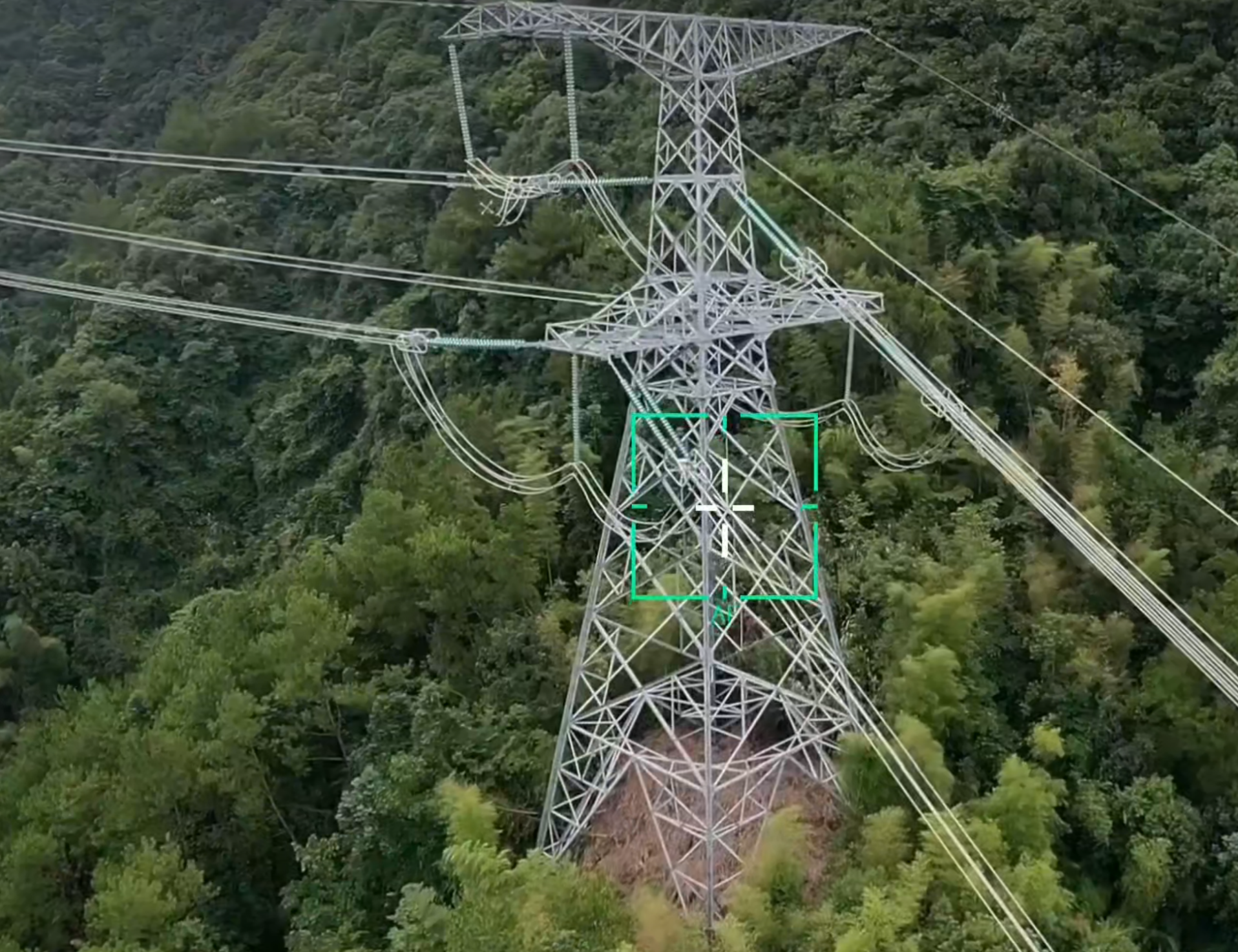
Feiyan delivers automated power line inspection services using UAV or helicopter platforms equipped with LiDAR and high-resolution cameras. This enables efficient, large-scale data collection even in challenging terrain. Our proprietary AI analytics automatically process point clouds to detect vegetation encroachment, classify risks, and identify hardware defects, generating actionable reports for proactive right-of-way maintenance to enhance grid reliability and safety.
Our Differentiated Solution Framework
Built on the Swift4D Platform, our framework integrates efficient acquisition, intelligent analytics, and proactive maintenance:
Multi-Platform Acquisition: Y-1 UAVs (150-min endurance, fully autonomous) or helicopters equipped with AIMS Multi-sensor (LiDAR + high-res camera) cover 30-50 km of transmission corridors per sortie, overcoming terrain limitations.
Swift4D Point Cloud Processing: Real-time processing of massive point clouds and imagery generates high-precision 3D corridor models, extracting sag, tower posture, and clearance distances.
SwiftAI Hazard Detection: Deep learning classifies vegetation (by species, growth rate) and quantifies wire-vegetation clearance, assigning red/yellow/green risk levels per safety codes. It also detects hardware defects (damaged insulators, missing bolts, bird nests).
Actionable Reports & Work Orders: System auto-generates hazard lists with GPS coordinates, photos, risk levels, and recommended action deadlines, pushing to maintenance crewsвҖҷ mobile terminals for a closed-loop process.

Application Scenarios & Client Value
Application Scenarios
Vegetation encroachment assessment and risk classification for transmission corridors


Tower hardware defect detection (insulators, fittings, bolts)


Conductor sag and cross-span distance measurement
Post-disaster rapid patrol (typhoons, icing, wildfires)
Encroaching construction and foreign object hazard identification in ROW
Client Value
Efficiency Leap: 50 km per UAV daily, 10x faster than foot patrols; aerial data replaces tower climbing, eliminating safety risks.

Proactive Warning: mm-accurate clearance measurement enables 1-2 season advance warning for vegetation clearing, preventing flashovers.
Cost-Effective: Replaces expensive helicopter patrols, enabling routine high-frequency inspection with 40%+ annual O&M cost reduction.

Data-Driven: Multi-temporal models support corridor change trend analysis, guiding clearing plans and species replacement strategies.


