 AIMS
AIMS AIMS-H Long Focus
 Farsightв„ў System
 Riegl VQ-1560i
 Riegl VQ-780II
 UltraCam Eagle M3
 Y-1 VTOL UAV
 Aerial Acquisition
 UAV Acquisition
 Satellite Acquisition
 Field Acquisition
 Integrated
 LiDAR
LiDAR Orthophoto
 DEM
DEM DTM/DSM
 3D Mapping
 Topographic
 Infrared
 Feature Extraction
 BIM
BIM Transportation
 Water
Water power
power  Forestry
 Agriculture
 Mines & Quarries
 Heritage Buildings
 About feiyan
 Recognition
 Cases
Cases

search


Solution

AI-Driven Tree Species Classification & Biodiversity Mapping
Feiyan integrates the Y-1 UAV System, AIMS Multi-sensor Camera, and Swift4D Platform to deliver AI-driven tree species classification and biodiversity mapping. Using high-resolution imagery, multispectral data, and LiDAR with deep learning, it enables individual tree-level species identification and spatial diversity mapping for forest inventory, invasive species monitoring, and precision silviculture.
Our Differentiated Solution Framework
Built on Swift4D, the framework integrates multi-modal acquisition, spectral-structural fusion, AI recognition, and biodiversity mapping:
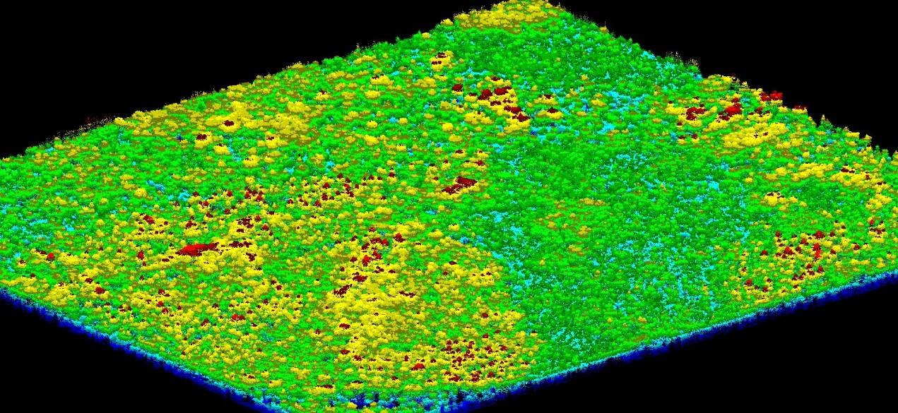
Multi-Modal Acquisition: Y-1 captures RGB and multispectral data; AIMS adds LiDAR point clouds and hyperspectral data, overcoming ground survey limitations.
Spectral-Structural Fusion: Swift4D fuses multi-temporal imagery and point clouds to extract spectral, textural, and height features, significantly improving diversity estimation accuracy.
SwiftAI Species Identification: CNNs and instance segmentation extract individual tree crowns, integrating spectral and height data for classification, generating single-tree species polygons.
Biodiversity Mapping & Monitoring: Grid-based calculation of richness, Shannon, and Simpson indices; multi-temporal comparison tracks disease spread and vegetation succession.

Application Scenarios & Client Value
Application Scenarios
Forest inventory and species distribution mapping
![]()
![]()


Biodiversity baseline surveys for protected areas
Invasive species (e.g., Spartina alterniflora) monitoring and control

Early detection and spread tracking of pine wilt disease

Precision thinning and carbon accounting

Client Value
Efficiency: AI replaces manual work, reducing field time by 80% and compressing cycles from months to days.
Accuracy: Individual tree-level classification provides high-precision data for conservation and restoration.
Early Warning: High-frequency patrols combined with change detection narrow the risk window for outbreaks.
Sustainability: Long-term monitoring supports forest health assessment and carbon accounting.


