 AIMS
AIMS AIMS-H Long Focus
 Farsightв„ў System
 Riegl VQ-1560i
 Riegl VQ-780II
 UltraCam Eagle M3
 Y-1 VTOL UAV
 Aerial Acquisition
 UAV Acquisition
 Satellite Acquisition
 Field Acquisition
 Integrated
 LiDAR
LiDAR Orthophoto
 DEM
DEM DTM/DSM
 3D Mapping
 Topographic
 Infrared
 Feature Extraction
 BIM
BIM Transportation
 Water
Water power
power  Forestry
 Agriculture
 Mines & Quarries
 Heritage Buildings
 About feiyan
 Recognition
 Cases
Cases

search


Solution

Proactive Forest Fire Detection & Operational Monitoring
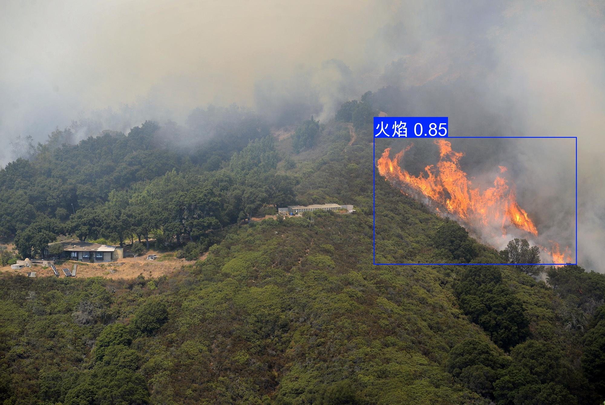
We deliver proactive wildfire management intelligence via a data-driven framework, integrating the Farsightв„ў VTOL Fixed-Wing UAV System, multi-modal sensing, and Swift4D Analytics Platform. Combining near-real-time satellite data, high-frequency aerial surveys, and SwiftAI-powered detection, we enable cm-level hotspot verification, dynamic fire perimeter mapping, and rapid spread modelingвҖ”optimizing emergency response, firefighting coordination, and post-fire recovery for forestry agencies and fire departments.
Our Differentiated Solution Framework
1. Stereo Perception & High-Frequency Data Acquisition
Deploy "UAV full-area scanning + tower fixed-point supplementary monitoring" to eliminate blind spots.
The Farsightв„ў System covers over 3,000 kmВІ per hangar (30-50 km operational radius) with 150-minute endurance and 5-minute autonomous battery swapping.
Capture thermal infrared, LiDAR, and hyperspectral data for cm-level 3D modeling and precise fire source localization.
2. SwiftAI-Powered Intelligence & Real-Time Alerting
SwiftAI algorithm warehouse detects smoke, flames, and high-temperature anomalies within 10 minutes, with near-zero false alarms.
Implement "SwiftAI initial screening вҶ’ UAV verification вҶ’ responder dispatch" three-level response loop.
Generate real-time fire spread forecasts and 3D situational sandboxes via Swift4D for data-driven decision-making.
3. End-to-End Operational Coordination & Post-Fire Assessment
Synchronize UAV real-time feeds, terrain models, and responder data on Swift4DвҖҷs unified dashboard for air-ground collaborative command.
Deploy UAVs within 72 hours post-fire for cm-level burn scar mapping and vegetation loss quantification.
Track restoration progress via NDVI monitoring and automate compliance-ready reports.
Application Scenarios & Client Value
Application Scenario | Pain Points Addressed | Solution & Deliverables | Value to Client |
Large-Scale Forest Patrols | Monitoring blind spots; slow detection; high costs. | Farsightв„ў UAV high-frequency patrols; SwiftAI detection; 3,000+ kmВІ coverage | 10-minute fire detection; 30-50% cost reduction; no blind spots |
High-Risk Area Surveillance | Inadequate nighttime monitoring; manual inefficiency | Targeted UAV patrols; thermal infrared monitoring; SwiftAI real-time alerts | Proactive hazard mitigation; enhanced patrol safety |
Emergency Command | Chaotic resource allocation; poor situational awareness | Swift4D 3D sandbox; real-time UAV feeds; unified command dashboard | 40% faster response; minimized firefighter risk |
Post-Fire Assessment & Restoration | Inaccurate damage quantification; slow data collection | cm-level burn scar mapping; Swift4D NDVI monitoring; restoration reports | Data-driven restoration planning; transparent stakeholder reporting |


