AIMS
AIMS AIMS-H Long Focus
 Farsightâą System
 Riegl VQ-1560i
 Riegl VQ-780II
 UltraCam Eagle M3
 Y-1 VTOL UAV
 Aerial Acquisition
 UAV Acquisition
 Satellite Acquisition
 Field Acquisition
 Integrated
 LiDAR
LiDAR Orthophoto
 DEM
DEM DTM/DSM
 3D Mapping
 Topographic
 Infrared
 Feature Extraction
 BIM
BIM Transportation
 Water
Water power
power  Forestry
 Agriculture
 Mines & Quarries
 Heritage Buildings
 About feiyan
 Recognition
 Cases
Cases

search

Enter search content


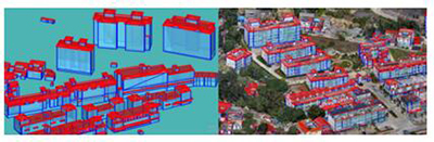
What is Digital Surface ModelïŒDSMïŒ
Apr 18, 2023
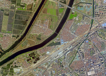
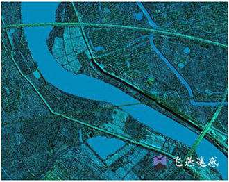
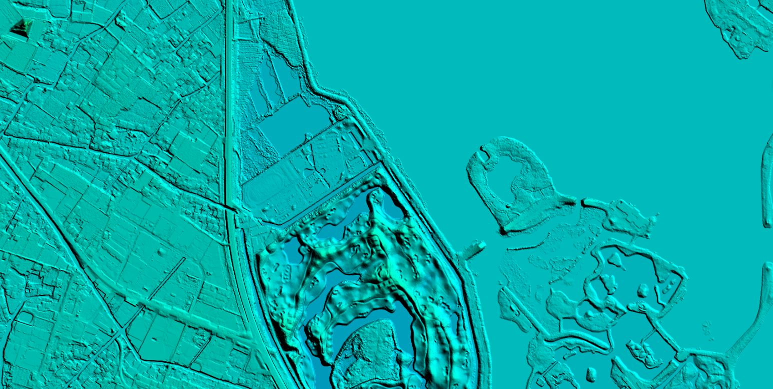
In a LiDAR system, a light pulse travels to the ground, and when the light pulse bounces off its target and returns to the sensor, the detection range is obtained. LiDAR provides massive point clouds with elevation values, which can come from building tops, tree canopies, power lines, and other features, and DSM captures natural and architectural features on the Earth's surface.

DSM can be used for 3D modeling in telecommunications, urban planning and aviation. In aviation, DSM can determine runway obstacles in the approach area. In vegetation management, DSM can see the location and amount of vegetation encroachment. DSM can be used in urban planning to check whether proposed buildings will interfere with views.


relevant news
-
 Jan 10, 2023
What is Satellite Acquisition?
Satellite acquisition refers to the process of finding and locking onto a satellite signal for the purpose of receiving and transmitting data. More > -
Apr 12, 2023
The Difference Between DOM and DSM
Digital Orthophoto Map (DOM) has the advantages of high precision, rich information, intuitive and realistic, fast acquisition, etc., and can be used as map analysis background control information. More > -
Apr 19, 2023
Real-Scene 3D White Model Construction with Multi-Source Data Fusion
As the initial product of the 3D architectural model, the white model contains information such as the location, height, shape, area, and volume of the building More > -
May 17, 2023
Features of Oblique Photography
The birth of oblique photography technology has subverted the traditional way of operation. More > -
Jul 03, 2023
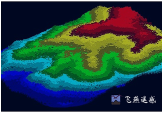
What is Digital Surface Model
Digital Surface Model (DSM) refers to a ground elevation model that includes the heights of surface buildings, bridges and trees. Compared with DEM, DEM only contains the elevation information of the terrain and does not include other surface information. DSM is based on DEM and further covers the elevation of other surface information except the ground. In some areas where there is a demand for building height, it has received a lot of attention. More >