AIMS
AIMS AIMS-H Long Focus
 Farsightâą System
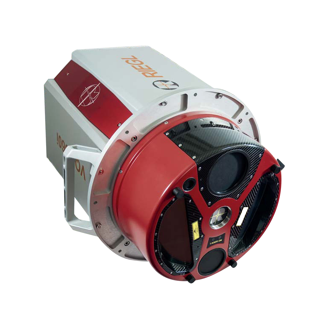
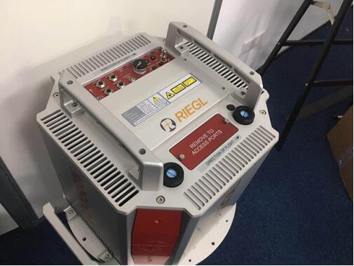
 Riegl VQ-1560i
 Riegl VQ-780II
 UltraCam Eagle M3
 Y-1 VTOL UAV
 Aerial Acquisition
 UAV Acquisition
 Satellite Acquisition
 Field Acquisition
 Integrated
 LiDAR
LiDAR Orthophoto
 DEM
DEM DTM/DSM
 3D Mapping
 Topographic
 Infrared
 Feature Extraction
 BIM
BIM Transportation
 Water
Water power
power  Forestry
 Agriculture
 Mines & Quarries
 Heritage Buildings
 About feiyan
 Recognition
 Cases
Cases

search


Current Situation and Application of Airborne LiDAR
May 09, 2023
Although laser technology has not been around for a long time since it came out, it has several extremely valuable features such as high brightness, high directionality, high monochromaticity and high coherence, and is widely used in national defense, military, industry and agriculture. It is widely used in production, medical health and scientific research.

Applications
1. Military applications
At present, great achievements have been made in mine detection lidar, chemical reagent detection lidar, atmospheric monitoring lidar, and biochemical land warfare lidar. In addition, China's attack laser radar is quite advanced, including the world's most cutting-edge five core technologies: breakthroughs in laser material research, breakthroughs in the physical mechanism of laser radiation materials and imaging maps, breakthroughs in one-time fast tracking and positioning control technology, Breakthroughs in high-density energy reversible conversion carrier materials, and breakthroughs in laser imaging technology.
2. Application of wind measurement
LiDAR has high resolution, high precision, large detection range, and the ability to provide three-dimensional wind field information under clear sky conditions. Wind lidar uses the Doppler effect of light, mainly in two ways: coherent (heterodyne) detection and incoherent (direct) detection.
3. Meteorological applications
The national sandstorm monitoring network can find out the exact source of sandstorms through joint research of advanced observation, simulation and satellite remote sensing, and scientifically distinguish the effects of natural factors such as meteorological and climatic conditions and human factors such as the increase of desertified land on sandstorms. It provides a scientific basis for accurate early warning and forecasting of sandstorms, and formulation of comprehensive and efficient prevention and control plans.
4. Application in soil and water conservation monitoring
Due to the impact of construction and development, it is very difficult to control water and soil erosion. According to the survey, the area of water and soil erosion due to development and construction in the whole country reaches more than 1.00Ă104 square kilometers every year. Because the measurement accuracy of laser radar is much finer than that of traditional methods, and it can reflect the shape of the measured site in detail, and it is easy to realize three-dimensional modeling, thus realizing non-contact measurement, greatly reducing the workload of the field and reducing the out of danger.


-
 Mar 18, 2022
Feiyan Invested 20 Million For Airborne LiDAR Measurement
Feiyan invested 20 million to introduce airborne LiDAR measurement, which once again laid the foundation for the hardware strength of feiyan in the industry. More > -
Mar 22, 2022
What is LiDAR point cloud data?
LiDAR (laser detection and ranging) is an optical Remote sensing technology which mainly USES the laser as the emitting light source and adopts the active Remote sensing equipment of photoelectric detection technology. Primarily used in airborne laser mapping applications, it is increasingly becoming a cost-effective alternative to traditional measurement techniques such as photogrammetry. More > -
Mar 22, 2022
The Riegl Vq-1560i Airborne Laser Lidar Lived up to Expectations
The ninth China surveying and mapping geographic information technology equipment expo has been successfully concluded. More > -
Mar 22, 2022
Lidar Forest Survey, Incomparable Advantages
In recent years, LiDAR forest survey has attracted more and more people's attention. However, the hotter this new technology is, the more it needs to be understood from all aspects calmly. More > -
Mar 22, 2022
Lidar Is a Key Technology Involved in Terrain Mapping
This question cannot be asked like that. Aerial photography must be sunny, but the altitude angle of the sun must be considered. More > -
Mar 22, 2022
LiDAR and Hyperspectral Remote Sensing Data Fusion Realize Complementary Advantages
With the continuous development and progress of earth observation technology, and the continuous diversification of means for obtaining spatial information, the use of a single means of spatial data resources has been difficult to meet people's information needs. Lidar and hyperspectral Remote sensing, as two common Remote sensing methods, have different characteristics: Lidar can quickly, efficiently and accurately obtain three-dimensional spatial data of features, and hyperspectral images can well characterize the spectral information of features , Reflecting the characteristics of its features, materials, texture, etc. The fusion of these two kinds of data can achieve complementary advantages, maximize their respective characteristics, and achieve more accurate intelligent detection and identification of objects and higher-precision classification and extraction, which are widely used in forestry ecology, precision agriculture, environment Monitoring and other fields. More > -
Mar 22, 2022
What Are the Requirements for the Airborne Lidar Camera for the Acquisition of Lidar Point Cloud Data
In the effective altitude range, to ensure the lowest point cloud density, the laser radar maximum laser emission frequency To be higher. More > -
Mar 22, 2022
The Basics of LiDAR
LiDAR is an active Remote sensing system. An active system means that the system itself generates energy - in this case, light - to measure things on the ground. In a LiDAR system, light is emitted from a rapidly firing laser. You can imagine light quickly strobing from a laser light source. This light travels to the ground and reflects off of things like buildings and tree branches. The reflected light energy then returns to the LiDAR sensor where it is recorded. More > -
Mar 22, 2022
What Are the Different Uses of LiDAR Processing?
LiDAR (Light Detection and Ranging) technology and processing is used in a wide range of research and practical applications. With its ability to measure dimensions, distances, textures, and many other aspects of targeted subjects, LiDAR processing has become an increasingly important tool in geology, geography, surveying, agriculture, and forestry. Atmospheric sciences, archaeology, seismology, and geomatics also depend on data gathered using LIDAR processing for research, while physics and astronomy benefit from LiDAR's ability to create highly precise maps. More >