AIMS
AIMS AIMS-H Long Focus
 Farsightâą System
 Riegl VQ-1560i
 Riegl VQ-780II
 UltraCam Eagle M3
 Y-1 VTOL UAV
 Aerial Acquisition
 UAV Acquisition
 Satellite Acquisition
 Field Acquisition
 Integrated
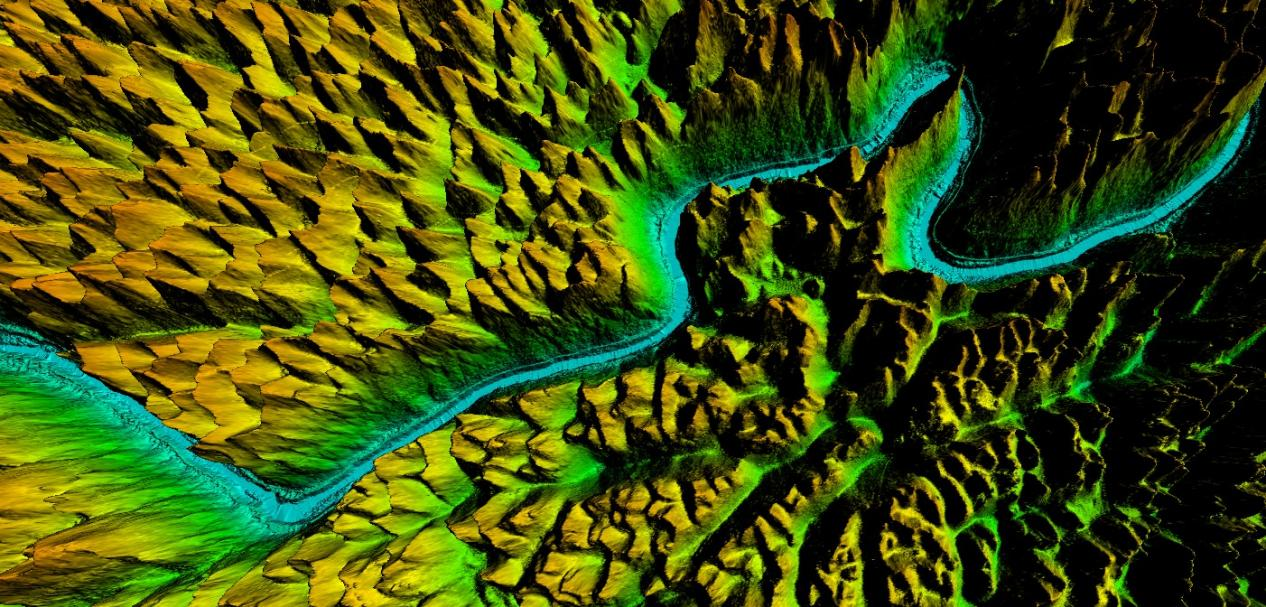
 LiDAR
LiDAR Orthophoto
 DEM
DEM DTM/DSM
 3D Mapping
 Topographic
 Infrared
 Feature Extraction
 BIM
BIM Transportation
 Water
Water power
power  Forestry
 Agriculture
 Mines & Quarries
 Heritage Buildings
 About feiyan
 Recognition
 Cases
Cases

search


Feiyan Remote Sensing Training an Important Role in Ensuring the Completion of Aerial Photography
Mar 22, 2022

In the previous article "organizing comprehensive and systematic training to improve the professional level of the team", we mentioned the training situation of the first day of the 3-day training. Today we continue to talk about the training in the future.

First of all, the first speaker will give you the training, mainly covering the situation of the large aircraft and the company's own equipment, and the implementation of some projects in the field.
Field work focuses on the acquisition of source data.
Before the Aerial photography mission, weather conditions should be monitored to determine whether Aerial photography can be conducted, and advanced equipment, suitable aircraft platforms and flight strategies should be developed for different projects and terrain. Fanyin Remote sensing in a number of Aerial photography projects ahead of schedule to complete field data acquisition, reflecting the efficient and advanced ability of fanyin data acquisition.

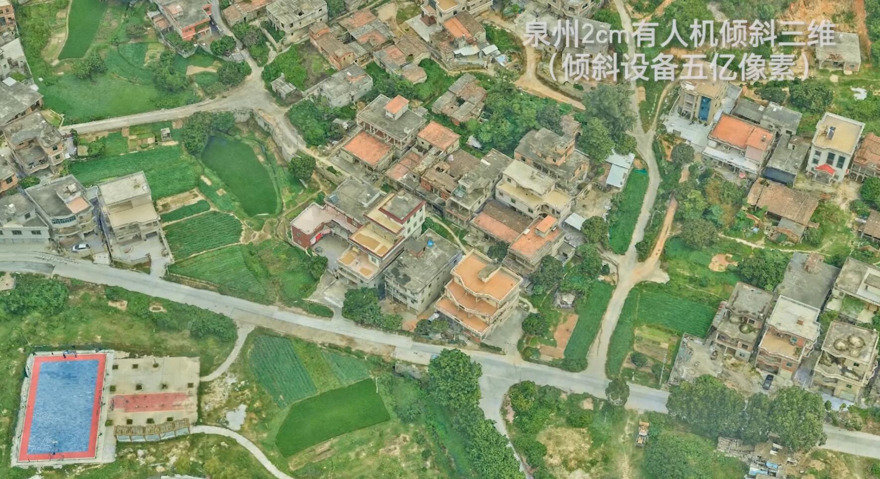
The second speaker explained in detail the technical personnel who played an important role in each Aerial photography project and the technical process of the Aerial photography project. The scanning methods and principles of frame Aerial photography, lidar point cloud and oblique Aerial photography are explained by combining pictures and pictures.
Before the execution of the Aerial photography task, project requirements and content assessment, airspace application, route design, Aerial photography season and Aerial photography time selection are required. Among them, the project requirements are to analyze the shooting area scope, data type, ground resolution, point density and post-production requirements of the Aerial photography project.
Every link of the work is to high efficiency to ensure the quality and quantity of the implementation of Aerial photography project.

The third speaker told us about the powerful internal processing team behind feiyan Remote sensing -- with professional and mature data post-processing capacity and rapid data production capacity.
This part of the training mainly covers the production methods of digital elevation model DEM, DSM, DOM and DLG, oblique 3d data processing process, airborne laser lidar processing process and the product results of flying swallow, such as 4D products, image wall charts and atlases.
Among them, the process of tilted 3d data processing needs to go through data preparation, space triple encryption, image uniform light and color, 3d model generation, 3d model modification, quality inspection, and final result sorting and submission.

For example, the generated data product DEM&DSM can monitor the coastal zone erosion by comparing the product results of different years.
To sum up, we know that to complete the whole Aerial photography project, a series of work needs to be carried out from the preparation of Aerial photography, the acquisition of field Aerial photography data, the processing of internal Aerial photography data, to the final review and submission of results. And every step needs to consider many complicated factors to ensure the smooth completion of the Aerial photography project.
Feiyan Remote sensing has been working in the field of Aerial photogrammetry for several decades, and has completed the surveying and mapping of more than 1 million square kilometers of Aerial photography, selected more than 50,000 kilometers of lines, and produced more than 300,000 square kilometers of orthophoto images.
These achievements are inseparable from the mature and experienced Aerial photography team, technical team and internal industry processing team, they are indispensable, is an important role in the completion of the entire Aerial photography project.


-
Oct 31, 2021
We participated in the infrastructure construction of the national parks
In order to protect biodiversity and promote the sustainable development of mankind, China formally established the first batch of national parks on October 12, 2021. More > -
Mar 22, 2022
Aviation Remote Sensing Surveying and Mapping
Is obtained by the industry news: the Chinese national geographic information bureau of surveying and mapping said 2018 will accelerate the construction of aerospace Remote sensing mapping, through high score 7 satellite launch preparation, promote resource 03 star project no. 3, 4 star, the construction of domestic satellite receiving station and overseas processing system, promote new platforms such as drones, and airborne laser radar is a new application of sensor, gradually formed multi-resolution, multi-type, multi-sensor, all-weather comprehensive efficient aerospace Remote sensing mapping ability. This marks the arrival of the era of aviation Remote sensing surveying and mapping, and China will accelerate the construction of aviation Remote sensing surveying and mapping. More > -
Mar 22, 2022
3S Technology Application Status
RS, GPS and GIS technology, referred to as More > -
Mar 22, 2022
Monitoring of Water Pollutants Through Aerial Remote Sensing
Aerial Remote sensing can monitor pollutant substances and detect water pollution problems in water areas through aerial Remote sensing. More > -
Mar 22, 2022
Feiyan Remote Sensing Organized Comprehensive and Systematic Training to Improve the Professional
Recently, feiyan Remote sensing held a large-scale employee training in the headquarters, invited the directors of each branch to participate in the training, and organized the examination. More > -
Mar 22, 2022
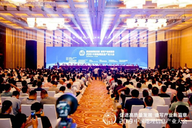
Feiyan Remote Sensing Won the Award of
With the theme of More > -
Mar 22, 2022
Remote Sensing Applications Usher in a New Blue Ocean
Recently, at the second forum on Remote sensing application technology held in Beijing, China's autonomous Remote sensing image processing software has made great progress. More > -
Mar 22, 2022
How to use aerial remote sensing to monitor pests and diseases?
Airborne LiDAR Aerial photography can be used to analyze the degree of pests and diseases of crops or forest trees based on the laser reflection intensity of crops or forest trees; Aerial imagery can also be used to analyze the effects of crops or forest trees based on the spectral characteristics of crops or forest trees. Degree of pests and diseases. More > -
Mar 22, 2022
We won the 2021 National Excellent Surveying and Mapping Project Bronze Award
A project calledâAcquisition and Processing of Airborne Lidar Data for Guangxi Forest Resources Planning and Design Surveyâ won the National Excellent Surveying and Mapping Project Bronze Award in 2021 by Feiyan Remote Sensing. More >