AIMS
AIMS AIMS-H Long Focus
 Farsightâą System
 Riegl VQ-1560i
 Riegl VQ-780II
 UltraCam Eagle M3
 Y-1 VTOL UAV
 Aerial Acquisition
 UAV Acquisition
 Satellite Acquisition
 Field Acquisition
 Integrated
 LiDAR
LiDAR Orthophoto
 DEM
DEM DTM/DSM
 3D Mapping
 Topographic
 Infrared
 Feature Extraction
 BIM
BIM Transportation
 Water
Water power
power  Forestry
 Agriculture
 Mines & Quarries
 Heritage Buildings
 About feiyan
 Recognition
 Cases
Cases

search


3S Technology Application Status
Mar 22, 2022

RS, GPS and GIS technology, referred to as "3 s" technology, Remote sensing technology is (RemoteSensing, RS), geographical information system (GeographyInformationSystems, GIS) and global positioning systems (GPS GlobalPositioningSystems,) collectively, space technology, sensor technology, satellite positioning and navigation technology and computer technology, communication technology, the combination of Multi-disciplinary highly integrated modern information technology for the collection, processing, management, analysis, expression, dissemination and application of spatial information.
1ăApplication status of 3S technology
3s technology is the acquisition, processing, analysis, management, precise positioning, has the characteristics of spatial data feature information of a means of information technology, in precision agriculture, forestry, land, water conservancy, ecology, disasters, urban planning, mining, petroleum, military and other areas of development, investigation, evaluation, detection and prediction of the play to the role of the foundation and the information provided, provide the basis for scientific decision-making and the safeguard.
(1) Application in the field of forestry
The application of 3s technology has fundamentally changed the traditional way of forest resources information management, as the new tool of modern forestry management, its application in the field of forestry research mainly include information management of forest resources, forest management optimization decision-making, the division of forestry classified management, forest fire prevention, sampling design, forestry thematic mapping, design YingZaoLin planning and design of deforestation, forest protection, forest resource management network, many aspects, such as precision forestry.
Through high-resolution geographic information system technology and Remote sensing image recognition technology, strengthening the secondary inventory of forest resources can effectively improve the survey accuracy, 3 S technology can provide users with rich content of information and timely and accurate basic information.
When used for pest monitoring and management, terrain map, soil type map, vegetation type map, water distribution map, disease and insect distribution map can be made into different layers, referred to as spatial database. The amount of occurrence, harm degree, all kinds of meteorological factors into the relevant database. GIS spatial data operation and graphic processing and analysis are used to enrich the information of outbreak, damage and spread of diseases and pests, so as to make corresponding management decisions and develop more effective forest pest monitoring and management information system.
(2) Application in the field of precision agriculture
Precision agriculture is also known as precision agriculture, precision agriculture, precision farming and prescription farming. Is the field of international agricultural science research hot spot in recent years, in fact is the main application of 3 s technology, management and crop production assistant decision support system and intelligent agriculture machinery and equipment technology, on the basis of the positioning block information collected, around blocks according to the soil, water, crops diseases and insect pests, weeds, yield, etc. The differences in time and space, suitable for cultivation, fertilization, irrigation, drug use, it is reasonable to input to obtain the best economic benefits, and protect the environment, to ensure agricultural sustainable development.
To put it simply: precision agriculture is the use of RS for macro control; Use GPS to pinpoint the location of the ground; GIS is used to store the ground information (terrain, geomorphology, crop types and growth, soil texture and nutrients, water status, etc.), and according to the spatial variable data of the elements in the area, the optimal tillage, fertilization, sowing, irrigation, spraying and other operations are precisely set, changing the traditional extensive operation into fine production.
(3) Application in the field of land management
â Application in land resource survey
3S technology and Remote sensing technology are used to obtain land use change information quickly, in real time and efficiently. GPS quickly and accurately collects the spatial position of land use change map spot; GIS can edit the collected data to realize the automation of data management and combine the three effectively, which can better improve the shortcomings of traditional land survey methods.
⥠Application in cadastral mapping
3S technology is of great help to the analysis and processing of Remote sensing image of cadastral information data source, internal industry database construction, and field mapping. Especially, the mapping of the boundary of ownership and the coefficient of farmland barrier is very accurate.
3S technology mainly adopts Remote sensing technology of aviation and aerospace in the survey of native land in China, taking rural land survey as an example, with 1:10,000 scale as the main scale. Remote sensing technology makes use of aviation and aerospace Remote sensing technology to obtain effective and objective ground images from Remote sensing in a timely manner. The effective information from Remote sensing images is also used for investigation and measurement.
In the survey of native land, Remote sensing images of multi-platform, multi-band and multi-information source are mainly used to realize the full coverage of current Remote sensing images. Only 3S technology can achieve this goal. With the gradual maturity of computer and Remote sensing technology, 3S technology has been widely used in China's land cadastral mapping work.
âą Application in general land planning
Through GPS and Remote sensing technology, land information can be obtained directly, ideal data can be obtained, data can be input into GIS system, and the establishment of land use spatial information system can provide systematic data source reference for land planning. At the same time, we can use the powerful analysis and processing function to analyze and evaluate the current situation of land use and carry out the long-term planning of land use. The visualization function of GIS is utilized to realize the simulation display and analysis of the results of planning and design, providing information for further improvement and optimization of planning and design.
(4) Application of 3S technology in highway survey and design
The traditional road mapping is generally a small scale topographic map of the survey area and a total station of theodolite on both sides of the survey line after alignment. With the development of 3S technology, airborne lidar and unmanned aerial vehicle (uav) such as GPS (positioning device) and IMU (inertial measurement device) have improved the three-dimensional mapping accuracy, making mapping work more efficient and fast. Road mapping personnel only need to carry out a few image control points in the field of simple field operations. Then, the plane coordinates and elevation of the encryption points are obtained through analytical aerial triangulation calculation in the interior industry, which is characterized by the fact that when photogrammetric adjustment is not restricted by the condition of access, the error in the survey area is small, and the size of the area has little influence on the mapping accuracy. In addition, the image generated by uav provides great convenience for the making of the effect drawing, which provides great convenience for the report of the scheme and the display of the road effect drawing.
In recent years, GPS static survey has been widely applied to road plane and elevation control survey. Compared with traditional traverse surveying, GPS static survey overcomes the error accumulation caused by distance Angle and degree, making the plane and elevation control more accurate. In recent years, China has paid more and more attention to environmental protection, and paid more and more attention to the combination of highway construction and surrounding environment. With the development of Aerial photogrammetry such as uav and RS Remote sensing, the surrounding environment can be interpreted through the influence of regional Aerial photography or Remote sensing, which greatly reduces the field working time and improves working efficiency.
Surveying and mapping science and technology, especially 3S technology, has brought about great changes in highway survey and design. Its importance in highway survey and design is self-evident. With the continuous development and improvement of 3S technology, highway survey and design will become more accurate, rapid and efficient.


-
Oct 31, 2021
We participated in the infrastructure construction of the national parks
In order to protect biodiversity and promote the sustainable development of mankind, China formally established the first batch of national parks on October 12, 2021. More > -
Mar 22, 2022
Aviation Remote Sensing Surveying and Mapping
Is obtained by the industry news: the Chinese national geographic information bureau of surveying and mapping said 2018 will accelerate the construction of aerospace Remote sensing mapping, through high score 7 satellite launch preparation, promote resource 03 star project no. 3, 4 star, the construction of domestic satellite receiving station and overseas processing system, promote new platforms such as drones, and airborne laser radar is a new application of sensor, gradually formed multi-resolution, multi-type, multi-sensor, all-weather comprehensive efficient aerospace Remote sensing mapping ability. This marks the arrival of the era of aviation Remote sensing surveying and mapping, and China will accelerate the construction of aviation Remote sensing surveying and mapping. More > -
Mar 22, 2022
Monitoring of Water Pollutants Through Aerial Remote Sensing
Aerial Remote sensing can monitor pollutant substances and detect water pollution problems in water areas through aerial Remote sensing. More > -
Mar 22, 2022
Feiyan Remote Sensing Organized Comprehensive and Systematic Training to Improve the Professional
Recently, feiyan Remote sensing held a large-scale employee training in the headquarters, invited the directors of each branch to participate in the training, and organized the examination. More > -
Mar 22, 2022
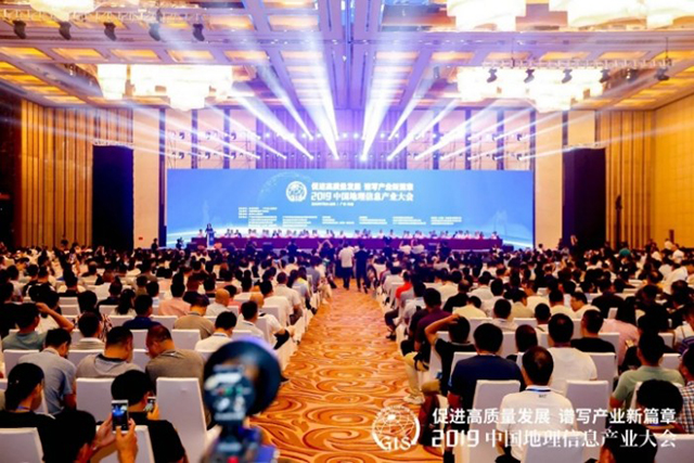
Feiyan Remote Sensing Won the Award of
With the theme of More > -
Mar 22, 2022
Feiyan Remote Sensing Training an Important Role in Ensuring the Completion of Aerial Photography
In the previous article More > -
Mar 22, 2022
Remote Sensing Applications Usher in a New Blue Ocean
Recently, at the second forum on Remote sensing application technology held in Beijing, China's autonomous Remote sensing image processing software has made great progress. More > -
Mar 22, 2022
How to use aerial remote sensing to monitor pests and diseases?
Airborne LiDAR Aerial photography can be used to analyze the degree of pests and diseases of crops or forest trees based on the laser reflection intensity of crops or forest trees; Aerial imagery can also be used to analyze the effects of crops or forest trees based on the spectral characteristics of crops or forest trees. Degree of pests and diseases. More > -
Mar 22, 2022
We won the 2021 National Excellent Surveying and Mapping Project Bronze Award
A project calledâAcquisition and Processing of Airborne Lidar Data for Guangxi Forest Resources Planning and Design Surveyâ won the National Excellent Surveying and Mapping Project Bronze Award in 2021 by Feiyan Remote Sensing. More >