AIMS
AIMS AIMS-H Long Focus
 Farsightâą System
 Riegl VQ-1560i
 Riegl VQ-780II
 UltraCam Eagle M3
 Y-1 VTOL UAV
 Aerial Acquisition
 UAV Acquisition
 Satellite Acquisition
 Field Acquisition
 Integrated
 LiDAR
LiDAR Orthophoto
 DEM
DEM DTM/DSM
 3D Mapping
 Topographic
 Infrared
 Feature Extraction
 BIM
BIM Transportation
 Water
Water power
power  Forestry
 Agriculture
 Mines & Quarries
 Heritage Buildings
 About feiyan
 Recognition
 Cases
Cases

search


What Are the Main Advantages of Aerial Photogrammetry Technology?
Jun 09, 2023
Aerial photogrammetry technology is a technology that applies flight technology to surveying and mapping. For surveying and mapping, the application of advanced technology can not only solve many problems in traditional surveying and mapping, but also make surveying and mapping technology play a greater value.
Advantage 1: wide application fields and large development space
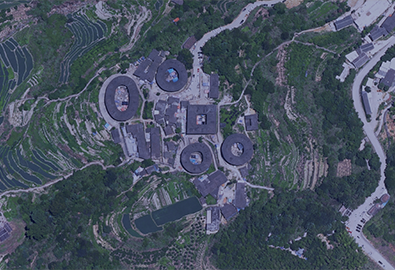
Traditional topographic surveying techniques are easily affected by various factors such as technical level, personnel professional skills and terrain characteristics. For complex terrain, traditional topographic surveying techniques show more limitations. Aerial photogrammetry technology can effectively solve the difficulties encountered in artificial topographic survey and many existing problems. It has shown strong advantages in geological analysis of mining areas, environmental monitoring, and early warning of natural disasters. On the one hand, it can ensure the safety of personnel; on the other hand, the accuracy of measurement data can be greatly improved, especially in the early warning and prevention and control of natural energy disasters, accurate measurement data and precise positioning are crucial. Aerial photogrammetry can provide three-dimensional data information for engineering surveyors and mappers. By obtaining a large amount of large-scale topographical data information in the high altitude, it can provide scientific basis for the work in the fields of mine geological survey and environmental protection. It can scientifically evaluate the geology of mining areas and provide ideas for the prevention of natural disasters and mining accidents.

Advantage 2: The information content is complete and specific
In traditional surveying and mapping methods, the acquisition and recording of data information basically relies on manual work, but aerial photogrammetry technology can realize complete and accurate data processing and storage. While the high-altitude topographic data is quickly acquired, it has great performance in data acquisition and storage. More precise and efficient features. At the same time, the system can automatically establish a resource library of data resources, which can provide scientific and comprehensive data support for subsequent engineering surveying and mapping work. In the acquisition of human geographic information, aerial photogrammetry technology shows unique advantages, which can provide a more regional direction for environmental protection and ecological environment construction, and can make environmental governance work more targeted. The more specific the information content, the more accurate the direction will be provided for the formulation of environmental protection strategies, thereby improving the efficiency and value of environmental protection work.
Advantage 3: save costs and improve economic benefits
Surveying and mapping work has the problems of heavy workload and high cost investment. Due to the lack of high-tech applications in traditional surveying and mapping work, the work efficiency cannot meet the actual needs. For dangerous environments or complex terrain surveying and mapping, there is even no way to start. Influenced by various factors, due to technical limitations, it is impossible to obtain the required terrain information in many environments. The application of aerial photogrammetry technology can avoid many problems caused by human factors. For example: In terms of the accuracy of data measurement, human factors are likely to cause errors, but aerial photogrammetry technology can accurately measure terrain and landforms through advanced instruments, especially the unavoidable problems of human factors can be solved. Especially in the surveying and mapping of large-scale terrain, traditional surveying and mapping work has many limitations. The working mode of combining aircraft and photographic instruments can break through the limitations of technology, improve work efficiency, reduce unnecessary costs, and then more Funds are used for the development and research of surveying and mapping technologies.


-
 Jun 21, 2021
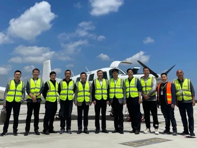
The Department of Natural Resources of Jiangsu Province guides the surveying and mapping aerial photography work
Recently, Feiyan remote sensing in the project implementation site welcomed Lin Hao, chief planner of the Department of Natural Resources of Jiangsu Province, and the Office of Land Surveying and Mapping, Law Enforcement Supervision Bureau, Finance and Capital Use Office, joint research and supervision of the 2021 province's basic mapping aerial photography work. More > -
Mar 18, 2022
Aerial photography to understand
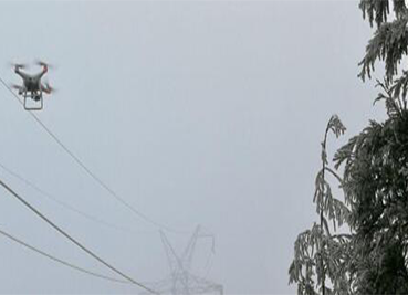
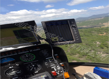
Aerial photography, as a modern means of photography, can overlook things from a height that is difficult for people to reach, and convey a macro image to the audience from a completely liberated perspective, bringing a brand-new visual enjoyment. In recent years, with the development of television and flight technology, various methods of Aerial photography have been widely used in the production of films and TV documentaries. During the expo, helicopter Aerial photography was used many times to show the lively scene of the expo site. Today let's take a closer look at Aerial photography and learn its secrets. More > -
Mar 22, 2022
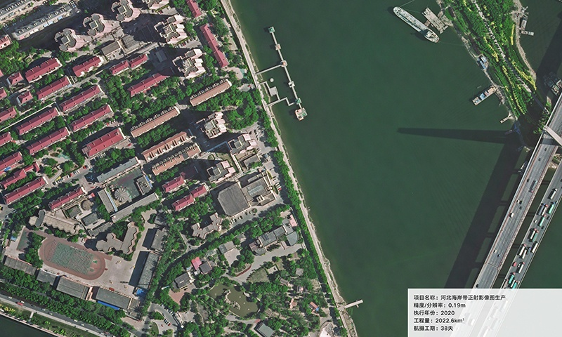
Aerial Photography for Shoreline Mapping
Aerial photographs are a little different than the photos you might take with your own camera. The primary aerial photographic product is a high-resolution (39 megapixel) digital color photograph. Depending on the camera lens, photos can be taken in black-and-white or near-infrared. More > -
Mar 23, 2022
The Most Scientific Method To Obtain Water Conservancy Topographic Survey Data
As we all know, Aerial photogrammetry technology is playing an increasingly important role in urban planning and construction. Moreover, compared with the traditional topographic survey technology, Aerial photogrammetry technology has the advantages of small volume, light weight, rapid response, good accuracy and low flight conditions. Therefore, Aerial photogrammetry technology is also the most scientific and effective method in the topographic survey of water conservancy projects. More > -
May 23, 2023
What Are the Limitations of Drone Aerial Photography?
Compared with traditional aerial photography, the low efficiency of UAV aerial photography has become one of the main bottlenecks restricting its development. More > -
May 25, 2023
What is Surveying and Mapping Aerial Photography
Surveying and mapping aerial photography is the use of aerial photography to obtain the image data of the target object. More > -
Jun 26, 2023
Application of Aerial Photogrammetry in Water Conservancy Engineering Terrain Surveying and Mapping
aerial photogrammetry technology plays an active role in urban planning and construction, especially in water conservancy engineering design. Among them, the most scientific method to obtain topographic surveying and mapping data of water conservancy projects is aerial photogrammetry. More >