AIMS
AIMS AIMS-H Long Focus
 Farsightâą System
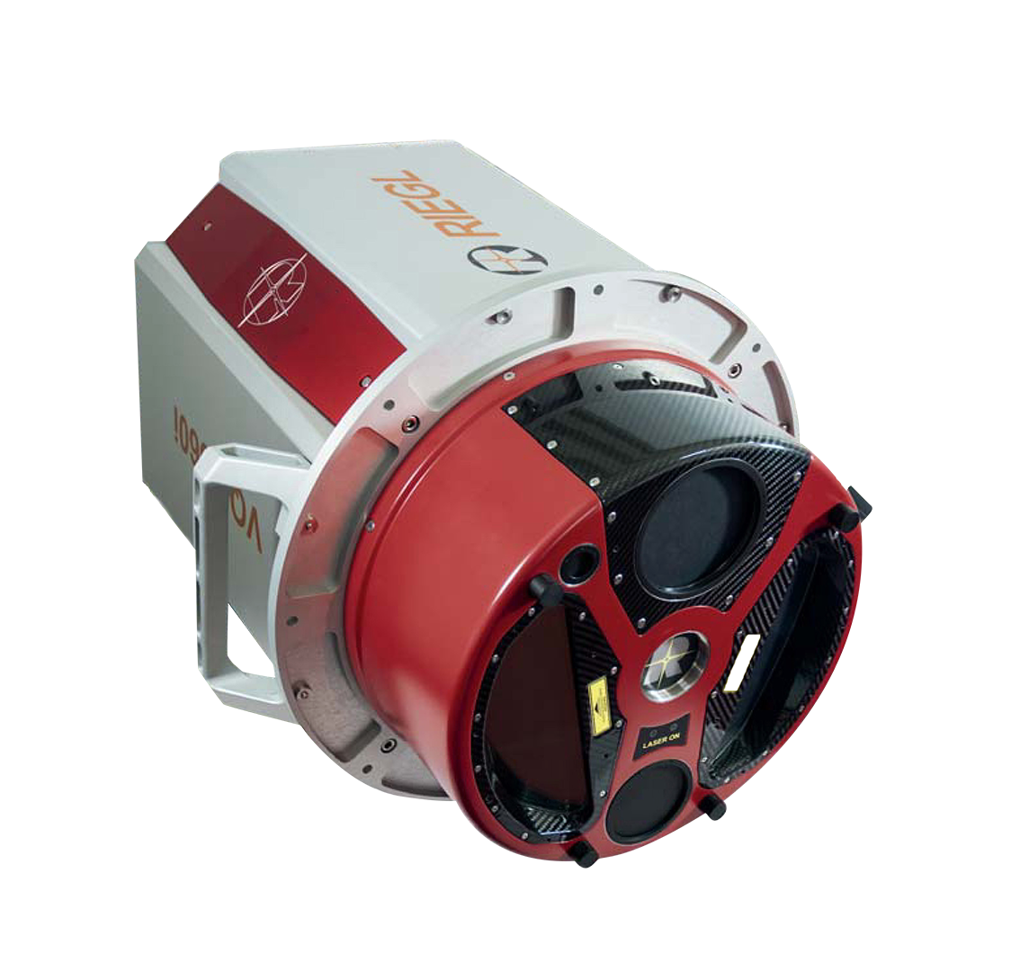
 Riegl VQ-1560i
 Riegl VQ-780II
 UltraCam Eagle M3
 Y-1 VTOL UAV
 Aerial Acquisition
 UAV Acquisition
 Satellite Acquisition
 Field Acquisition
 Integrated
 LiDAR
LiDAR Orthophoto
 DEM
DEM DTM/DSM
 3D Mapping
 Topographic
 Infrared
 Feature Extraction
 BIM
BIM Transportation
 Water
Water power
power  Forestry
 Agriculture
 Mines & Quarries
 Heritage Buildings
 About feiyan
 Recognition
 Cases
Cases

search


How to process and model point cloud data
Aug 09, 2023
In the process of 3D laser scanning, the acquisition of point cloud data is often affected by factors such as object occlusion and uneven illumination, which is easy to cause the blind spot of complex shape objects and form holes. At the same time, due to the limited range of scanning measurement, it can not be completely measured for a large range of scenes, and it must be scanned and measured several times. The scanning results are often multiple pieces of point cloud data with different coordinate systems and noise, which cannot fully meet people's requirements for the authenticity and real-time performance of digital models, so it is necessary to conduct pre-processing such as de-noising, simplification, registration and hole filling for three-dimensional point cloud data.

Through data preprocessing, the noise and external points in the point cloud can be effectively eliminated, the point cloud data can be simplified on the basis of maintaining geometric characteristics, and the point clouds scanned from different angles can be unified into the same coordinate system, which provides a robust data basis for the subsequent surface construction and 3D solid model generation.Point cloud modeling requires the use of reality modeling software to better evaluate point clouds and generate more accurate 3D models.
The reality modeling software can enhance, segment and classify the point cloud data, and combine it with the engineering model. Model completion conditions quickly and efficiently and support the design process with advanced 3D modeling, cross section cutting, fracture lines and terrain extraction.
It is also possible to generate very large scalable terrain models based on point cloud data. By synchronizing with the original data source, scalable terrain models can be updated to the latest in real time. The value of this is to have a global, up-to-date and comprehensive representation of all the data and to use various display modes and perform analysis, as well as to generate animations and visualizations.


-
 Mar 18, 2022
Feiyan Invested 20 Million For Airborne LiDAR Measurement
Feiyan invested 20 million to introduce airborne LiDAR measurement, which once again laid the foundation for the hardware strength of feiyan in the industry. More > -
Mar 22, 2022
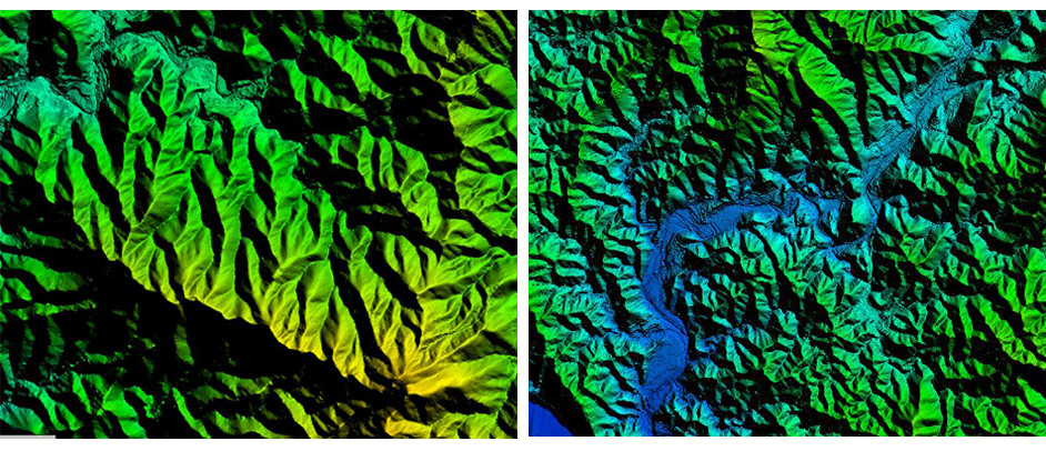
What is LiDAR point cloud data?
LiDAR (laser detection and ranging) is an optical Remote sensing technology which mainly USES the laser as the emitting light source and adopts the active Remote sensing equipment of photoelectric detection technology. Primarily used in airborne laser mapping applications, it is increasingly becoming a cost-effective alternative to traditional measurement techniques such as photogrammetry. More > -
Mar 22, 2022
The Riegl Vq-1560i Airborne Laser Lidar Lived up to Expectations
The ninth China surveying and mapping geographic information technology equipment expo has been successfully concluded. More > -
Mar 22, 2022
Lidar Forest Survey, Incomparable Advantages
In recent years, LiDAR forest survey has attracted more and more people's attention. However, the hotter this new technology is, the more it needs to be understood from all aspects calmly. More > -
Mar 22, 2022
Lidar Is a Key Technology Involved in Terrain Mapping
This question cannot be asked like that. Aerial photography must be sunny, but the altitude angle of the sun must be considered. More > -
Mar 22, 2022
LiDAR and Hyperspectral Remote Sensing Data Fusion Realize Complementary Advantages
With the continuous development and progress of earth observation technology, and the continuous diversification of means for obtaining spatial information, the use of a single means of spatial data resources has been difficult to meet people's information needs. Lidar and hyperspectral Remote sensing, as two common Remote sensing methods, have different characteristics: Lidar can quickly, efficiently and accurately obtain three-dimensional spatial data of features, and hyperspectral images can well characterize the spectral information of features , Reflecting the characteristics of its features, materials, texture, etc. The fusion of these two kinds of data can achieve complementary advantages, maximize their respective characteristics, and achieve more accurate intelligent detection and identification of objects and higher-precision classification and extraction, which are widely used in forestry ecology, precision agriculture, environment Monitoring and other fields. More > -
Mar 22, 2022
What Are the Requirements for the Airborne Lidar Camera for the Acquisition of Lidar Point Cloud Data
In the effective altitude range, to ensure the lowest point cloud density, the laser radar maximum laser emission frequency To be higher. More > -
Mar 22, 2022
The Basics of LiDAR
LiDAR is an active Remote sensing system. An active system means that the system itself generates energy - in this case, light - to measure things on the ground. In a LiDAR system, light is emitted from a rapidly firing laser. You can imagine light quickly strobing from a laser light source. This light travels to the ground and reflects off of things like buildings and tree branches. The reflected light energy then returns to the LiDAR sensor where it is recorded. More > -
Mar 22, 2022
What Are the Different Uses of LiDAR Processing?
LiDAR (Light Detection and Ranging) technology and processing is used in a wide range of research and practical applications. With its ability to measure dimensions, distances, textures, and many other aspects of targeted subjects, LiDAR processing has become an increasingly important tool in geology, geography, surveying, agriculture, and forestry. Atmospheric sciences, archaeology, seismology, and geomatics also depend on data gathered using LIDAR processing for research, while physics and astronomy benefit from LiDAR's ability to create highly precise maps. More >