AIMS
AIMS AIMS-H Long Focus
 Farsightâą System
 Riegl VQ-1560i
 Riegl VQ-780II
 UltraCam Eagle M3
 Y-1 VTOL UAV
 Aerial Acquisition
 UAV Acquisition
 Satellite Acquisition
 Field Acquisition
 Integrated
 LiDAR
LiDAR Orthophoto
 DEM
DEM DTM/DSM
 3D Mapping
 Topographic
 Infrared
 Feature Extraction
 BIM
BIM Transportation
 Water
Water power
power  Forestry
 Agriculture
 Mines & Quarries
 Heritage Buildings
 About feiyan
 Recognition
 Cases
Cases

search


Feiyan Remote Sensing Susong County Surveying and Mapping Project Successfully Passed Acceptance
May 29, 2023
Background Of The Project
Susong County Natural Resources and Planning Bureau has followed the development trend of digital economy and digital city in recent years, scientifically grasped the new development stage, implemented the new development concept, served to build a new development pattern, and launched the Susong County Geographical Surveying and Mapping Comprehensive Service Construction Project . The project fully combines the development needs of Susong County, and incorporates digital aerial photography, lidar aerial photography and oblique aerial photography into the service content, intending to promote the deep integration of real-scene 3D data and natural resource business, and effectively play the role of real-scene 3D "unified base map" .
Project Status
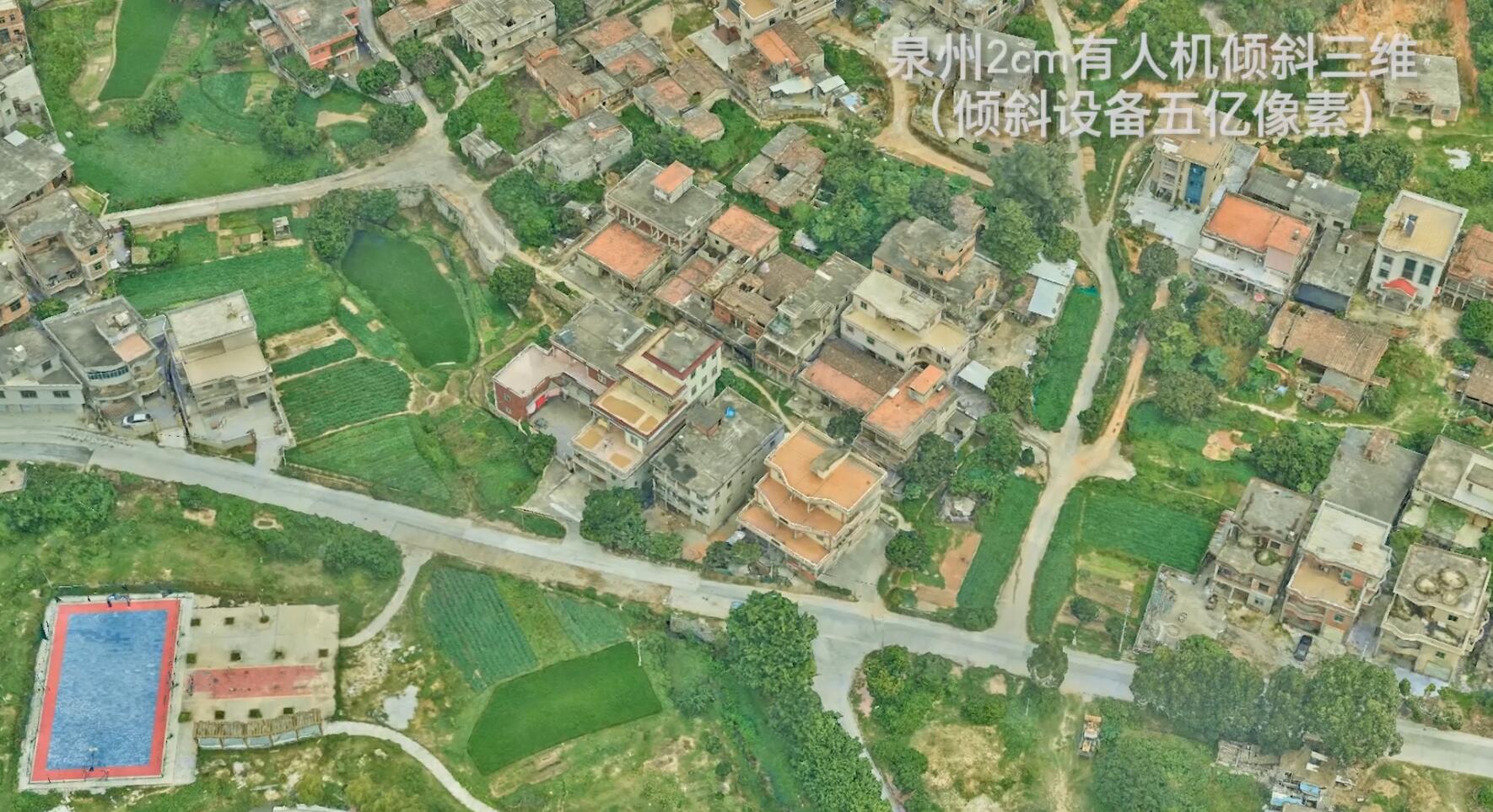
Feiyan Remote Sensing was honored to undertake this project, and obtained high-definition image data of 2,370 square kilometers in Susong County through a 450-megapixel digital aerial camera and a laser radar aerial camera with a laser emission frequency up to 2000KHz.
Combined with the high-precision digital elevation model, construct a terrain-level 3D model of the large scene in the whole area, and implement close-range oblique aerial photography of key areas in Susong County by drones, realize the pilot test of the county-level 3D model, and provide a basis for the delineation of the three districts and three lines, the national territory Spatial planning and county-level refined management provide three-dimensional and intuitive decision-making basis.

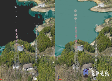
Comparison of city-level real scene 3D models before and after refinement
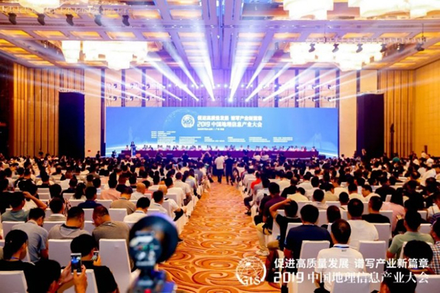
At the acceptance meeting, the experts and leaders of the expert group unanimously agreed that the project passed the acceptance, which fully affirmed our company's ability to guarantee airspace coordination, personnel equipment, and aerial photography, and recognized the digital elevation model (DEM), digital orthophoto (DOM) and terrain-level and city-level real-scene 3D data results are conducive to the establishment of accurate data-based, data-based decision-making, data-based management, and data-based innovation through the use of geographic image data and various spatial planning data superposition analysis technologies. The governance model provides geographic information data support for the high-quality economic and social development of the county.
Data Application
At the same time, the project data is issued through the information platform of the Susong Resources and Planning Bureau (intranet computer terminal and mobile tablet terminal) and is directly used for land change investigation, satellite law enforcement investigation, land consolidation, project site selection, land and space planning compilation, For business work such as urban planning and design, various business data layers and high-definition images are superimposed and analyzed, which effectively assists front-line personnel to carry out various business tasks such as natural resources and planning management, and greatly improves work efficiency. In particular, it will play an important role in village planning compilation and natural resource supervision, providing solid geographic information data support for the high-quality economic and social development of counties, and is conducive to promoting the cross-regional and cross-level overall management, integration and collection of real-world 3D construction data. shared use.


-
 Oct 31, 2021
We participated in the infrastructure construction of the national parks
In order to protect biodiversity and promote the sustainable development of mankind, China formally established the first batch of national parks on October 12, 2021. More > -
Mar 22, 2022
Aviation Remote Sensing Surveying and Mapping
Is obtained by the industry news: the Chinese national geographic information bureau of surveying and mapping said 2018 will accelerate the construction of aerospace Remote sensing mapping, through high score 7 satellite launch preparation, promote resource 03 star project no. 3, 4 star, the construction of domestic satellite receiving station and overseas processing system, promote new platforms such as drones, and airborne laser radar is a new application of sensor, gradually formed multi-resolution, multi-type, multi-sensor, all-weather comprehensive efficient aerospace Remote sensing mapping ability. This marks the arrival of the era of aviation Remote sensing surveying and mapping, and China will accelerate the construction of aviation Remote sensing surveying and mapping. More > -
Mar 22, 2022
3S Technology Application Status
RS, GPS and GIS technology, referred to as More > -
Mar 22, 2022
Monitoring of Water Pollutants Through Aerial Remote Sensing
Aerial Remote sensing can monitor pollutant substances and detect water pollution problems in water areas through aerial Remote sensing. More > -
Mar 22, 2022
Feiyan Remote Sensing Organized Comprehensive and Systematic Training to Improve the Professional
Recently, feiyan Remote sensing held a large-scale employee training in the headquarters, invited the directors of each branch to participate in the training, and organized the examination. More > -
Mar 22, 2022
Feiyan Remote Sensing Won the Award of
With the theme of More > -
Mar 22, 2022
Feiyan Remote Sensing Training an Important Role in Ensuring the Completion of Aerial Photography
In the previous article More > -
Mar 22, 2022
Remote Sensing Applications Usher in a New Blue Ocean
Recently, at the second forum on Remote sensing application technology held in Beijing, China's autonomous Remote sensing image processing software has made great progress. More > -
Mar 22, 2022
How to use aerial remote sensing to monitor pests and diseases?
Airborne LiDAR Aerial photography can be used to analyze the degree of pests and diseases of crops or forest trees based on the laser reflection intensity of crops or forest trees; Aerial imagery can also be used to analyze the effects of crops or forest trees based on the spectral characteristics of crops or forest trees. Degree of pests and diseases. More >