AIMS
AIMS AIMS-H Long Focus
 Farsightā¢ System
 Riegl VQ-1560i
 Riegl VQ-780II
 UltraCam Eagle M3
 Y-1 VTOL UAV
 Aerial Acquisition
 UAV Acquisition
 Satellite Acquisition
 Field Acquisition
 Integrated
 LiDAR
LiDAR Orthophoto
 DEM
DEM DTM/DSM
 3D Mapping
 Topographic
 Infrared
 Feature Extraction
 BIM
BIM Transportation
 Water
Water power
power  Forestry
 Agriculture
 Mines & Quarries
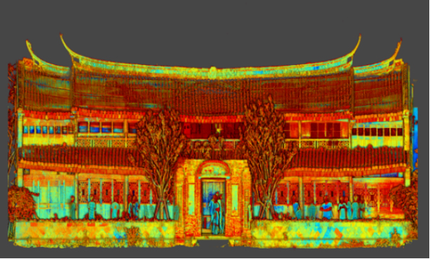
 Heritage Buildings
 About feiyan
 Recognition
 Cases
Cases

search


Infrared
Color Infrared (CIR) Imagery Aerial imagery, whether it is panchromatic (gray scale), color, or color infrared (CIR) imagery, is based on the fact that each type of land cover, depending of its current condition, absorbs a particular portion of the electromagnetic spectrum, transmits another portion, and reflects the remaining portion, which can be recorded with a passive imaging system. In particular, most objects exhibit a negligible NIR reflectance, but actively growing plants exhibit a high NIR reflectance and stressed plants (either from disease or drought) exhibit a reduction in their NIR reflectance. In addition, there are subtle NIR reflectance differences between vegetation types and species that can aid in plant identification.
Color Infrared aerial photography
Color Infrared aerial photography can not only be used to document changes to the environment, the health of forests, wetlands, bays and oceans, but also to document and monitor such items as damage to roofs, the tracking of dairy farm out flows, pinpointing the source of, and monitoring, insect or disease infested vineyards, or sites contaminated by toxic chemicals, and more other applications.
Infrared film and infrared digital sensors are sensitive to a certain portion of the spectrum of light, and by careful filtration, processing and selection of films, infrared aerials can provide invaluable information. Please contact us to get additional information about color infrared aerial photography.
Most infrared aerial documentation involves the creation of vertical infrared aerials. Combined with orthorecitification techiques, comprehensive infrared aerial maps can be created which can be invaluable both for planning and monitoring purposes.
Specifications of Color Infrared aerial photography
Sensor: UCX
Resolution: 0.5m
Project area: 4071.3kmĀ²
Duration: 1month
Output: true color, full color, infrared (data)
Application: pine wood nematode disease surveillance
From: Jinhua City, Zhejiang Province
View more

ā For more information or to order Color Infrared aerial photography products or services from Feiyan Technology, please contact us by e-mail at frank.zhao@feiyantech.com.


-
 Jun 17, 2022
Satellite Technologies For Plant Nutrient Deficiency Identification And Treatment
Satellite Technologies For Plant Nutrient Deficiency Identification And Treatment More > -
Jun 22, 2022
Historical Building Surveying and Mapping
China will further step up efforts to safeguard and transmit historical and cultural heritage as part of ongoing urban and rural development strategies. More > -
Mar 22, 2022
Utility of oblique aerial photography
With the rapid development of China's social economy, the value of real estate is increasing accordingly, which makes the country pay more and more attention to real estate surveying and mapping, and the requirements are higher and higher. More > -
Mar 22, 2022
What is tilt photography?
Tilt photography is a new and high technology developed in recent years in the field of international Remote sensing surveying and mapping. By carrying multiple sensors on the same flight platform and collecting images from different angles such as vertical and tilt, more complete and accurate information of ground objects can be obtained. More > -
Mar 22, 2022
Feiyan Remote Sensing LiDAR aerial photography project accumulates over 100,000 square kilometers
At present, airborne LiDAR technology has made great progress and has been widely used in many fields. Following the trend of technology development, feiyan Remote sensing has long been in the forefront of the industry. More > -
Mar 22, 2022
Mount Everest Elevation Measurement in 2020
On the afternoon of April 30, the first press conference of the 2020 Mount Everest elevation measurement was held at the Everest Base Camp, and the 2020 Mount Everest elevation measurement was officially launched. More > -
Mar 22, 2022
What are the restrictions on drone aerial photography?
Compared with traditional Aerial photography, the low efficiency of UAV Aerial photography has become one of the main bottlenecks restricting its development. More > -
Mar 22, 2022
The 6th Jiangsu University Surveying and Mapping Geo-Information business plan competition achieved
The 6th Jiangsu University Surveying and Mapping Geo-Information business plan competition achieved full success last week. Feiyan Remote sensing participated in this event as one of the chief co-sponsors. The competition provides an excellent platform for our students, played a major role in cultivating talent of Surveying and Mapping Geo-Information application as well. More > -
Mar 22, 2022
7 Ways to Process LiDAR Data
LiDAR technology has given the spatial data industry some of the largest data volumes weāve ever seen. Most point clouds Iāve worked with have been tens of gigabytes in size. More >