AIMS
AIMS AIMS-H Long Focus
 Farsightā¢ System
 Riegl VQ-1560i
 Riegl VQ-780II
 UltraCam Eagle M3
 Y-1 VTOL UAV
 Aerial Acquisition
 UAV Acquisition
 Satellite Acquisition
 Field Acquisition
 Integrated
 LiDAR
LiDAR Orthophoto
 DEM
DEM DTM/DSM
 3D Mapping
 Topographic
 Infrared
 Feature Extraction
 BIM
BIM Transportation
 Water
Water power
power  Forestry
 Agriculture
 Mines & Quarries
 Heritage Buildings
 About feiyan
 Recognition
 Cases
Cases

search


Cases

AIMS-H Multimodal (Long-Focal Length Version)
The AIMS-H is an advanced long-focal-length aerial camera designed for ultra-high-resolution remote sensing. It simultaneously captures 5-lens tilted imagery with 750 MP total output, featuring a 180mm nadir lens and 300mm oblique lenses. This configuration ensures exceptional image clarity even at restricted flight altitudes, supporting detailed 3D modeling and precise mapping. Ideal for urban digital twins, infrastructure inspection, corridor mapping, and heritage documentation, AIMS-H delivers flexible, high-fidelity imaging under complex operational conditions.
Developed independently by Feiyan Remote Sensing, the AIMS Multimodal Aerial Camera (Long-Focal Length Version), abbreviated as AIMS-H, is a cutting-edge aerial survey equipment designed for high-precision remote sensing missions. It can simultaneously capture 5-lens tilted imagery, with each lens offering a resolution of approximately 150 million pixels and a total combined resolution of up to 750 million pixelsāwith the flexibility to upgrade to 200 million pixels per lens as project requirements demand. The nadir lens features a focal length of 180mm, while the four oblique lenses are equipped with a 300mm focal length, forming a 45Ā° angle with the nadir lens. A key advantage of AIMS-H is its exceptional flexibility to adapt to project-specific flight altitude restrictions: users can flexibly adjust the focal length based on actual operational constraints, ensuring consistent high-resolution imagery delivery and making it an ideal solution for complex aerial survey missions.
Technical Specifications
Module / Component | Parameter | Specification |
System Overview | Total System Pixel Output | 750 Megapixels (5 x 150MP) |
Camera Configuration | 1 Nadir + 4 Oblique Cameras | |
Angle Between Nadir & Oblique | 45Ā° | |
Nadir Camera (1x) | Camera Model | Phase One iXM-RS150F |
Image Resolution | 14204 x 10652 pixels (150 MP) | |
Pixel Size | 3.76 Ī¼m | |
Focal Length | 180 mm | |
Aperture Range | f/8 - f/11 | |
Shutter Speed | Up to 1/2500 s | |
Sensor Dynamic Range | 83 dB | |
Oblique Camera (4x) | Camera Model | Phase One iXM-RS150F |
Image Resolution | 14204 x 10652 pixels (150 MP) | |
Pixel Size | 3.76 Ī¼m | |
Focal Length | 300 mm | |
Aperture Range | f/8 - f/11 | |
Sensor Type | CMOS | |
General Parameters | Image Output Format | JPEG; TIFF (8 or 16-bit optional) |
Operational Temperature | -10Ā°C to +40Ā°C |
Core Advantages
Ultra-High Resolution Performance: With a total resolution of 750 million pixels and 150 million pixels per lens, AIMS-H enables the capture of fine-grained details in aerial imagery, meeting the strict requirements of high-precision surveying and mapping projects.
Long-Focal Length Advantage: The optimized focal length configuration (180mm nadir lens, 300mm oblique lenses) ensures superior image clarity even in low-altitude restricted areas, eliminating the trade-off between flight height and resolution.
Multimodal Synchronous Acquisition: The 5-lens tilted imaging system provides comprehensive coverage of the surveyed area, capturing both vertical and oblique perspectives simultaneously to support 3D modeling and multi-angle analysis.
High-Performance Hardware Configuration: Equipped with a long-life central blade shutter (max 1/2500s), wide ISO range (50ļ½6400), and 83dB high dynamic range, the camera adapts to complex lighting conditions and ensures stable image quality in various operating environments.
Robust Environmental Adaptability: The operating temperature range of -10āļ½+40ā allows AIMS-H to perform reliably in harsh climates, from cold plateaus to hot lowlands.
Flexible Image Output: Supports JPEG and TIFF formats (8-bit/16-bit optional), compatible with mainstream post-processing software and meeting the technical standards of international surveying and mapping projects.
Primary Applications
High-Fidelity Urban 3D Modeling & Digital Twins: Capturing intricate architectural details for creating millimeter-accurate city models and digital twins, especially valuable for historic preservation and modern urban planning.
Critical Infrastructure Inspection: Providing the extreme visual detail needed for close-up analysis of bridges, dams, power generation facilities, and monuments from a safe and compliant distance.
Corridor Mapping in Sensitive Environments: Ideal for surveying railways, pipelines, and highways that pass through restricted or complex terrain where standard systems cannot achieve the required resolution.
Cultural Heritage and Archaeology Documentation: Enabling non-intrusive, high-detail recording of archaeological sites, historical buildings, and cultural landscapes for restoration and study.
Precision Cadastral and Topographic Surveys: Supporting large-scale mapping projects where the highest possible image ground resolution is a mandatory requirement for feature extraction and analysis.


-
 Jun 17, 2022
Satellite Technologies For Plant Nutrient Deficiency Identification And Treatment
Satellite Technologies For Plant Nutrient Deficiency Identification And Treatment More > -
Jun 22, 2022
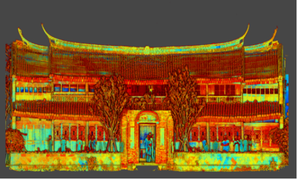
Historical Building Surveying and Mapping
China will further step up efforts to safeguard and transmit historical and cultural heritage as part of ongoing urban and rural development strategies. More > -
Mar 22, 2022
Utility of oblique aerial photography
With the rapid development of China's social economy, the value of real estate is increasing accordingly, which makes the country pay more and more attention to real estate surveying and mapping, and the requirements are higher and higher. More > -
Mar 22, 2022
What is tilt photography?
Tilt photography is a new and high technology developed in recent years in the field of international Remote sensing surveying and mapping. By carrying multiple sensors on the same flight platform and collecting images from different angles such as vertical and tilt, more complete and accurate information of ground objects can be obtained. More > -
Mar 22, 2022
Feiyan Remote Sensing LiDAR aerial photography project accumulates over 100,000 square kilometers
At present, airborne LiDAR technology has made great progress and has been widely used in many fields. Following the trend of technology development, feiyan Remote sensing has long been in the forefront of the industry. More > -
Mar 22, 2022
Mount Everest Elevation Measurement in 2020
On the afternoon of April 30, the first press conference of the 2020 Mount Everest elevation measurement was held at the Everest Base Camp, and the 2020 Mount Everest elevation measurement was officially launched. More > -
Mar 22, 2022
What are the restrictions on drone aerial photography?
Compared with traditional Aerial photography, the low efficiency of UAV Aerial photography has become one of the main bottlenecks restricting its development. More > -
Mar 22, 2022
The 6th Jiangsu University Surveying and Mapping Geo-Information business plan competition achieved
The 6th Jiangsu University Surveying and Mapping Geo-Information business plan competition achieved full success last week. Feiyan Remote sensing participated in this event as one of the chief co-sponsors. The competition provides an excellent platform for our students, played a major role in cultivating talent of Surveying and Mapping Geo-Information application as well. More > -
Mar 22, 2022
7 Ways to Process LiDAR Data
LiDAR technology has given the spatial data industry some of the largest data volumes weāve ever seen. Most point clouds Iāve worked with have been tens of gigabytes in size. More >