AIMS
AIMS AIMS-H Long Focus
 Farsightā¢ System
 Riegl VQ-1560i
 Riegl VQ-780II
 UltraCam Eagle M3
 Y-1 VTOL UAV
 Aerial Acquisition
 UAV Acquisition
 Satellite Acquisition
 Field Acquisition
 Integrated
 LiDAR
LiDAR Orthophoto
 DEM
DEM DTM/DSM
 3D Mapping
 Topographic
 Infrared
 Feature Extraction
 BIM
BIM Transportation
 Water
Water power
power  Forestry
 Agriculture
 Mines & Quarries
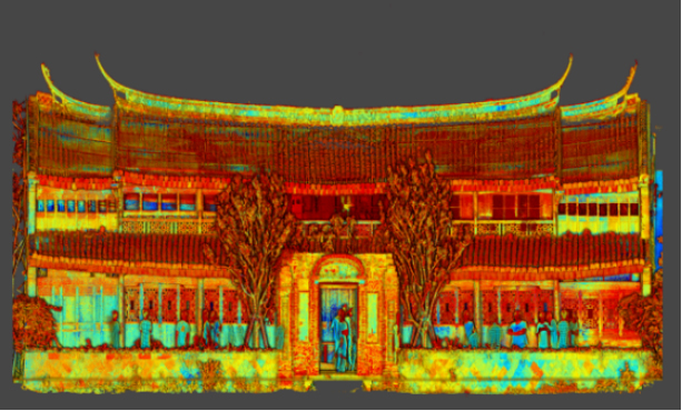
 Heritage Buildings
 About feiyan
 Recognition
 Cases
Cases

search


RIEGL VQ-1560i
The RIEGL VQ-1560i is an ultra-high-performance airborne LiDAR scanner featuring dual-wavelength (green & NIR) waveform processing. With a laser pulse rate up to 2 MHz, it achieves rapid, wide-area coverage and delivers exceptionally dense, high-fidelity point clouds. Its wide 58Ā° field of view and forward/backward scanning capability capture complex terrain and structural details with precision. Designed for large-scale topographic mapping, 3D city modeling, infrastructure corridor surveys, forestry management, and coastal studies, it provides unmatched efficiency and data quality for professional surveying applications.
The RIEGL VQ-1560i Airborne LiDAR, owned and operated by Feiyan Remote Sensing, is an ultra-high-performance professional surveying device integrated with dual-wavelength waveform processing technology. Specifically designed for ultra-large-area mapping and high-density point cloud acquisition scenarios, it features two laser channels supporting simultaneous green laser and near-infrared (NIR) measurement. With an ultra-high laser pulse repetition rate and multi-cycle echo processing capability, it enables rapid wide-area coverage during medium-to-high altitude operations while delivering high-fidelity, high-density point cloud data. Its unique forward/nadir/backward scanning function and wide field of view design can accurately capture complex terrain and ground object details. Combined with flexible integration features and industrial-grade stable quality, it serves as a core equipment for Feiyan Remote Sensing to provide high-quality services in large-scale national land surveying, smart city construction, ecological environment monitoring and other fields.
Technical Specifications
Category | Parameter | English Specification |
Core Performance | Laser Pulse Repetition Rate | Up to 2 MHz (burst mode); 1 MHz per single channel |
Ground Measurement Rate | Up to 1.33 million measurements/sec | |
Multiple Target Detection | Multiple-Time-Around (MTA) processing, up to 25 pulses simultaneously in the air | |
Effective Field of View (FOV) | 58Ā° | |
Maximum Measurement Range | Up to 5,800 m (at ā„ 60% target reflectivity); Up to 3,800 m (at ā„ 20% target reflectivity) | |
Minimum Measurement Range | 50 m | |
Maximum Operational Altitude (AGL) | Up to 18,300 ft (5,578 m) | |
Maximum Operational Efficiency | Up to 857 kmĀ²/h (varies with altitude, flight speed and laser power level) | |
Point Density | Up to 60.2 pts/mĀ² (adjustable based on operational parameters) | |
Mechanical & Power | Weight | Compact integrated design (typical ~45 kg) |
Power Consumption | 20 - 32 V DC / Typical 370 W | |
Mounting Design | Standard flange for aircraft hatch or stabilized mount installation | |
Environmental Adaptability | Operating Temperature Range | -25ā ~ +60ā (industrial-grade ruggedized design) |
Maximum Compatible Flight Speed | Up to 350 knots | |
Protection Rating | IP54 | |
Data Processing & Integration | Waveform Recording | Online waveform processing + smart & full waveform recording |
Multi-Wavelength Support | Dual channels (green laser + near-infrared laser) for complementary data acquisition | |
Camera Compatibility | Seamless integration with 150 MP RGB camera; optional thermal/NIR camera | |
IMU/GNSS Integration | Fully integrated high-performance IMU/GNSS system | |
Synchronization & Interface | Synchronization Mode | GNSS time synchronization + 1 PPS input |
Data Interface | High-speed fiber data interface + Ethernet |
Core Advantages
Dual-Wavelength High-Efficiency Acquisitionļ¼Dual laser channels support simultaneous green laser and NIR measurement, with 1 MHz per channel laser pulse repetition rate and 1.33 million measurements per second. Combined with a maximum operational efficiency of 857 kmĀ²/h, it significantly shortens the cycle of ultra-large-area projects and improves Feiyan Remote Sensing's service delivery capability.
Superior Data Fidelity & Completenessļ¼Advanced full waveform processing technology and MTA multi-cycle echo processing (supporting up to 25 simultaneous pulses in the air) can penetrate dense vegetation and building occlusions. Dual-wavelength data complementarily enhances target features, providing high-precision and high-integrity data support for Feiyan Remote Sensing's surveying services.
Flexible Full-Scenario Adaptabilityļ¼58Ā° wide FOV combined with forward/nadir/backward scanning function adapts to medium-to-high altitude operation needs. Point density can be flexibly adjusted from 0.5 to 60.2 pts/mĀ², meeting both wide-area national land surveying and high-density urban 3D modeling requirements, covering multiple industry service scenarios of Feiyan Remote Sensing.
Industrial-Grade Stable Operationļ¼IP54 protection rating and operating temperature range of -25ā~+60ā can withstand extreme climates and complex outdoor environments. The integrated ruggedized design enhances vibration and interference resistance, ensuring the stability and continuity of Feiyan Remote Sensing's long-term operations.
Seamless Integration & Smart Processingļ¼Seamlessly integrates high-performance IMU/GNSS system and high-pixel camera, supporting synchronous multi-modal data acquisition. Real-time waveform processing and intelligent analysis technology shorten data processing cycles, optimizing the overall efficiency of Feiyan Remote Sensing's services.
High-Density Uniform Point Cloudļ¼The optimized scanning system design ensures uniform point cloud distribution across the entire field of view, with a point density of over 50 pts/mĀ². It provides a high-quality data foundation for high-precision 3D modeling and digital twin construction, facilitating the implementation of accurate applications in various professional scenarios.
Application Fields
Large-Scale National & Regional Base Mapping: Rapid production of high-resolution Digital Terrain Models (DTMs) and Digital Surface Models (DSMs) over thousands of square kilometers with exceptional efficiency.
Complex Urban & 3D City Modeling: The bidirectional scanning is uniquely capable of capturing both roof and faƧade details in a single pass, making it ideal for creating highly accurate 3D building models, urban digital twins, and supporting smart city planning.
Critical Infrastructure Corridor Mapping: Delivers the density and accuracy required for power line, pipeline, railway, and highway surveys, including clearance analysis, vegetation encroachment detection, and asset inventory.
Forestry Management & Biomass Estimation: Provides detailed terrain and canopy height models under dense vegetation, supporting sustainable resource management and carbon stock assessment.
Coastal Zone & Hydrological Studies: The dual-wavelength (DW) model enables seamless land-and-water mapping, suitable for shoreline mapping, shallow water bathymetry, and flood risk modeling.
Mining & Energy Sector: High-precision volumetric calculations, stockpile management, and site change detection for improved operational planning and compliance.
Disaster Response & Risk Assessment: Rapid deployment for post-event damage assessment, landslide mapping, and generating accurate terrain data for mitigation planning.


-
 Jun 17, 2022
Satellite Technologies For Plant Nutrient Deficiency Identification And Treatment
Satellite Technologies For Plant Nutrient Deficiency Identification And Treatment More > -
Jun 22, 2022
Historical Building Surveying and Mapping
China will further step up efforts to safeguard and transmit historical and cultural heritage as part of ongoing urban and rural development strategies. More > -
Mar 22, 2022
Utility of oblique aerial photography
With the rapid development of China's social economy, the value of real estate is increasing accordingly, which makes the country pay more and more attention to real estate surveying and mapping, and the requirements are higher and higher. More > -
Mar 22, 2022
What is tilt photography?
Tilt photography is a new and high technology developed in recent years in the field of international Remote sensing surveying and mapping. By carrying multiple sensors on the same flight platform and collecting images from different angles such as vertical and tilt, more complete and accurate information of ground objects can be obtained. More > -
Mar 22, 2022
Feiyan Remote Sensing LiDAR aerial photography project accumulates over 100,000 square kilometers
At present, airborne LiDAR technology has made great progress and has been widely used in many fields. Following the trend of technology development, feiyan Remote sensing has long been in the forefront of the industry. More > -
Mar 22, 2022
Mount Everest Elevation Measurement in 2020
On the afternoon of April 30, the first press conference of the 2020 Mount Everest elevation measurement was held at the Everest Base Camp, and the 2020 Mount Everest elevation measurement was officially launched. More > -
Mar 22, 2022
What are the restrictions on drone aerial photography?
Compared with traditional Aerial photography, the low efficiency of UAV Aerial photography has become one of the main bottlenecks restricting its development. More > -
Mar 22, 2022
The 6th Jiangsu University Surveying and Mapping Geo-Information business plan competition achieved
The 6th Jiangsu University Surveying and Mapping Geo-Information business plan competition achieved full success last week. Feiyan Remote sensing participated in this event as one of the chief co-sponsors. The competition provides an excellent platform for our students, played a major role in cultivating talent of Surveying and Mapping Geo-Information application as well. More > -
Mar 22, 2022
7 Ways to Process LiDAR Data
LiDAR technology has given the spatial data industry some of the largest data volumes weāve ever seen. Most point clouds Iāve worked with have been tens of gigabytes in size. More >