AIMS
AIMS AIMS-H Long Focus
 Farsightā¢ System
 Riegl VQ-1560i
 Riegl VQ-780II
 UltraCam Eagle M3
 Y-1 VTOL UAV
 Aerial Acquisition
 UAV Acquisition
 Satellite Acquisition
 Field Acquisition
 Integrated
 LiDAR
LiDAR Orthophoto
 DEM
DEM DTM/DSM
 3D Mapping
 Topographic
 Infrared
 Feature Extraction
 BIM
BIM Transportation
 Water
Water power
power  Forestry
 Agriculture
 Mines & Quarries
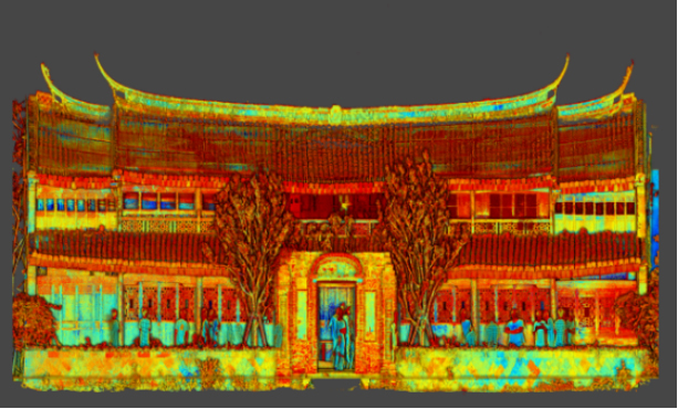
 Heritage Buildings
 About feiyan
 Recognition
 Cases
Cases

search


Cases

Farsightā¢ Unattended Low-Altitude System
Farsightā¢ is a fully automated aerial monitoring solution, integrating the long-endurance Y-1 VTOL UAV, an intelligent Smart Hanger, and the Swift AI platform. It enables 24/7, large-area surveillance and data collection without personnel on-site. The system delivers a complete "detection-to-action" workflow, with multi-sensor fusion, AI analytics, and autonomous operations. Ideal for smart city management, environmental monitoring, infrastructure inspection, and precision forestry, it provides a cost-effective, scalable solution for wide-area remote sensing and automated patrols.
The Farsightā¢ System is a next-generation, fully automated aerial monitoring solution designed for persistent, large-scale operations. Integrating the high-endurance Y-1 VTOL UAV, the intelligent UAV Smart Hanger, and the powerful Swift AI platform, it delivers a complete "detection-to-action" workflow. This system overcomes traditional limitations of coverage, frequency, and cost, enabling 24/7 intelligent surveillance and data acquisition across thousands of square kilometers without on-site personnel.
Technical Specifications
Component | Parameter | Specification |
System Performance | Maximum Operational Radius | 30-50 km |
Typical Coverage Area | > 3,000 kmĀ² | |
UAV Smart Hanger | Battery Swap Time | < 5 minutes |
Landing Precision | Ā±10 cm | |
Communication | 1000M Fiber / 4G / 5G | |
Operational Temperature | -20Ā°C to 50Ā°C | |
Control & Safety | AI Platform | Swift AI |
Emergency Parachute | Yes (Activates at 110 km/h) | |
Core Aerial Platform | UAV Model | Y-1 VTOL Fixed-Wing |
Role | System's primary data acquisition unit |
Core Advantages
Wide Coverage Ā· Minimal Deployment: With an operational radius of 30-50km and a single-flight coverage area of 30kmĀ², only a few systems are needed to fully cover large regions (e.g., Nanjing: 6587kmĀ²), reducing deployment quantity by 98% compared to traditional multi-rotor nests and significantly lowering infrastructure investment.
Fully Autonomous Operation Ā· Efficient Collaboration: The UAV Smart Hanger supports 5-minute intelligent battery swapping and adapts to full scenarios from -20ā to +50ā, enabling autonomous takeoff/landing, environmental monitoring, and fault early warning of UAVs. Equipped with the Y-1 UAV's 150-minute long endurance, it can complete 3 flights per day, increasing data acquisition efficiency by 25 times compared to traditional solutions.
Multi-Modal Fusion Ā· Comprehensive Data: Compatible with diverse payloads such as panorama cameras (420MP total pixels, 900MP single photo), LiDAR scanners (2000kHz emission frequency), tilted cameras (300MP total pixels), and hyperspectral cameras (280 spectral channels), it can acquire multiple types of data (video, image, point cloud, thermal infrared) in one flight to meet cross-scenario analysis needs.
AI Empowerment Ā· Intelligent Closed-Loop: Equipped with the Swift AI multi-modal large model, it supports intelligent recognition of over 10 types of targets including highway debris, landslides, pine wood nematodes, and flames. It realizes a full business closed-loop of "data collection - real-time analysis - early warning push - work order distribution - on-site verification - result feedback", improving recognition accuracy and processing efficiency by 80% compared to manual work.
Safe & Reliable Ā· Compliant & Controllable: Equipped with an intelligent parachute system (maximum opening speed 110km/h, opening time 1.2s) and a maximum descent speed of only 5.5m/s, it ensures low-altitude operation safety. Supports custom electronic fences and no-fly zone warnings to prevent entering sensitive areas, complying with global low-altitude flight regulations.
Low-Cost Operation & Maintenance Ā· Long-Term Adaptability: The system's construction and operation cost is only 1/10 of that of traditional multi-rotor nest clusters (total investment of a single system over 5 years < 4.5 million RMB, equivalent to 15% of the total investment of 60 multi-rotor nests). The modular design supports hardware upgrades and algorithm iterations, adapting to long-term business development needs.
Applications & Case Studies
Smart City & Compliance: Automated city-wide monitoring for unauthorized construction and land use changes, as deployed in Xiamen's change detection project.
Environmental Protection: Large-scale inspection of river outfalls and coastline, utilized in Qingdao's pollution source survey and Weihai coastal patrols.
Precision Forestry: Early detection of pine wilt disease through AI analysis of spectral data, demonstrated in surveys across Zhejiang and Shandong.
Linear Infrastructure Inspection: Efficient, automated patrols for power lines, highways, and pipelines.


-
 Jun 17, 2022
Satellite Technologies For Plant Nutrient Deficiency Identification And Treatment
Satellite Technologies For Plant Nutrient Deficiency Identification And Treatment More > -
Jun 22, 2022
Historical Building Surveying and Mapping
China will further step up efforts to safeguard and transmit historical and cultural heritage as part of ongoing urban and rural development strategies. More > -
Mar 22, 2022
Utility of oblique aerial photography
With the rapid development of China's social economy, the value of real estate is increasing accordingly, which makes the country pay more and more attention to real estate surveying and mapping, and the requirements are higher and higher. More > -
Mar 22, 2022
What is tilt photography?
Tilt photography is a new and high technology developed in recent years in the field of international Remote sensing surveying and mapping. By carrying multiple sensors on the same flight platform and collecting images from different angles such as vertical and tilt, more complete and accurate information of ground objects can be obtained. More > -
Mar 22, 2022
Feiyan Remote Sensing LiDAR aerial photography project accumulates over 100,000 square kilometers
At present, airborne LiDAR technology has made great progress and has been widely used in many fields. Following the trend of technology development, feiyan Remote sensing has long been in the forefront of the industry. More > -
Mar 22, 2022
Mount Everest Elevation Measurement in 2020
On the afternoon of April 30, the first press conference of the 2020 Mount Everest elevation measurement was held at the Everest Base Camp, and the 2020 Mount Everest elevation measurement was officially launched. More > -
Mar 22, 2022
What are the restrictions on drone aerial photography?
Compared with traditional Aerial photography, the low efficiency of UAV Aerial photography has become one of the main bottlenecks restricting its development. More > -
Mar 22, 2022
The 6th Jiangsu University Surveying and Mapping Geo-Information business plan competition achieved
The 6th Jiangsu University Surveying and Mapping Geo-Information business plan competition achieved full success last week. Feiyan Remote sensing participated in this event as one of the chief co-sponsors. The competition provides an excellent platform for our students, played a major role in cultivating talent of Surveying and Mapping Geo-Information application as well. More > -
Mar 22, 2022
7 Ways to Process LiDAR Data
LiDAR technology has given the spatial data industry some of the largest data volumes weāve ever seen. Most point clouds Iāve worked with have been tens of gigabytes in size. More >