AIMS
AIMS AIMS-H Long Focus
 Farsightâą System
 Riegl VQ-1560i
 Riegl VQ-780II
 UltraCam Eagle M3
 Y-1 VTOL UAV
 Aerial Acquisition
 UAV Acquisition
 Satellite Acquisition
 Field Acquisition
 Integrated
 LiDAR
LiDAR Orthophoto
 DEM
DEM DTM/DSM
 3D Mapping
 Topographic
 Infrared
 Feature Extraction
 BIM
BIM Transportation
 Water
Water power
power  Forestry
 Agriculture
 Mines & Quarries
 Heritage Buildings
 About feiyan
 Recognition
 Cases
Cases

search


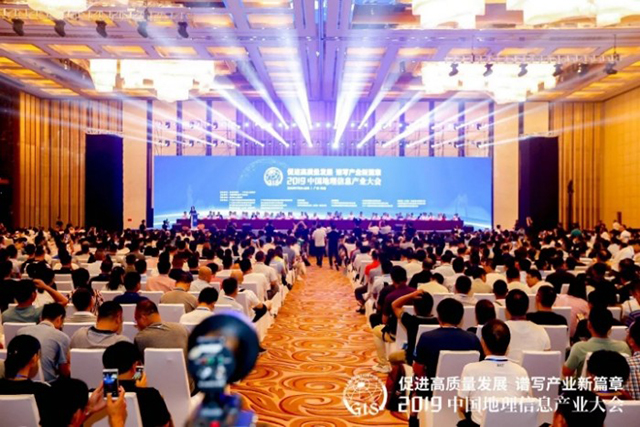
Feiyan won golden medal in the 2021 Fujian Provincial Excellent Surveying&Mapping
Mar 23, 2022
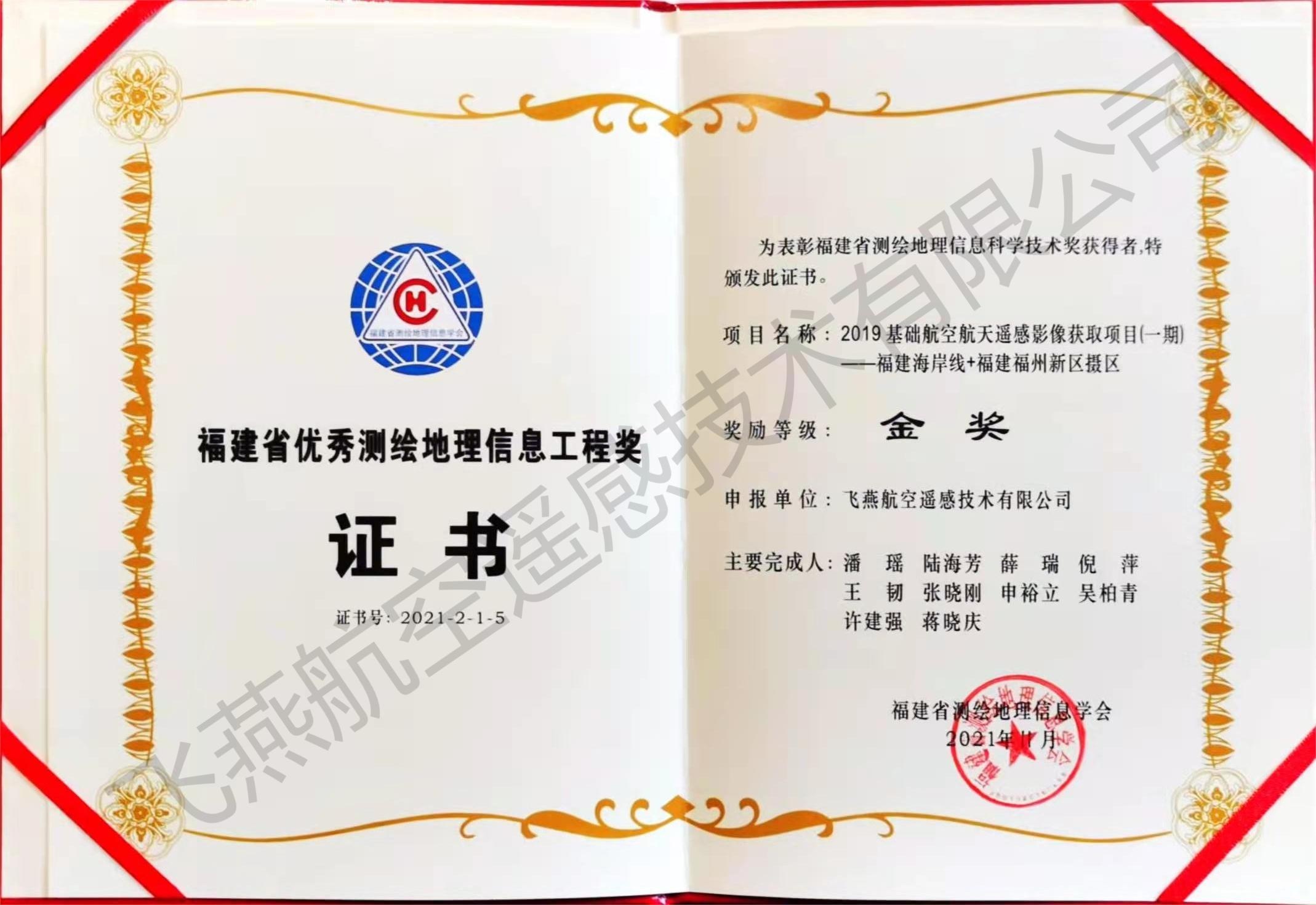
Congratulations! A project calledâ2019 Basic Aerospace Remote sensing Image Acquisition Project -Fujian Coastline & Fujian Fuzhou New Area Photographic Areaâ carried out by Feiyan Remote sensing won a golden medal in the 2021 Fujian Provincial Excellent Surveying and Mapping Geographic Information Engineering Prize.
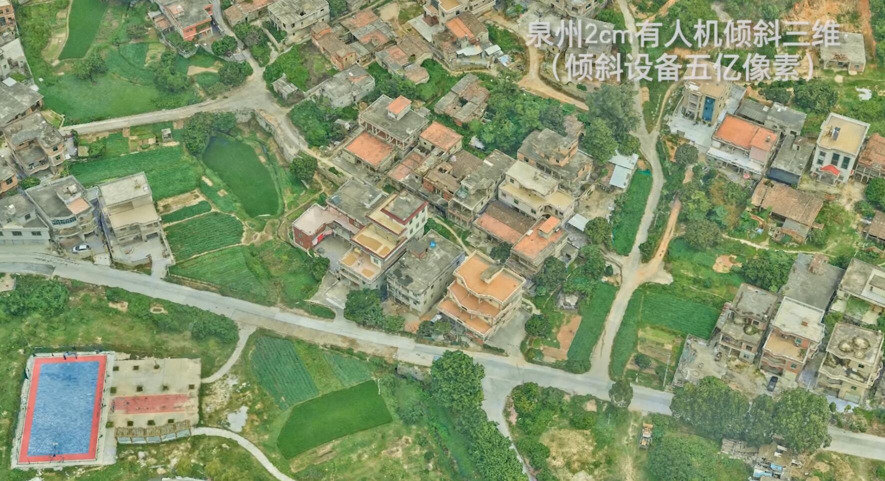
The project used the Cessna 208B equipped with the largest UCE digital aerial camera and POS system, which lasted for 35 days and covered a total area of 5864kmÂČ. We optimized the design for the coastline and islands, adopted the method of large overlap Aerial photography and accurately adjust the local exposure point, completed the task on time with quality and quantity. Aiming at the color cast phenomenon that water and land are prone to appear together, we developed a water boundary tracking and expansion algorithm to automatically extract the boundary line of the water area to form an accurate water and land boundary.
The final acquisition of true color, panchromatic, and color infrared image data (better than 0.2m) has passed the acceptance of the National Basic Geographic Information Center and the National Oceanic Information Center.
The project lays a foundation for the application and service of aerial Remote sensing images of coastlines. It also provides a guarantee for the production of orthophoto maps, the update of coastline foundations, coastline surveys, and reclamation monitoring of the National Ocean Information Center.

We welcome customers from worldwide to contact us and get the best surveying and mapping service from us. With years experience, our team will definitely fulfill the task you give us with heart and passion.


-
 Oct 31, 2021
We participated in the infrastructure construction of the national parks
In order to protect biodiversity and promote the sustainable development of mankind, China formally established the first batch of national parks on October 12, 2021. More > -
Mar 22, 2022
Aviation Remote Sensing Surveying and Mapping
Is obtained by the industry news: the Chinese national geographic information bureau of surveying and mapping said 2018 will accelerate the construction of aerospace Remote sensing mapping, through high score 7 satellite launch preparation, promote resource 03 star project no. 3, 4 star, the construction of domestic satellite receiving station and overseas processing system, promote new platforms such as drones, and airborne laser radar is a new application of sensor, gradually formed multi-resolution, multi-type, multi-sensor, all-weather comprehensive efficient aerospace Remote sensing mapping ability. This marks the arrival of the era of aviation Remote sensing surveying and mapping, and China will accelerate the construction of aviation Remote sensing surveying and mapping. More > -
Mar 22, 2022
3S Technology Application Status
RS, GPS and GIS technology, referred to as More > -
Mar 22, 2022
Monitoring of Water Pollutants Through Aerial Remote Sensing
Aerial Remote sensing can monitor pollutant substances and detect water pollution problems in water areas through aerial Remote sensing. More > -
Mar 22, 2022
Feiyan Remote Sensing Organized Comprehensive and Systematic Training to Improve the Professional
Recently, feiyan Remote sensing held a large-scale employee training in the headquarters, invited the directors of each branch to participate in the training, and organized the examination. More > -
Mar 22, 2022
Feiyan Remote Sensing Won the Award of
With the theme of More > -
Mar 22, 2022
Feiyan Remote Sensing Training an Important Role in Ensuring the Completion of Aerial Photography
In the previous article More > -
Mar 22, 2022
Remote Sensing Applications Usher in a New Blue Ocean
Recently, at the second forum on Remote sensing application technology held in Beijing, China's autonomous Remote sensing image processing software has made great progress. More > -
Mar 22, 2022
How to use aerial remote sensing to monitor pests and diseases?
Airborne LiDAR Aerial photography can be used to analyze the degree of pests and diseases of crops or forest trees based on the laser reflection intensity of crops or forest trees; Aerial imagery can also be used to analyze the effects of crops or forest trees based on the spectral characteristics of crops or forest trees. Degree of pests and diseases. More >