AIMS
AIMS AIMS-H Long Focus
 FarsightБ└╒ System
 Riegl VQ-1560i
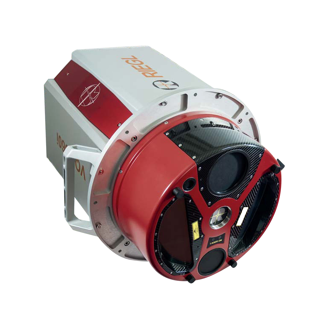
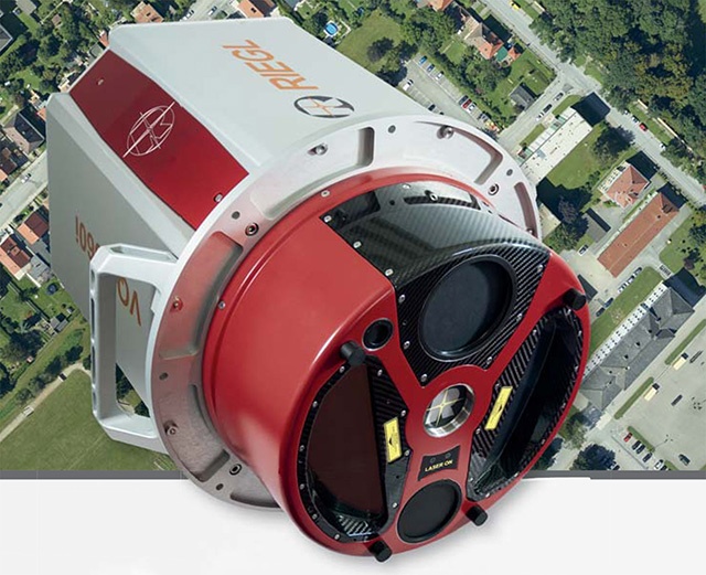
 Riegl VQ-780II
 UltraCam Eagle M3
 Y-1 VTOL UAV
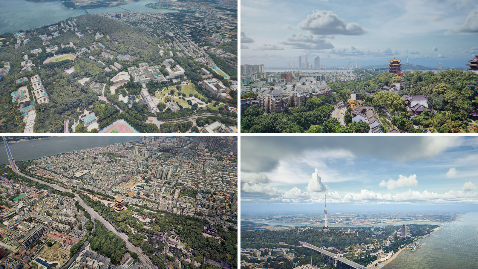
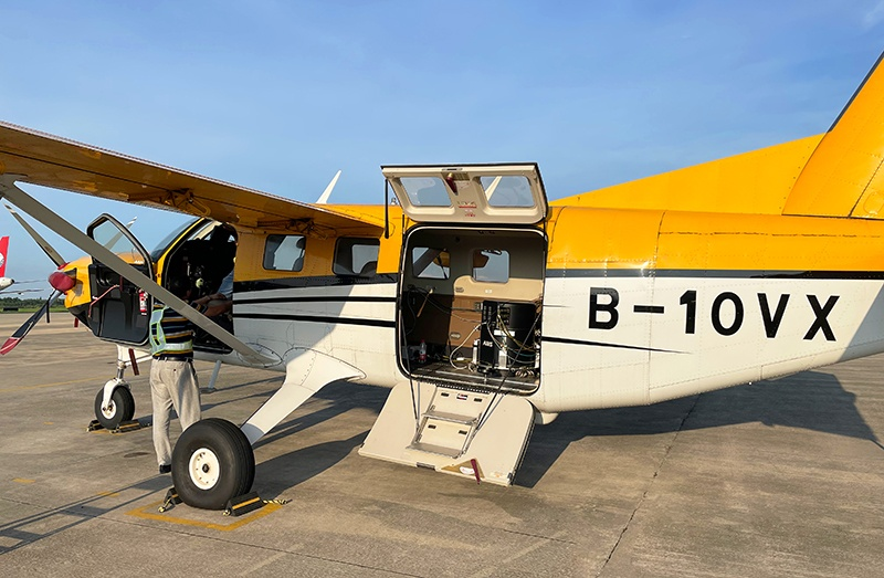
 Aerial Acquisition
 UAV Acquisition
 Satellite Acquisition
 Field Acquisition
 Integrated
 LiDAR
LiDAR Orthophoto
 DEM
DEM DTM/DSM
 3D Mapping
 Topographic
 Infrared
 Feature Extraction
 BIM
BIM Transportation
 Water
Water power
power  Forestry
 Agriculture
 Mines & Quarries
 Heritage Buildings
 About feiyan
 Recognition
 Cases
Cases

search

Enter search content


News
 HomeЦ──>Ц──NewsЦ──


all news
-
 Mar 22, 2022
3S Technology Application Status
RS, GPS and GIS technology, referred to as More > -
Mar 22, 2022
Aviation Remote Sensing Surveying and Mapping
Is obtained by the industry news: the Chinese national geographic information bureau of surveying and mapping said 2018 will accelerate the construction of aerospace Remote sensing mapping, through high score 7 satellite launch preparation, promote resource 03 star project no. 3, 4 star, the construction of domestic satellite receiving station and overseas processing system, promote new platforms such as drones, and airborne laser radar is a new application of sensor, gradually formed multi-resolution, multi-type, multi-sensor, all-weather comprehensive efficient aerospace Remote sensing mapping ability. This marks the arrival of the era of aviation Remote sensing surveying and mapping, and China will accelerate the construction of aviation Remote sensing surveying and mapping. More > -
Mar 22, 2022
What is tilt photography?
Tilt photography is a new and high technology developed in recent years in the field of international Remote sensing surveying and mapping. By carrying multiple sensors on the same flight platform and collecting images from different angles such as vertical and tilt, more complete and accurate information of ground objects can be obtained. More > -
Mar 22, 2022
Utility of oblique aerial photography
With the rapid development of China's social economy, the value of real estate is increasing accordingly, which makes the country pay more and more attention to real estate surveying and mapping, and the requirements are higher and higher. More > -
Mar 18, 2022
Feiyan Invested 20 Million For Airborne LiDAR Measurement
Feiyan invested 20 million to introduce airborne LiDAR measurement, which once again laid the foundation for the hardware strength of feiyan in the industry. More > -
Mar 18, 2022
Aerial photography to understand
Aerial photography, as a modern means of photography, can overlook things from a height that is difficult for people to reach, and convey a macro image to the audience from a completely liberated perspective, bringing a brand-new visual enjoyment. In recent years, with the development of television and flight technology, various methods of Aerial photography have been widely used in the production of films and TV documentaries. During the expo, helicopter Aerial photography was used many times to show the lively scene of the expo site. Today let's take a closer look at Aerial photography and learn its secrets. More >