AIMS
AIMS AIMS-H Long Focus
 FarsightБ└╒ System
 Riegl VQ-1560i
 Riegl VQ-780II
 UltraCam Eagle M3
 Y-1 VTOL UAV
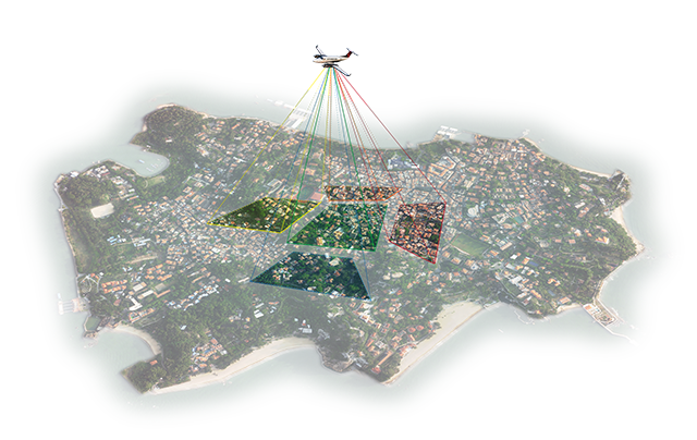
 Aerial Acquisition
 UAV Acquisition
 Satellite Acquisition
 Field Acquisition
 Integrated
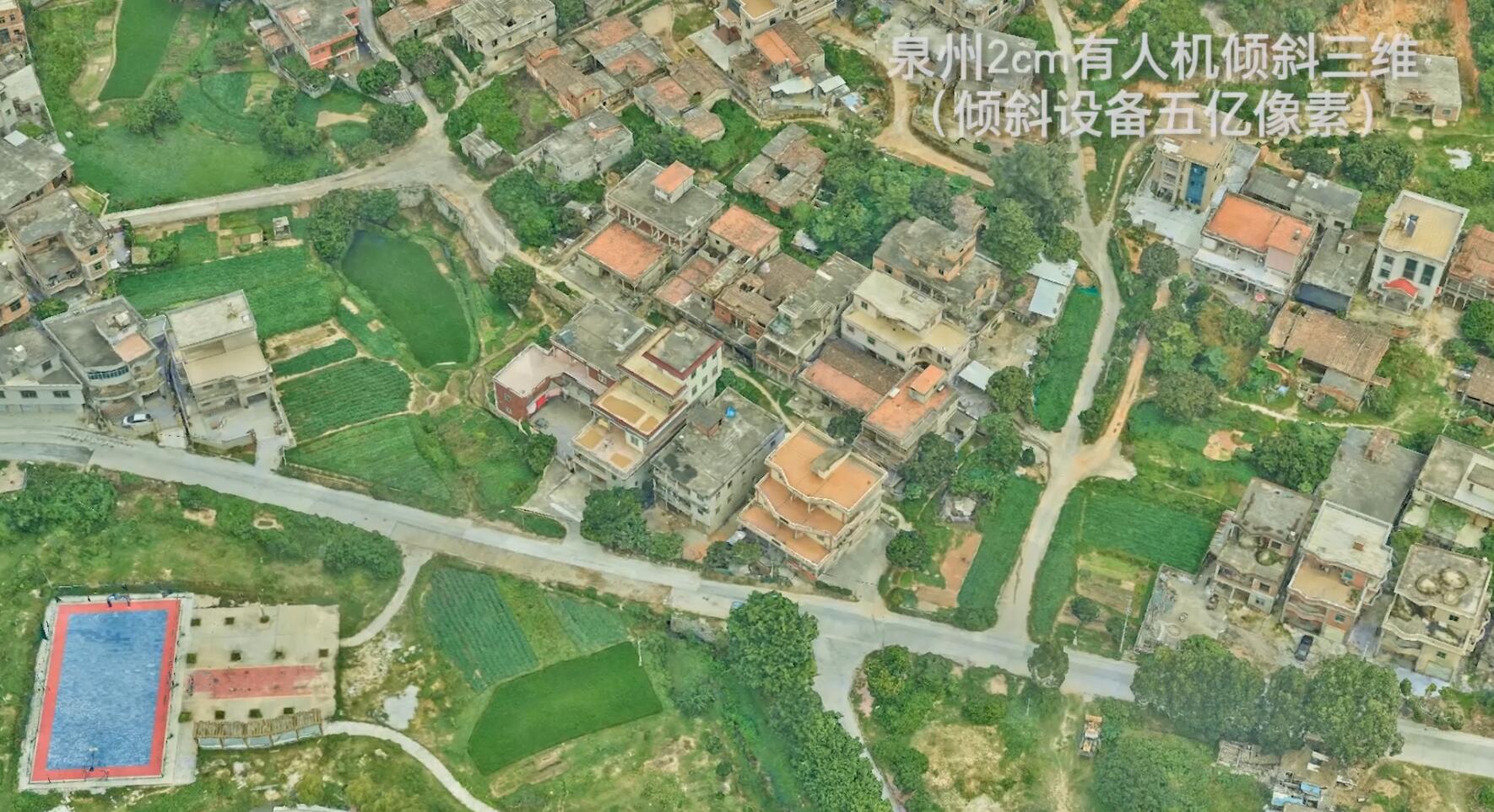
 LiDAR
LiDAR Orthophoto
 DEM
DEM DTM/DSM
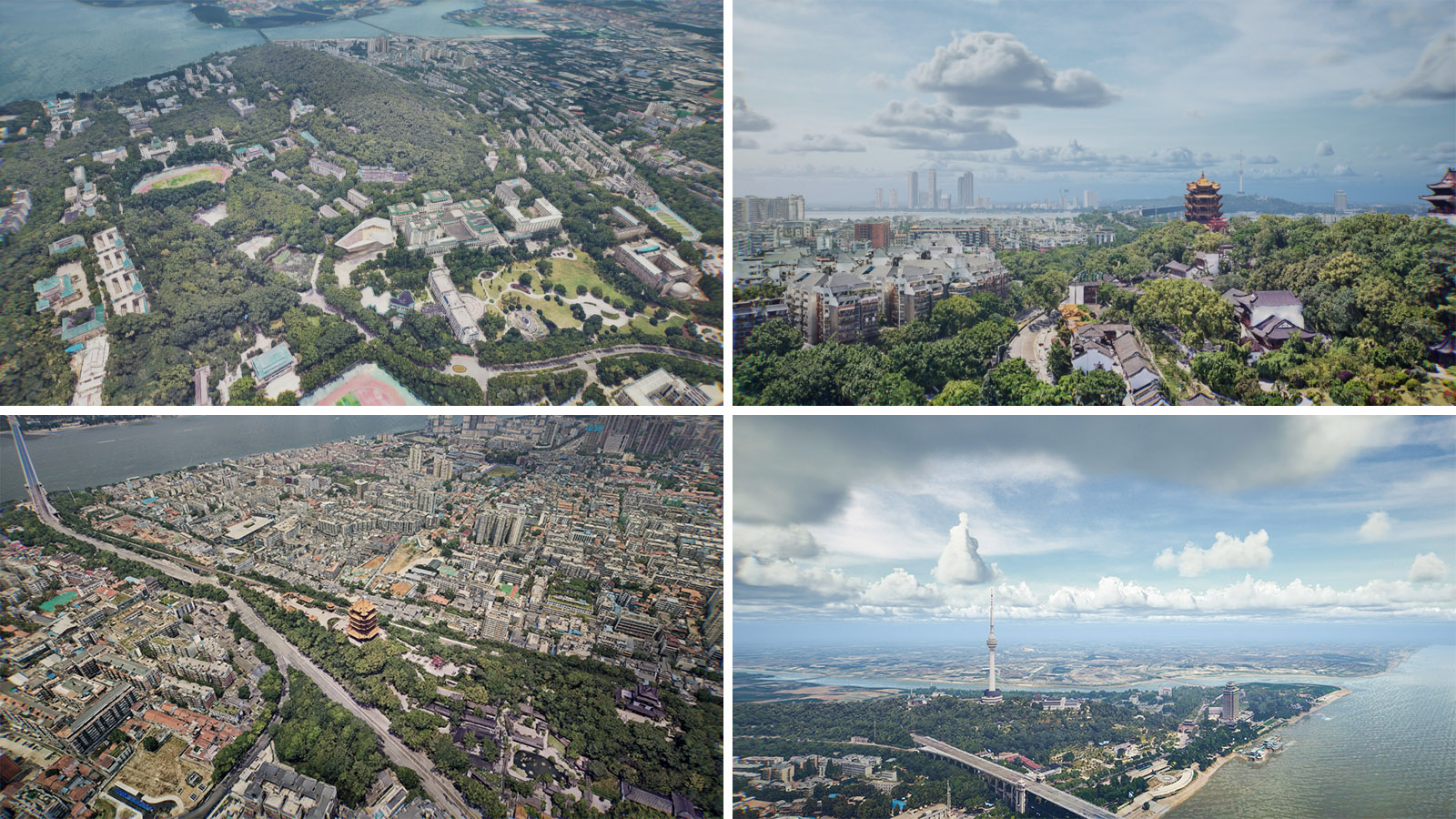
 3D Mapping
 Topographic
 Infrared
 Feature Extraction
 BIM
BIM Transportation
 Water
Water power
power  Forestry
 Agriculture
 Mines & Quarries
 Heritage Buildings
 About feiyan
 Recognition
 Cases
Cases

search

Enter search content


News
 HomeЦ──>Ц──NewsЦ──


all news
-
 Mar 22, 2022
Lidar Forest Survey, Incomparable Advantages
In recent years, LiDAR forest survey has attracted more and more people's attention. However, the hotter this new technology is, the more it needs to be understood from all aspects calmly. More > -
Mar 22, 2022
The Riegl Vq-1560i Airborne Laser Lidar Lived up to Expectations
The ninth China surveying and mapping geographic information technology equipment expo has been successfully concluded. More > -
Mar 22, 2022
What is DOM in mapping 4D products?
With the combination and continuous development of mapping technology and computer technology, maps are not limited to previous models. Modern digital maps are mainly composed of DOM, DEM, DRG, DLG and composite models. More > -
Mar 22, 2022
Application of Tilt Photography in Rapid Resource Survey
Tilt photography is the international Remote sensing field of surveying and mapping emerging developed a high and new technology, combined with traditional Aerial photography and close range measurement technology, to subvert the previous orthogonal projection as can only be taken from the Angle of vertical limit. More > -
Mar 22, 2022
Monitoring of Water Pollutants Through Aerial Remote Sensing
Aerial Remote sensing can monitor pollutant substances and detect water pollution problems in water areas through aerial Remote sensing. More > -
Mar 22, 2022
What is LiDAR point cloud data?
LiDAR (laser detection and ranging) is an optical Remote sensing technology which mainly USES the laser as the emitting light source and adopts the active Remote sensing equipment of photoelectric detection technology. Primarily used in airborne laser mapping applications, it is increasingly becoming a cost-effective alternative to traditional measurement techniques such as photogrammetry. More >