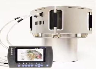
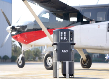
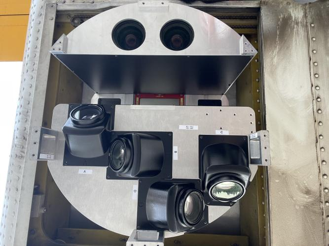
AIMS
AIMS AIMS-H Long Focus
 FarsightБ└╒ System
 Riegl VQ-1560i
 Riegl VQ-780II
 UltraCam Eagle M3
 Y-1 VTOL UAV
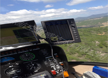
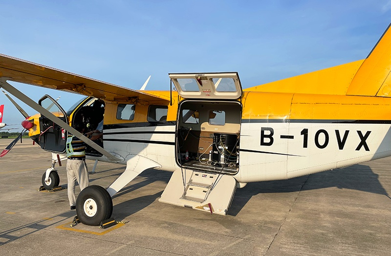
 Aerial Acquisition
 UAV Acquisition
 Satellite Acquisition
 Field Acquisition
 Integrated
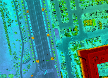
 LiDAR
LiDAR Orthophoto
 DEM
DEM DTM/DSM
 3D Mapping
 Topographic
 Infrared
 Feature Extraction
 BIM
BIM Transportation
 Water
Water power
power  Forestry
 Agriculture
 Mines & Quarries
 Heritage Buildings
 About feiyan
 Recognition
 Cases
Cases

search

Enter search content


News
 HomeЦ──>Ц──NewsЦ──


all news
-
 Jun 12, 2023
What Are the Advantages of Digital Aerial Photogrammetry System?
Б─▀With the continuous development of digital technology, aerial remote sensing data acquisition has entered the all-digital era. More > -
Jun 09, 2023
What Advanced Remote Sensing Equipment Does Feiyan Remote Sensing Have?
With its advanced aerial photography equipment, Feiyan Remote Sensing has completed many national, provincial and ministerial-level More > -
Jun 09, 2023
What Are the Main Advantages of Aerial Photogrammetry Technology?
Б─▀Aerial photogrammetry technology is a technology that applies flight technology to surveying and mapping. More > -
Jun 08, 2023
In What Fields Can the Aims Multi-modal Aerial Camera Be Applied?
Based on the Aviation Integrated Multi-Sensor (AIMS) independently developed by Feiyan Aviation Remote Sensing Technology Co., Ltd., it can produce conventional 4D products and real-world 3D models. More > -
Jun 07, 2023
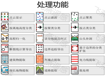
What Are the Remote Sensing Image Processing Software?
The basic functions of remote sensing image processing software include remote sensing image, vector data management and processing, three-dimensional browsing More > -
Jun 06, 2023
What Is the General Density of Power Inspection Points?
Б─▀What is the general density of power inspection points? Regular inspections of transmission lines can effectively eliminate possible hidden dangers or losses and ensure the safety of power grid operation. More >